By Jim Dustin
Copyright DustinBooks LLC, 2014. All rights reserved.
I think at some point the phrase “the lure of the open road” will be relegated to the same niches of American history now reflected in “B” westerns, Civil War romance novels and sitcoms without laugh tracks.
The speed of cars will be strictly governed, breakdowns will be responded to automatically and at fixed fees, GPS systems will guide us unerringly to our destinations, trucks will be incapable of throwing stones or following too closely, and quite possibly, we won’t have to drive at all. We will simply board our “transportation vehicles, or “TVs” and arrive at a pre-determined destination in 6.73462 hours. In fact, Google or someone is “driving” an autonomous car across the nation as I write this – no human driver needed. What fun.
My generation drives. But I expect our grandchildren will say with shock and disbelief, “You didn’t really ever ride in a car going 140 mph, did you?” Many in my generation honestly can say we did. I did in 1968 in a 427, 390-horse powder blue Corvette down Interstate 70 in Missouri. I also drove a Honda 600cc XL motorcycle at over 100 mph on Interstate 270 outside St. Louis.
That wasn’t as fast as the motorcycle would go, but it was as fast as it was going to go with me riding on it. Riding a machine that weighed only 270 pounds at that speed meant that traction was illusory. One sufficiently errant gust of wind, and I would have been down. I was growing up.
But I am still a creature of the road trip generation. When things are getting a little too tense and a little too uncomfortable, you can hop in your car and go somewhere. My first car was a 1964 Chevelle, which was kind of, sort of a muscle car given the right engine and transmission and so on. I never installed speed kits, but it was a three-speed with a standard transmission, and I could spin the tires.
The car was named “Clark,” and it was in no condition to go on road trips. In the future I know is coming, Clark would not be allowed on any road in any civilized nation. But I took Clark on road trips anyway. I was careful to always take the title along in case I had to abandon the car somewhere. I didn’t have enough money for major repairs. I drove it from St. Louis to Charleston, North Carolina – a 1,712-mile round trip – during one blurry summer in the 1970s. At one point, my friends and I were having a contest to see who could leap across the car lengthwise in the fewest steps. That competition left nice dents in the roof and hood but didn’t impair the operability of the car. Insurance didn’t cover the damage because I don’t believe I had insurance back then. I was growing up, but not very quickly.
I still go on road trips. I still go on road trips because I like to travel, but I don’t like to fly. There are too many situations nowadays where one can’t avoid being treated like a head of cattle without voluntarily stepping into such a situation. I learned about road tripping at the feet of legends. These included Al Dedecker, who engineered the 1,000-mile dash from St. Charles, Missouri, to Aspen, Colorado. Or Tom Gee, who went off from Columbia, Missouri, to attend a football game in Boulder, Colorado, yet ended up in Oklahoma. Or John Whitefield, who completed a road trip from Columbia, Missouri, to Lake Havasu, Arizona, by way of Corpus Christi, Texas. He completed the trip, but his car didn’t. Or Jerry Cook, who trusted me and my van to transport his most precious possessions from New Orleans to St. Louis. I thought it would be a good idea to pick up some fresh shrimp at 75 cents a pound and sell it in St. Louis for $1.80 per pound. It would have worked if we hadn’t flipped the van and destroyed the precious possessions and 80 pounds of shrimp, all of which mixed together in a rich, aromatic stew in the back of the van. Or Rich Camp, who managed to fart all the way from Red Lake, Ontario, to St. Charles, Missouri. Ah, the memories.
Not too long ago, I thought my road trip days were over because I was losing my sight. I had just about given up driving at night or even passing anyone due to my deteriorating depth perception. I went on what I thought would be my last trip with two friends – both named Jim – from Walden, Colorado, to Baton Rouge, Louisiana – a 2,714-mile round trip. We drove straight through, there and back. The authorities already are limiting the time a truck driver can spend behind the wheel; in the future I foresee, passenger car drivers will face the same limitations.
Anyway, my sight got fixed through the replacement of old lenses clouded with cataracts with new lenses produced through the ingenuity of the American medical system (pre-Obama). I had a new Honda Pilot that had just proved itself over the 2,714 miles to Baton Rouge and back, I was recently retired, and I had a few extra bucks to blow. The open road beckoned.
Then, as it happened, some friends of mine in St. Charles, Missouri, were drinking perhaps too many beers one night and began planning a road trip from St. Louis to Anchorage, Alaska. Except their road trip would be atop motorcycles. This to me was proof of several, simultaneous midlife crises. These guys were more or less my age, and they were considering a 3,722-mile trip (one way!) across five states and two Canadian provinces through all kinds of weather on motor vehicles that can’t carry a lot of beer. Before I really considered how likely it was that they would actually do this, I said to one of them, “What you really need is a support vehicle.”
Well, several participants became about a half dozen which became a few until finally one disclosed, “That was just the beer talking.” That was in 2013.
The following year rolled around, and I decided that the St. Charles plan looked like a darned interesting trip. The more I looked at it, the more I wanted to go, motorcycle escort or not.
Only one thing deterred me. Me and Hondo the Honda (nearly renamed “The Flycatcher”) were taking a foursome to play golf in Steamboat Springs when the Honda died. Well, it didn’t die, it kind of went into an automotive work slowdown. This happened at a particularly disturbing moment on a two-lane highway when I was in the process of passing a slightly slower vehicle. There was oncoming traffic, so I needed all the speed I could get. What I got was a sudden deceleration and a comment from one of my passengers that “You’d better hurry.”
I had just enough speed remaining to cut in front of the car I was passing and then get off the road. The driver of that car possibly and understandably thought I was an idiot. As it turned out, the problem was a tiny fly – not even a full-size housefly type – had entered an airflow sensor and so confused the CPU that the Pilot could only go five miles an hour … in spurts. It was true, the mechanic told me. A tiny fly had disabled a $30,000 SUV. “And that will be $119 because an outside influence – the fly – disabled the car. Not covered under warranty. The actual part didn’t fail,” said the aforesaid mechanic. It seemed to me that the part had failed in much the same way that an outfielder who had just dropped a fly ball had failed except wasn’t given an error because an outside influence – the ball – caused the glove to fail. But there’s this thing called a “mechanic’s lien,” so I paid up.
This insect threat is a concern when one is planning a 5,000-mile drive through a mosquito-infested part of North America. It is said that the only way to avoid mosquitos in Alaska is to visit in the dead of winter when it is -40º and so there are very few mosquitos.
Going back to my vision of the future, this mechanical aberration wouldn’t be a concern because (a) we most likely won’t even be using internal combustion engines, and (b) roadside assistance would be quickly available after governmental agencies have taken over AAA and other insurance programs. It wouldn’t cost you anything beyond the 76 percent income tax rate that will be common throughout the world.
But we are still in the past as far as that future is concerned, so my concerns remained … for a while. Real road warriors from my generation do not dwell on that which we cannot control. I recall a road trip from St. Louis to Jackson Hole, Wyoming. It was a ski trip, so we were traveling in the deepest part of winter. We were stopped somewhere along the way, and Darryl McGraw asked me, “What are you doing?”
I answered, “I’m checking the weather ahead.”
“Why?” said Darryl. “We’re going to go anyway.”
This is the quintessential road tripper, and his quintessential motto: “We are going to go anyway.” So damn the flies and full speed ahead.
Planning
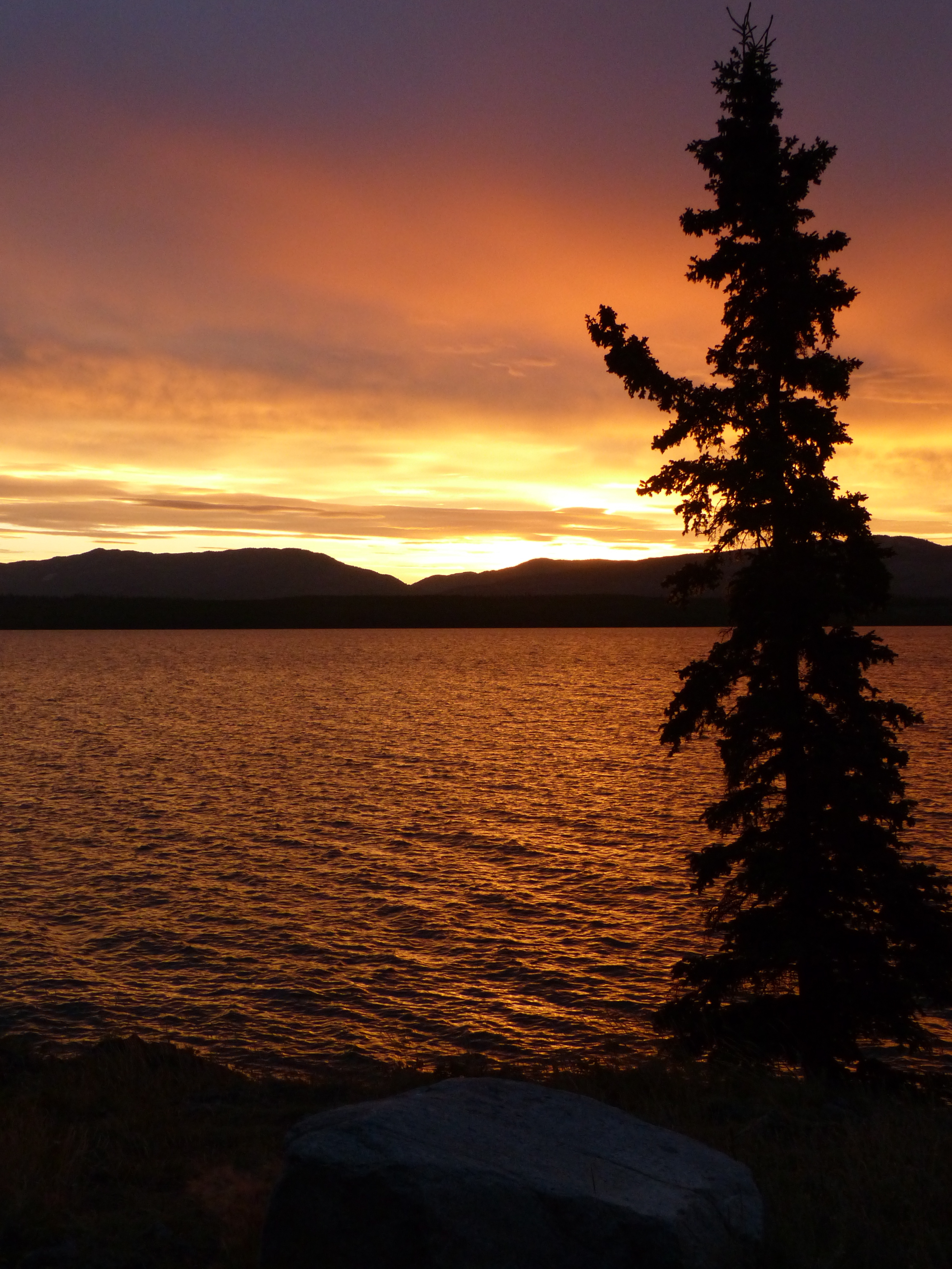
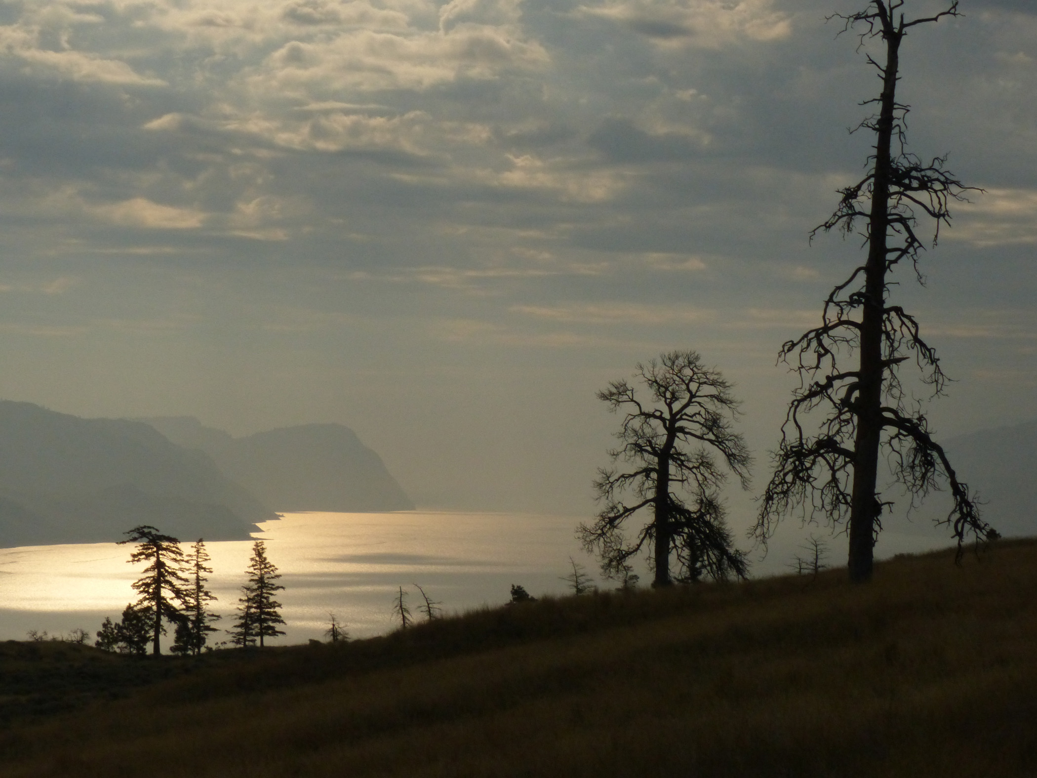
This view was from my camp on Lake Leberge, Yukon Territory. Canada has scores of similar provincial parks.
The motorcyclists were going to camp along the roadsides on their trip. Say their trip took two weeks. Staying in a motel every night would cost about $1,400 each. Camping costs little or nothing, and it’s not a bad plan for the western United States and Canada. The U.S. has national forests, and Canada has provincial parks. The cost for camping, if there’s anyone actually there to collect the fee, ranges from $10 to $21 per night at any of those public facilities. Or, with the vast amount of public lands in both nations, one could simply pull far off the road and utilize what is called disbursed camping (where legal, of course). I saw a lot of fire rings in some unusual places just off highways. One was on the grounds of a cell tower.
I didn’t want to do the tent thing. Rolling up a tent after a night of rain is just no fun. But the back of a Honda Pilot with one back seat folded down is almost exactly my height. I got one of those roll up mattresses, a couple of pillows and a sleeping bag, and voila, no tent needed. There was even room for my dog’s bed next to my feet (dogs don’t mind smelly feet, especially if those feet belong to its owner. It gives them a feeling of security. My dog frequently sleeps on the floor at home with her head on my underwear).
So that took care of the sleeping arrangements. Then I took seven pairs of socks and underwear. I figured on staying at a motel every sixth day to wash myself and my clothes. I know, you’re doing the math and thinking I only needed six pairs of each, but you have no idea how far apart motels can be in the Canadian bush. Then, two shirts, two pairs of jeans, one hoodie and one anarak. That turned out to be perfect, given the vicissitudes of weather in the northlands. I added a T-shirt, but I figured I’d be buying several as souvenirs along the way. That, and your face kit and whatever medicines you need, like, or are addicted to, and you’re on your way.
Couple things I added at the last minute that proved invaluable. One was mosquito netting. There aren’t really that many mosquitos in August, but there can be in low places. When it’s hot, it’s hard to sleep in a car with all the windows rolled up to keep the critters out. A little mosquito netting and some duct tape (always, always, always, wherever you’re going, whatever you’re doing, take duct tape), and you have a screen door.
Other additions were a gas stove, and an axe. At public campgrounds, you can either buy or get firewood. In the Yukon, firewood is free at provincial campgrounds, but it’s not split. Ergo, an axe (another difficult piece of cargo on a motorcycle, but not in an SUV). And at least once, I had to camp where no outside fires were allowed because of a nearby forest fire. Ergo, a gas stove. Plus, a gas stove is so much more convenient in the morning when one is ready to hit the road and one doesn’t want to mess with even a little cookfire.
Now I have come close to achieving road tripper perfection. Everything fits nicely in the Pilot or on a streamlined cartop carrier. Which means I am not one of those big ass campers, which I like to call “road clogs,” trying to climb a mountain while trailing a long line of cursing, frustrated drivers. And I am not on a motorcycle with no chance of staying dry when it rains.
A regular passenger car doesn’t work. I tried that with Clark the Chevelle. Better to stay in a youth hostel with dozens of possibly disease-carrying strangers than try to sleep in a car. The modern passenger car was designed so no one could sleep in one so that Americans could develop the “motel,” and later invent the station wagon, the minivan, and finally the epitome of road tripping, the large SUV. The all-wheel-drive SUV, I might add. If one happens to be traveling along the Top of the World Highway in the Yukon Territory after a night of rain on a stretch of road where guardrails have not yet been and may never be installed, one appreciates all-wheel drive. And good tires. I spent $846 before I left on good tires, and never had reason to regret one penny of that expenditure.
So I’m ready to go. I was delayed a week because the mayor and good friend Kyle Fliniau asked me to stay and help with some town business, but I finally escaped Walden, Colorado, on August 6, 2014.
Day One
I wasn’t headed for Anchorage. I’ve been to Anchorage and found no reason to return. That might have been due to me being in Anchorage on my honeymoon, which coincided with the first typhoon to ever reach that city in 100 years, two events that were not exactly high points in my life.
I headed for Dawson City. That’s 2,769 road miles, or a 5,538-mile round trip. I would prove to be off by about 1,700 miles, mainly because of the Canadian system of highway signage. More on that later.
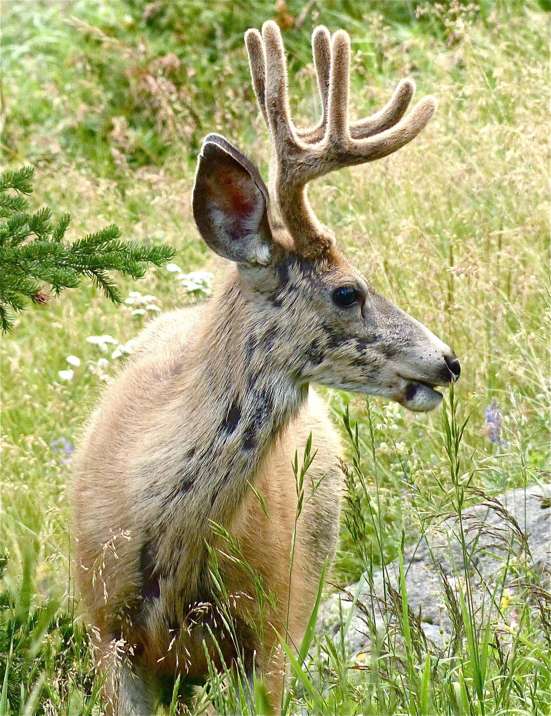
This fellow visited my first campsite in northern Wyoming. I thought the visit should reduce my camp fee by one buck.
So Day One takes me north into Wyoming, and I’m not using interstates. Interstates are boring. You can’t see or appreciate much going 75 mph. And I find small towns fascinating. I live in one. I’m a town trustee and an active member of the Lions Club. Driving state highways through small towns might give me some ideas on how my own town might be improved. Or not. See upcoming comments on Hyder, Alaska.
Whenever I start out on a road trip, I do the math. If one is driving from here to there on a schedule, one should figure making 50 mph. It doesn’t matter how fast one drives; it matters how often one stops. If one is traveling with a dog, the number of stops and the duration of the stops vary. No matter how nervous and jumpy the dog is in the car, after you stop, those bowels won’t move until the dog is good and ready. It’s worse with children. I don’t have any children, but I was one once. My dad was a road tripper. I used to be fascinated how he could light a cigarette from a pack of matches using only one hand. It’s a trick I later utilized in college by being able to light a cigarette while standing at the urinal in a bar restroom. One doesn’t impress many ladies in that particular locale, but it’s a neat trick.
My family was driving over one of the most spectacular highways in the U.S. – the Going to the Sun Highway in Glacier National Park – and I was sitting in the back of the car reading a book. My mom yelled at me to put down the book and look at the scenery. I pouted for a while but then got revenge by throwing up down the window well. It’s not all that easy to find a place to pull over while driving the Going to the Sun Highway unless you pull over a 1,000-foot drop. Such tasks as trying to clean puke out of a window well are going to play hell with your travel schedule.
So figure 50 mph, which means it was going to take six days to get to Dawson City if I drove ten hours a day. That’s a lot of driving, but I needed to get over this particular mental hurdle – I wasn’t on a schedule. I didn’t need to drive 70 mph or even 50 mph. I didn’t need to get to Dawson City on Aug. 12, or Aug. 15. I’m retired. My dog’s with me. There’s no need to be in a hurry.
So I meandered up from Rawlins to Riverton, from Riverton to Thermopolis and stopped to see the World’s Largest (allegedly) Mineral Hot Springs. They are pretty big. I didn’t head to Yellowstone because I’d been there several times and I can’t stand getting caught in these wildlife clots. If a larger-than-average house fly lands near a road in Yellowstone, 94,000 cars stop to take a photo of it and show it to their kids. It’s a wonder the larger animals aren’t killed by the sheer volume of Canon fire. The environmentalists complain about the amount of snowmobile traffic in Yellowstone in the winter, and their ceaseless whining resulted in two federal lawsuits and a decision setting the daily number of snowmobiles coming out of West Yellowstone at some odd number like 398. But they never complain about the 20,000 cars, SUVs, RVs, camper trailers, motor homes, pickups with caps, motorcycles and every other kind of vehicle that drives into Yellowstone every day in the summer.
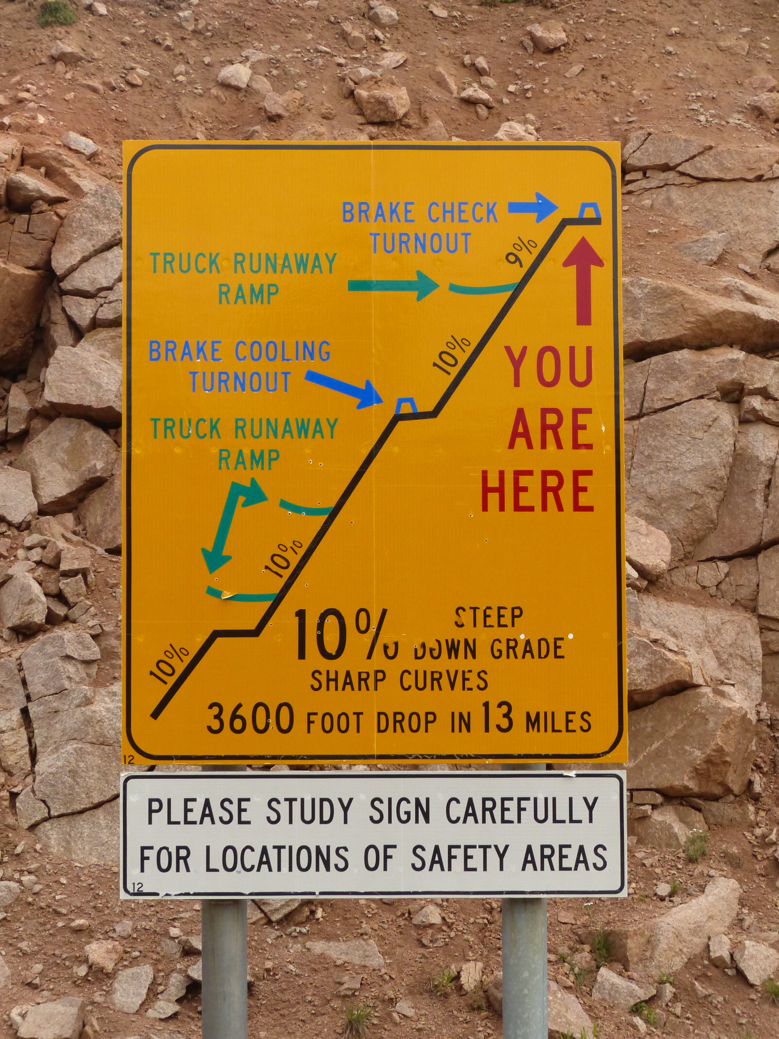
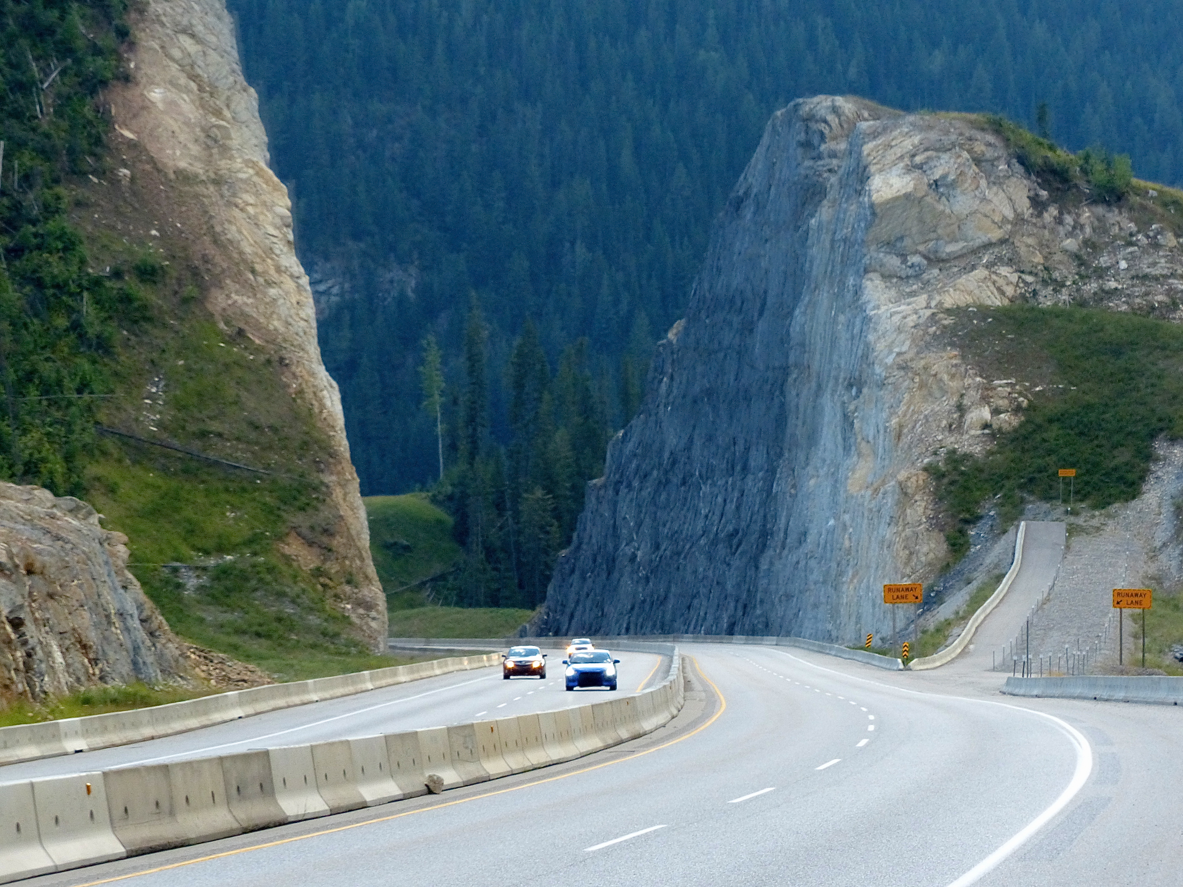
This road coming out of the Big Horn Mountains in northern Wyoming is so steep that the state installed three runaway truck ramps within a seven-mile stretch.
So I headed for the Bighorn Mountains. There’s a loop through the mountains along Highway 14, which I found oddly comforting. A Highway 14 runs through Jackson County where I live. It is also a very scenic route along the Rocky Mountains. I camped in a national park campground where some lady, claiming to represent the U.S. Forest Service, took $10 from me and told me not to let my dog run loose.
“There are moose around here. Your dog will chase one, and the moose will turn around and chase your dog, and you know where your dog will go,” she said.
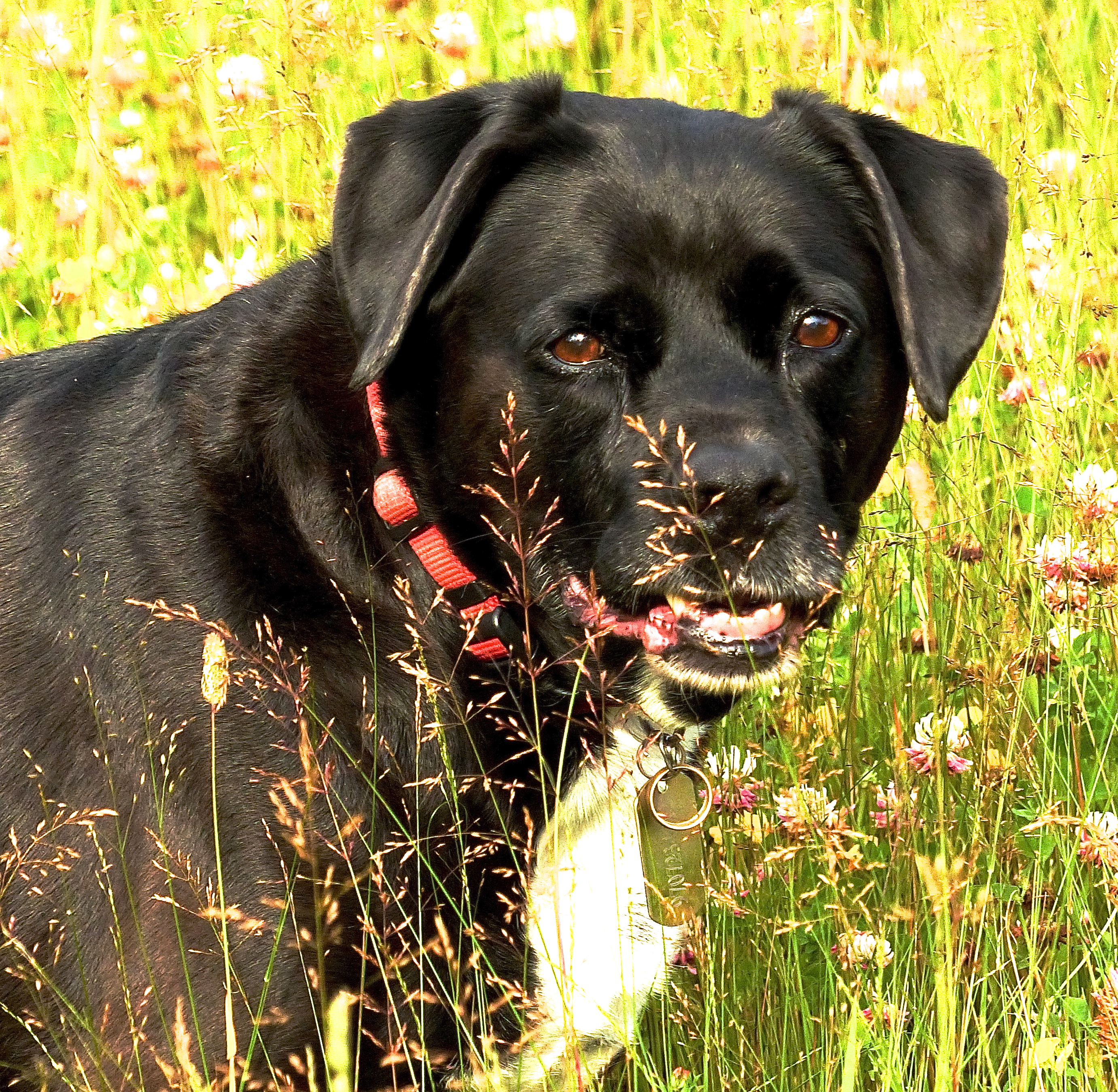
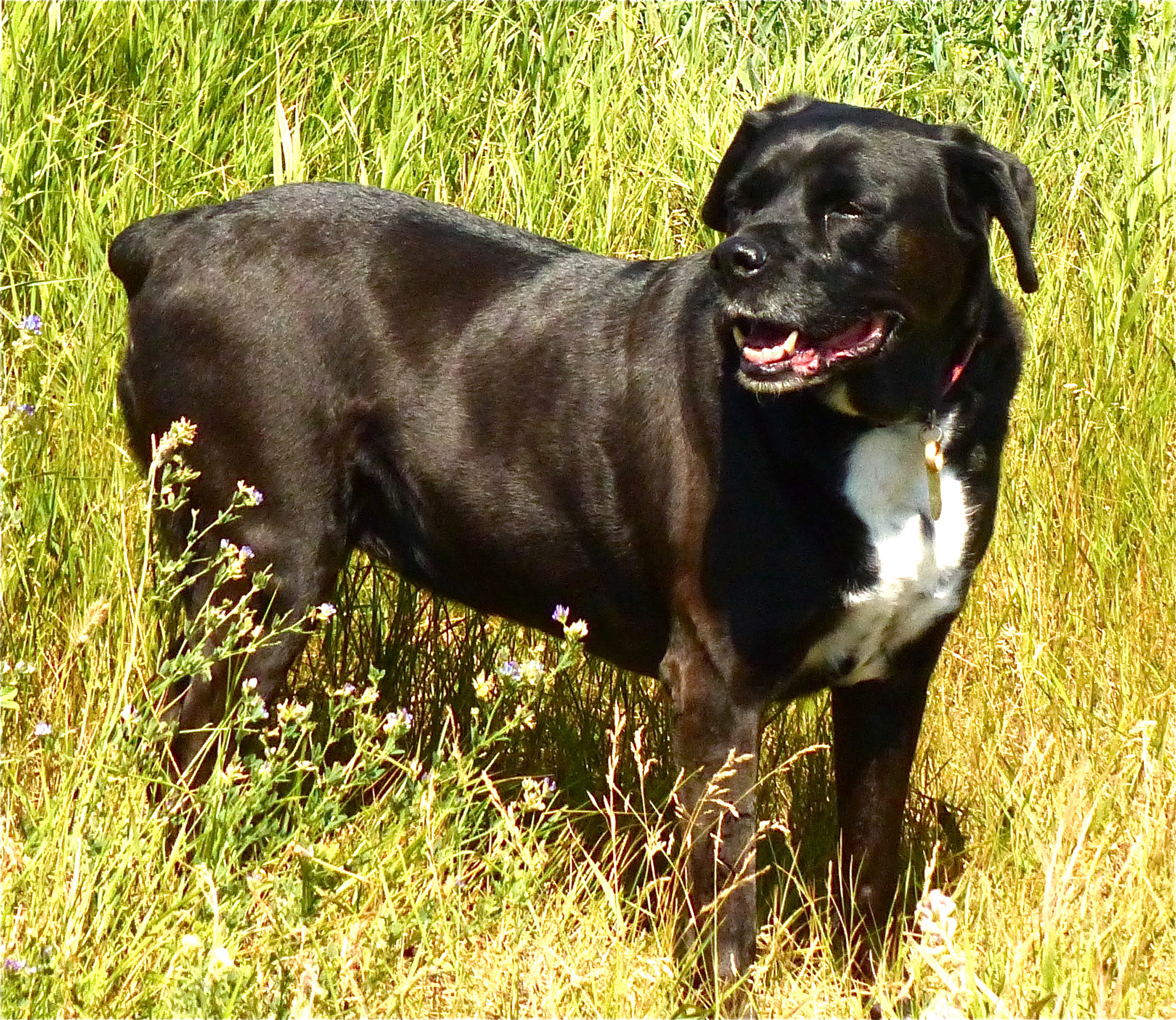
My dog Abby enjoyed the trip as much as I did, especially when she got to play in a field of wildflowers.
I sometimes get tired of being spoken to as if I were 11 years old and my only defensive weapon is kid puke. My dog Abby has chased many a moose in Jackson County and never once led the moose back to me. But rather than risk a $50 fine, I took Abby about 300 yards east and let her run loose and play in a summer meadow. There are few better mental pictures than that. If you ever lose your dog, dwell on images like that one. Don’t fixate on the death part. I hate dog books that end with the dog dying. So I wrote one where all the dogs come back to life. You can find out how to buy it elsewhere on this here website.
But I digress. I made 398 miles that first day and made my first course correction. A great asset to the road tripper is visitors centers. Most tourist towns have them, and every state has them near the borders with other states. At these places one can get maps, advice on local attractions, and brochures on various Indians and/or trappers and/or explorers and/or soldiers who died horribly in the region. All for free.
I could have, on Day Two, jumped over to Interstate 90 and crossed the border into Montana there. I would surely have found a state visitor’s center where one can also pee, poop, wash up and get weather reports, also for free. I checked with Abby, who had taken to looking out the back window at the scenery as we drove along. Her look said, “More scenery.” So we went back along alternate Highway 14 because it was just so pretty.
Day Two
This is a day of discovery. One discovery is that not all of the western United States is all that interesting. The map of Montana has several state highways labeled as “scenic route,” but unless one is oddly interest in wheat fields the size of Delaware, State Highway 89 is a bust. I kept waiting for the “scenic” along this route, but instead made pretty good time. There was little reason to stop.
There is also a general road rule: you can’t find what you need when you need it. I drove past a thousand campsites during the day, but when night started to fall, I couldn’t find a one. Highway 89 goes through a vast farming region, and I suspected the landowners there wouldn’t take kindly to someone camping in their wheat fields. I had this troubling vision of building a campfire and seeing a floating ember set off a prairie fire in the dry autumn wheat that would make the evening news in several countries. Therefore, it was night when I got to St. Mary, just south of the Canadian border, where I made another discovery: one needs to abandon some equipment along the way. Equipment must earn its passage just like any passenger.
I had a folding chair. It was handy around camp for not only sitting, but also as a step to access the cartop carrier. On Night Two, as I was standing the aforesaid chair, the chair collapsed, nearly ending my trip after one day by throwing me violently to the ground. That chair, I believe, now resides in a St. Mary landfill.
I had also built a little ramp for Abby to use when entering the back of the Honda. I tried to train her to use it at home. She wouldn’t set paw on it. She wouldn’t even walk on it when it sat flat on the ground. What is it with dogs? She would rather jump up on the rear of the Pilot, slightly misjudge, fall on her ass, then try it again rather than walk up a perfectly good ramp that I even equipped with treads. There wasn’t a good place to put the thing in the Pilot while driving, so I finally left it at a campsite in Canada. Either someone found a good use for it, or it became firewood.
At this point I had spent $29 on lodging and $4 on tonight’s dinner. The $4 bought me six ears of fresh corn at an FFA stand along Highway 89. I didn’t need six ears, but some sort of FFA math required that I buy at least six ears. I gave four ears to my neighbors at the campground.
A word about this campground. It was run by two pleasant fellows who apparently had turned their home’s backyard into a campground, one of the benefits of no zoning laws. Access was gained through a gap they had made in their stockade fence – no driveway; one just drove over the lawn. It was organized oddly, but had a grill and a picnic table. Me, my neighbors, and the proprietors all left their trash out at night. Next day, trash all over the neighborhood. I suspect it was a bear, but lesson learned.
Discovery No. 3: if you’re not prepared, prepare to be gouged. Gasoline in Browning, Montana, cost $3.58 a gallon. Gasoline in St. Mary cost $4.09. That, I discovered, was the last gas station before the Canadian border. Had I known the situation, I would have filled up in Browning. But I didn’t.
I’m a capitalist. I admit it. I admire successful people who have earned much money in their lives. But outright, blatant, miserly gouging makes all capitalists look bad and gives fuel to the socialist agenda. See, they’d say, if the government ran that gas station, gas would cost the same everywhere. It would cost much more, but we’d all suffer equally. That’s the essence of socialism – everyone suffers equally. St. Maryans and Browningans would all pay the same price for gas.
I might have agreed with the socialists at that point and flogged myself later for the sin of listening to a spurious argument that has never been proved out in any nation ever, but the gas station proprietor didn’t help. He was the only person manning the cash register, and he was the slowest person at making change I have ever encountered. It required about three minutes per customer. I’m doing the math again. There weren’t that many people in the store, but the line to the cash register was six deep. If you’re sixth in line, that’s 15 minutes to get to the counter.
I just wanted to ask the guy a question, but you didn’t want to do that. If you interrupted his change making, he’d have to start over. Now we’re at five to six minutes per customer, and then this gal at the front of the line says, after her initial transaction was complete, “Oh, and I need a pack of Camels.” I’m thinking, if you’re a smoker, how do you forget that you need a pack of smokes? If the proprietor had had a window well, that would have been the moment to unload that half-digested corn.
Day Three
The Canadian border. I neglected to mention earlier that another piece of equipment I was carrying was a Remington 870 pump shotgun. The Canadian border is a little different than, say, the U.S. southern border in that the Canadians don’t want you to bring guns into their country. The Americans not only don’t mind, they will provide guns to Mexican criminals to bring back into the U.S. as a clever scheme to track down Mexican criminals. Or at least that’s the way “Fast and Furious” was described by Eric Holder’s Justice Department, but I don’t think most Americans quite followed how that was supposed to work. I know I didn’t.
If you google something like “Americans visiting Canada,” you will find a host of things you have to do. You have to have adequate identification. There are certain fruits and vegetables you cannot bring into Canada, nor can you import large amounts of cash. If you’re bringing a dog, the dog has to have papers indicating his rabies shots are current, and even the dog food cannot contain beef byproducts. You can only bring a certain amount of liquor into Canada.
Or, if you don’t want to worry about all that stuff, bring a gun. I really did my homework on this. You cannot bring a pistol into Canada under any circumstances. You can bring a long gun, but the barrel has to be at least 18.5 inches long; it cannot have a foldable stock or a pistol grip; it cannot be fully automatic. You, the gun owner, will be subject to a background check, and you’d better have a good reason for bringing that gun north of the border. You must have prepared paperwork in advance, but the paperwork can’t be signed until you get to the border. And the gun has to have a legible serial number.
My good friend Ben Clayton help me set up the gun after I bought it, and thoughtfully added a shell carrier to the receiver. The shell carrier obscured the serial number. Me and two Royal Canadian Mounted Border Guards spent about 15 minutes trying to figure out how to read that serial number and never could. Fortunately, I’d brought the bill of sale with me, and had a good reason for bringing the gun. “I’m going to be camping out in wilderness areas, and I’m afraid of grizzly bears,” said I.
“So am I,” said the border guard, and he added, “Oh, and that gun has to have a trigger guard. That’s federal law.” That was not mentioned in any of my research. Through sheer good luck, the shotgun came with a trigger guard, which I had with me. Finally, mainly because of my good looks and trustworthy demeanor, they let me through.
Okay, were you following this closely? No questions about the dog or the dog food. No inquiries about booze, or fruits, or vegetables, no questions about how much cash I was carrying, not a word about drugs or prescription medicine. It was just the gun.
Now to cut the RCMP some slack, there were two other fellows from New Zealand being detained at this remote border crossing. After quizzing me about marijuana laws in Colorado, they explained that they were being held up because they were carrying more than $10,000 in cash and the Mounties had detected traces of marijuana and cocaine in their vehicle. Oh.
And I had to fill out a form at the border that included the question, are you male or female. No other choices, not gay, or transgender, or multi-gender, or cross-dresser, or bisexual, or female trapped in a man’s body; just male or female. How odd.
Another thing Canadians do that we don’t do but might have to do is print signs, food labels, trash can operation instructions and other printed communications in English and French. They do this because a bunch of whiny descendents of illiterate trappers in Quebec decided they were being discriminated against because everyone else spoke English. Rather than learn English, they made everyone else at learn French, or at least look at it. This is time-consuming. Reading a highway sign takes twice as long. One has to sometimes back up because he or elle didn’t have time to read the whole sign as he or elle passed only to discover, “Oh, the rest of it is French.” During my entire time in northwesrn Canada, I didn’t run into one person who spoke French or even had a French accent while speaking English.
For those of you who want to U.S. to become bi-lingual, or multi-lingual, this is what you’re going to have to do: change every highway sign in the nation.
There are more and more people in the U.S. who are arguing for a bilingual country, which means we are going to have to reprint everything in English and Spanish at least until the Chinese become a substantial minority here and want the same thing. Except our problem is bigger than Canada’s. For starters, there probably are 1 billion official road signs in the U.S. I’m just guessing; no one knows. If it costs about $100 to change one little sign, which it does, that means the English-speaking taxpayers of the U.S. are going to have to fork over $100 billion to change all the signs. And what if we make a mistake and change them all to English and French? We’d have to spend an additional $100 billion changing them to English and Spanish.
You may have deduced that the highway leading north to Calgary wasn’t all that exciting, except for the canola fields. Most of that part of agricultural Canada looks like agricultural Montana except instead of giant wheat fields the Canadians have giant canola fields, which are bright yellow and much prettier.
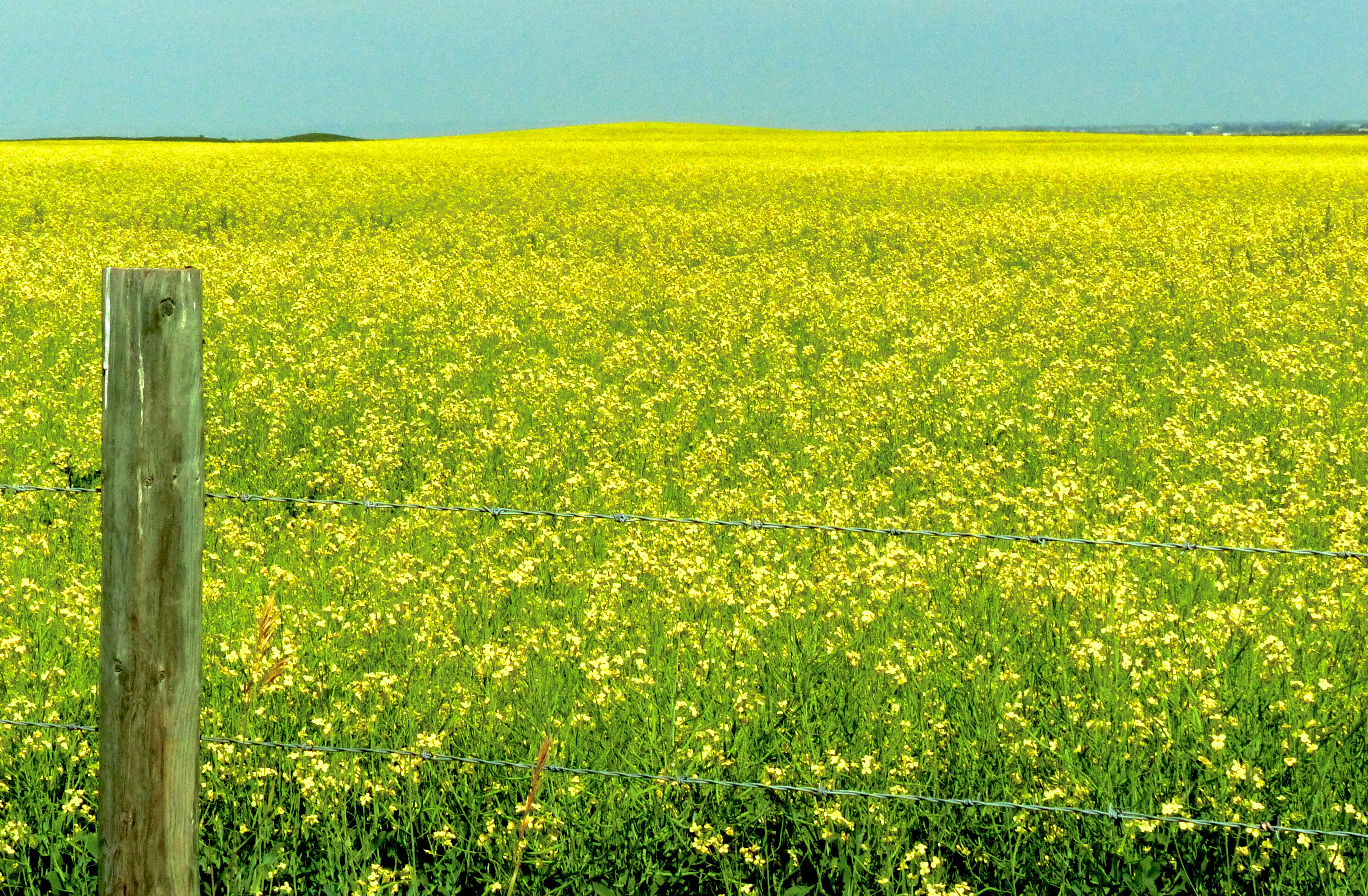
Much like the vast wheatfields of Montana, the Province of Alberta has vast fields of canola, which are prettier than wheat.
After getting thoroughly lost in Calgary, I escaped down Highway 1 to Banff, which I didn’t really appreciate because it had begun raining. On vacation, rain doesn’t fall; it sucks. Banff is a beautiful town, but it looked too expensive for me and one mutt. The mutt agreed.
I wanted to travel up Highway 93 through the Banff and Jasper national parks. I thought I’d camp through the night and take my own sweet time driving through these absolutely spectacular mountains. But I missed the turnoff at Lake Louise. If one misses a turnoff in rural Canada, one is not going to realize one’s mistake until the next highway intersection. And the next highway intersection might be 170 miles away. The reason for this is Canadians, possibly for aesthetic reasons or possibly because they have to print all thier signs in two languages, don’t put many highway markers along the highways. Thus, if you are on Highway 1, and you think you’re on Highway 93, you won’t know it until you drive 47 miles in the rain to the city of Golden (Canada, not Colorado) at which point you stop and look at your trip map say to yourself, “There’s not supposed to be a city here.”
So if we go back to that mileage calculation I had made, I just added 94 miles to it driving to Golden and back to Lake Louise, where I eventually found the cleverly disguised “Highway 93” sign, after failing to find it and having to ask directions to it and still ending up driving up someone’s driveway thinking it was Highway 93 and a poorly maintained Highway 93 at that. Honestly, it’s as if the Canadians didn’t want people using that highway.
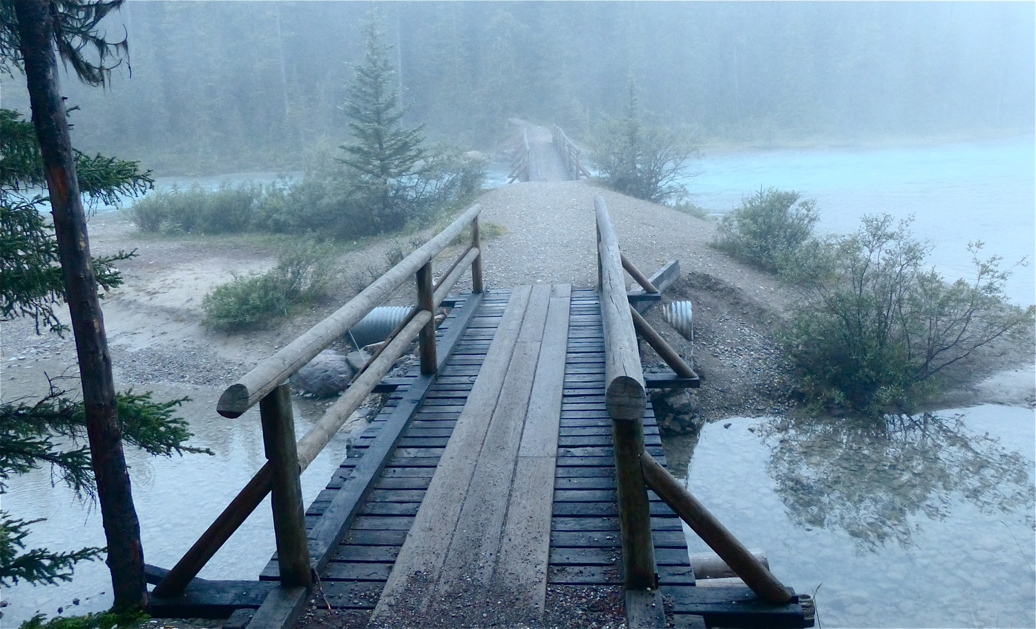
On my third morning, I found this misty river and a trail leading off into endless forest.
But this is where I discovered the provincial park campgrounds. These are almost like motels without roofs. They are clean, well maintained and relatively free of bears. A typical campsite will have an iron fire pit, a picnic table and available firewood. Many have tent sites complete with pre-installed ground hooks. Nearby will be vault toilets with oodles of toilet paper (note to campgrounds and sporting venues; don’t use that one-ply, narrow-ass toilet paper because it costs half as much. We’ll just use twice as much). Also nearby will be water, sometimes potable, sometimes not. And the campgrounds are always situated near a lake or a river or some form of natural beauty.
But they are sometimes crowded. Nuff said. Only one time did I have a problem finding a spot. Abby approved of the provincial campgrounds except for the leash laws, which she violated regularly.
I camped next to a group of guys who were partying pretty heavily. Two of them came over and said this was their campsite, but an RV had left the campsite next to their other campsite and they wanted to camp together so they took the RV’s campsite but if the RV came back they would have to take my campsite but it looked like the RV was gone for good. I didn’t follow any of that. I didn’t even know how to register for a campsite, which is kind of cumbersome.
A camper has to find a campsite, then go back to the registration kiosk and fill out a form, put money in the envelope, tear off the tab, deposit the money in an iron receptacle, then return to the campsite and post the tab on a little post. But I thought, what if someone takes my campsite while I’m up here registering? My money would have already been deposited, and if an argument ensues, there’s no one here to arbitrate. I took to leaving my two travel bins at the campsite while I was registering, and that seemed to work.
And the bunch of rowdy guys who were my neighbors turned out to be nice fellows. They were on a “no wives, no kids” outing and whooping it up next to a roaring fire in a soft rain. I asked what their plans were, thinking they off on some ultra-manly excursion.
“We’re taking a bus ride up to the top of a mountain. There’s a meadow up there with flowers that grow and bloom only two weeks out of the year,” they said. Cool.
Day Four
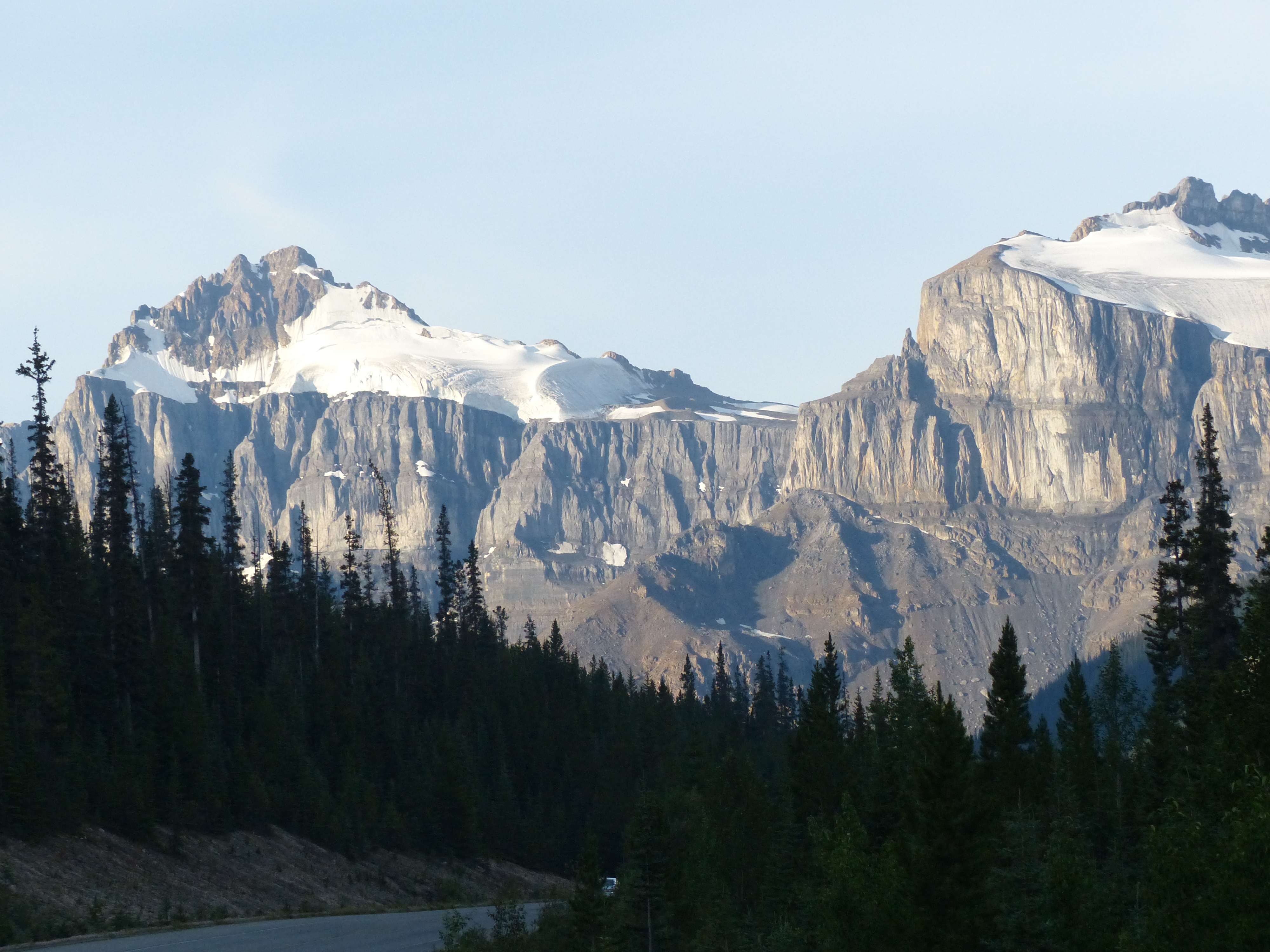
One favorite technique of travel writers is to say that they lack the words to describe what they saw, but then go on to describe what they saw. Using words. One sees phrases like, “Words cannot describe the majesty of these towering mountains, precipitous cliffs, mighty canyons, roaring waterfalls and sparkling rivers that carved stupendous gorges eons ago.” I’ll add another cliché to this lexicon: “cameras cannot truly reflect the majesty of” … and fill in the rest. I’m a professional photographer, but an impatient one. The way to take photographs out here is not to make a quick stop, snap a picture, and move on. One should stay at a site all day or maybe two or three days to wait for the right light. The problem is there are so many places in the West like the Jasper National Park. The Maligne Mountains in The Jasper are a sight any road tripper should aspire to see. It’s as if the mountains in Yosemite National Park and the Grand Teton Mountains got married and had a passel of big kids who all
Wouldn’t you like to drive a train through this part of the world?
These flat-topped mountains in British Columbia hold snow all year round.
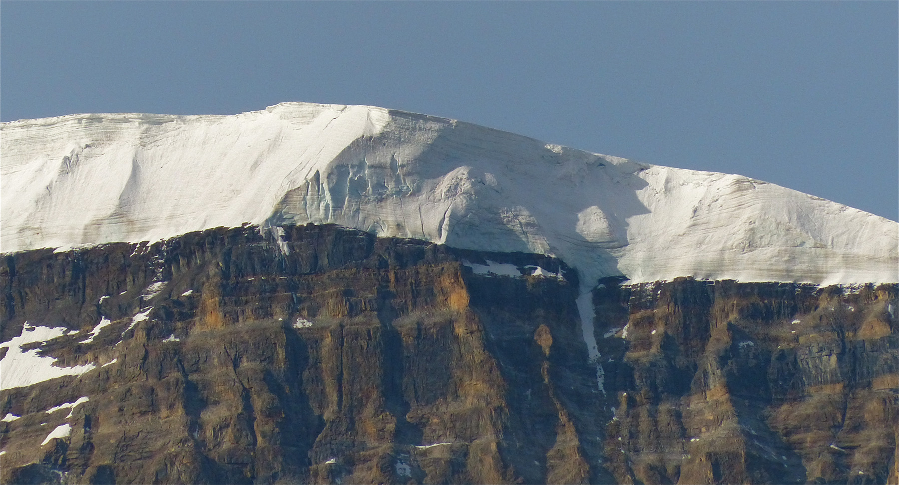
It’s hard to imagine how much snow is stored on top of this mountain, but I was guessing it 300 feet deep or more.
emigrated to Canada. Sometimes natural beauty is just unrelenting. It got to the point that when I was on the last legs of my trip in northern Idaho, I passed what apparently was a magnificent waterfall on the Kootenai River and decided I’d seen enough waterfalls.
Many moons ago, I had a group of friends in Missouri, and we used to take fishing trips to Canada. I have one of those fish I caught on the wall in my office, a 20-pound lake trout caught near the border of Manitoba and the Northwest Territories. The trip cost about $2,500 back then, so my sole souvenir from that trip came in at about $125 per pound. But I didn’t even get to eat it. My trophy is a replica. Lake trout live a long time and mine may still be swimming around up there. I also have tons of photos from those trips, but if one is taking what I call “postcard photos,” they are not much use later in life. I look at those photos of a serene Canadian lake at sunset and have no idea where or when I took that particular photo. I’m already a little hazy on where I took some waterfall photos on my latest trip.
Day Four was also when I began to get a grasp on Canadian math, which is different from FFA math. Canadians use something called a “kilometer” to measure distance. The kilometer was created as a tourism gimmick way back when explorer Alexander Mackenzie wondered if anyone would ever want to live in the northern territories he was exploring. Deducing after one winter that probably no one would want to live there, he figured tourists might work better than settlers to boost the economy.
Thus kilometers and gasoline by the liter, or “litre,” which is pronounced the same, uses the same letters, but “liter” does not look quite as classy as “litre.” If you are a typical American, you look at a sign and see 170, you automatically convert 170 to miles. It’s just habit. But in Canada, the sign that says “Prince George, 170,” means Prince George is 170 kilometers away, which is way shorter than 170 miles. Therefore, you arrive at Prince George way sooner than you thought and exclaim, “Y’know, Canada isn’t that big. We can go further, see more, and spend more money!”
You will also see this wonderful speed limit sign that says 100, and in little, tiny type, “kmh.” You might think that is an enticement to go 100 mph and then get nailed for speeding, but it’s not. I didn’t see a speed trap in the whole of northwestern Canada. I did see some RCMP stations, but I saw exactly two Royal Canadian Mounted Police officers, and they weren’t mounted; they were in a car.
And back to that litre thing. There are 3.7853 litres in an American gallon of gasoline. I generally paid about $1.40 per litre, and that works out to $5.29442 per gallon. So we see why that fellow in St. Mary, Montana, who couldn’t make change at any kind of a normal speed, was actually giving travelers a deal by charging $4.09 a gallon before they went into Canada.
Why this cost differential? Because Canadian governments put a hefty tax on gasoline. On average, about one-third of the total price of gasoline at the pump in Canada is tax. Total minimum taxes vary from 17 cents per litre (64.4 cents per U.S. gallon) in the Yukon to 41.01 cents per litre ($1.552 per U.S. gallon) in Vancouver. Geez, I remember a summer road trip when I was in college that took us from Columbia, Missouri, to Lake Havasu, Arizona. We stopped at Corpus Christi, Texas, to visit a girlfriend. Gas there at that time cost 19.9 cents per gallon. That was 1969. I think the heat in Lake Havasu that summer destroyed some of my brain cells, because I didn’t realize how much gas actually cost in Canada until I got home. However, I am a road tripper. It doesn’t matter what the gas costs; I am going to go anyway.
It could have been worse. There are even more litres in a United Kingdom gallon, but I’m not from the United Kingdom, so I didn’t have to pay that.
And now you know why the Canadians invented the litre. Too many Americans graduating from public school math programs don’t know how to make that conversion, so they don’t know that they’re getting gouged by gas prices in Canada, but that isn’t the worst of it. There is a lodge along Highway 37 in British Columbia called Bell II. I believe Bell I was blown up by irate customers. Highway 37 is the Cassier-Stewart Highway, which is part of the Great Northern Circle Route. That drive should be on the bucket list of every road tripper.
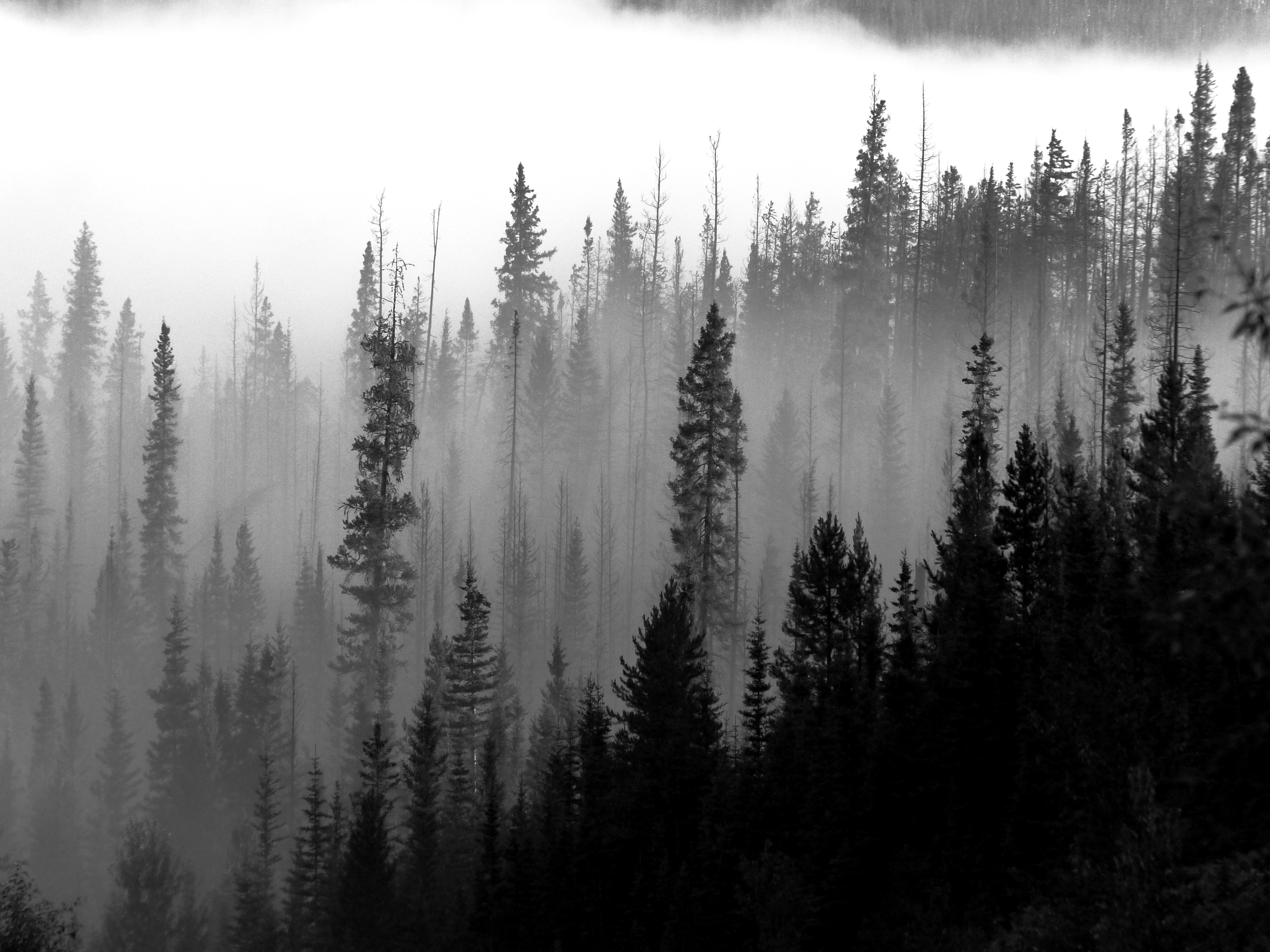
Fog blankets a valley in Canada’s Jasper National Park
Right at the Bell II Lodge is a highway sign that says something like, “check your gasoline gauge. There are no services for the next 230 kilometers.” It’s a very official-looking sign. So one looks at one’s gas gauge and finds one has 100 miles left, which one doesn’t know how many kilometers that is but it looks bad, so one pulls into the very attractive Bell II lodge for a fill-up and finds the price here is $1.58 a litre, or $5.98 per gallon.
There was a similarly-placed lodge along Highway 93, the Saskatchewan River Lodge, where gas was $1.48 a litre. What this lodge and Bell II lodge have in common is they have no competition within 100 miles of highway, and they have that neat government sign saying “check your gauge.” I don’t know which came first, the signs or the lodges. Gas in all of Canada doesn’t cost that much. They charge $1.11 in Calgary, or $4.20 per gallon U.S.
Here’s a couple of suggestions. To the Canadian provincial governments: allow competition along some of these remote routes. Capitalism does wonders for consumer prices. To the American government: pass a constitutional amendment that says we will not trade with any nation that does not adopt our system of weights and measures.
This is a huge digression from the story of my trip, but honestly, the road from Jasper to Prince George is kind of like over a few rivers and through the woods. I did a lot of thinking about Canadian math along the way and not a lot of sight-seeing.
Day Five
The Great Northern Circle Route begins at Prince George, goes up through Dawson Creek to Watson Lake in the Yukon Territory, drops down to Dease Lake, Meziadin Junction, Hazelton, Smithers, Vanderhoof and back to Prince George. Following this route, the road tripper will travel along all or parts of the Yellowhead Highway, the Cassier-Stewart Highway, the Cariboo Highway and the Alaska Highway, or the Alcan. The road tripper can take side trips off the loop along the Klondike Highway, the Highway at the Top of the World, and spur highways that drop down to Haines, Alaska and the strange town of Hyder, Alaska.
To get an idea how much rock was moved to make this highway cut, look at the cars.
I came down out of the Jasper National Park to pick up Highway 16 – the Yellowhead Highway – to Prince George. I got a sense of what great swathes of British Columbia actually are – uninhabited bush country. The province is like a really, really, really big small town. The area of British Columbia is 364,764 square miles, and the population is 4.6 million. But 2.5 million of those live in Vancouver, and that gives the whole rest of the province a population density of about 12 people per square mile. And most of those live along the paved highways, and the paved highways of any length in northern British Columbia number about six.
Driving from Jasper to Prince George gives one an idea of how vacant most of the area is. I listened to an entire audio book along that stretch of highway and thought about the news of the world that I was getting less and less of at that point. In the age of mass communication, I was becoming increasingly isolated the further north I traveled, and I so wanted to know how many protestors there were on the streets of Ferguson, Missouri, at 11:20 p.m. on Aug. 9 and what they were wearing (if you’re reading this in the year 2021, according to the news media Ferguson was the only thing happening in the whole world at that time).
I lost my cell phone service, I believe, when I entered Canada. Somewhere along the way I attempted to make a phone call, and I got a message display saying “emergency calls only.” Okay, I am something of a Luddite as far as cell phones are concerned, and I don’t have a smart phone, but the phone I had was clearly smarter than me. How, for instance, does the phone know whether a call is an emergency or not? All of British Columbia is not covered by a 911 system. There are signs saying you are leaving a 911 call area. And even more strange, when I crossed the line from Mountain Daylight Savings Time into the Pacific Time Zone, the phone asked me if I wanted to change displayed times to conform to the new time zone. How did the phone know I crossed into a new time zone, could change the time by itself, but refuse to do anything else?
And they weren’t even walking with the light.
I also began to lose satellite radio as I went further north and west. Satellite radio provides an alternative to regular radio, and regular radio in the northlands is limited pretty much to the Canadian Broadcasting Company. CBC is at times entertaining, and at times not, as was a half hour on how many women were attending an introduction to firefighting school in the Yukon and why. “Well, why?” you ask. Because Yukon women can do anything, one young lady explained. One suspects the reason that Yukon women can do anything is the same as the reason Alaskan women can do anything. The ratio of men to women in Alaska is about 17 to 1, but if you’ve met many of the men in the northern bush country, you would understand why the women say, “The odds are good, but the goods are odd.”
I didn’t mind losing the news so much as I minded losing Major League Baseball. I liked listening to St. Louis Cardinal baseball games while I was making dinner in camp or traveling long stretches of boring highway. But I began losing the signal in direct proportion to how far north I was. I’d just get little bursts of sound, like the excited announcer saying, “Holiday swings and hits …” then silence. I didn’t know if Holliday hit a home run or a long foul ball or the umpire.
It was kind of fun sometimes to fill in the blanks. “President Obama announced today that he …” and I hoped in the silence the sentence concluded, “would resign.” But usually I switched to audio books – I read all or parts of five books while on the trip – or just thinking. A friend of mine, Jay Edwards, got satellite radio because he loves jazz. But he didn’t get it for his car. “When I’m driving, I like to think,” he said. Oh, if only more voters would do that. Imagine a fellow driving to work after reading the morning paper and not listening to Rush Limbaugh (who, by the way, is absent from the airwaves in western Canada) who thinks to himself, “What are the ramifications of what that politician is proposing?” Or in the case of many high school graduates nowadays, “What exactly is a ramification?”
Morning breaks over one of the huge lakes that are found all over British Columbia.
I bypassed Prince George – after getting thoroughly lost in Calgary, I was avoiding big towns – and camped that night on an arm of Williston Lake. I don’t know how many lakes there are in British Columbia; more than ten thousand, I suspect. Many of them are immense. Williston Lake is the seventh largest manmade reservoir in the world. The surface area is 681 square miles. Its dam generates oodles of squeaky-clean energy. It makes one proud to be a human.
Day Six
Not a whole lot to report on Day 6, except that I was looking forward to a motel room. My modus operandi was this; I would stay in a motel room every sixth day, or when it was raining. The third day I got caught camping in the rain because there weren’t any motels along the route that were even reasonably priced.
After five days, one begins to smell, and when one is cooped up in a motor vehicle, there is no place for that smell to go.
In addition to that, I was on this diet I created. I wanted to lose weight on the trip. So my diet was oatmeal in the morning, fruit from markets along the way, and beans and sausage at night. This worked well as a weight loss regimen, but I also became one of the largest methane production facilities in any motor vehicle in North America. I looked in the back of the SUV once and Abby was sleeping on her stomach with her paws over her nose. I was thinking perhaps there might be a way to route this valuable gas from my sphincter to the Honda’s fuel injectors, but I decided it was more advantageous to change my diet.
And one has to be careful driving while farting. Putting this as delicately as possible, one’s fart should consist only of aromatic gases. “Surprise” is defined as a fart with a lump in it. Such surprises can turn an uneventful drive into a halt at a truck stop equipped with showers and possibly laundry facilities. Thus the diet went, so to speak, out the window.
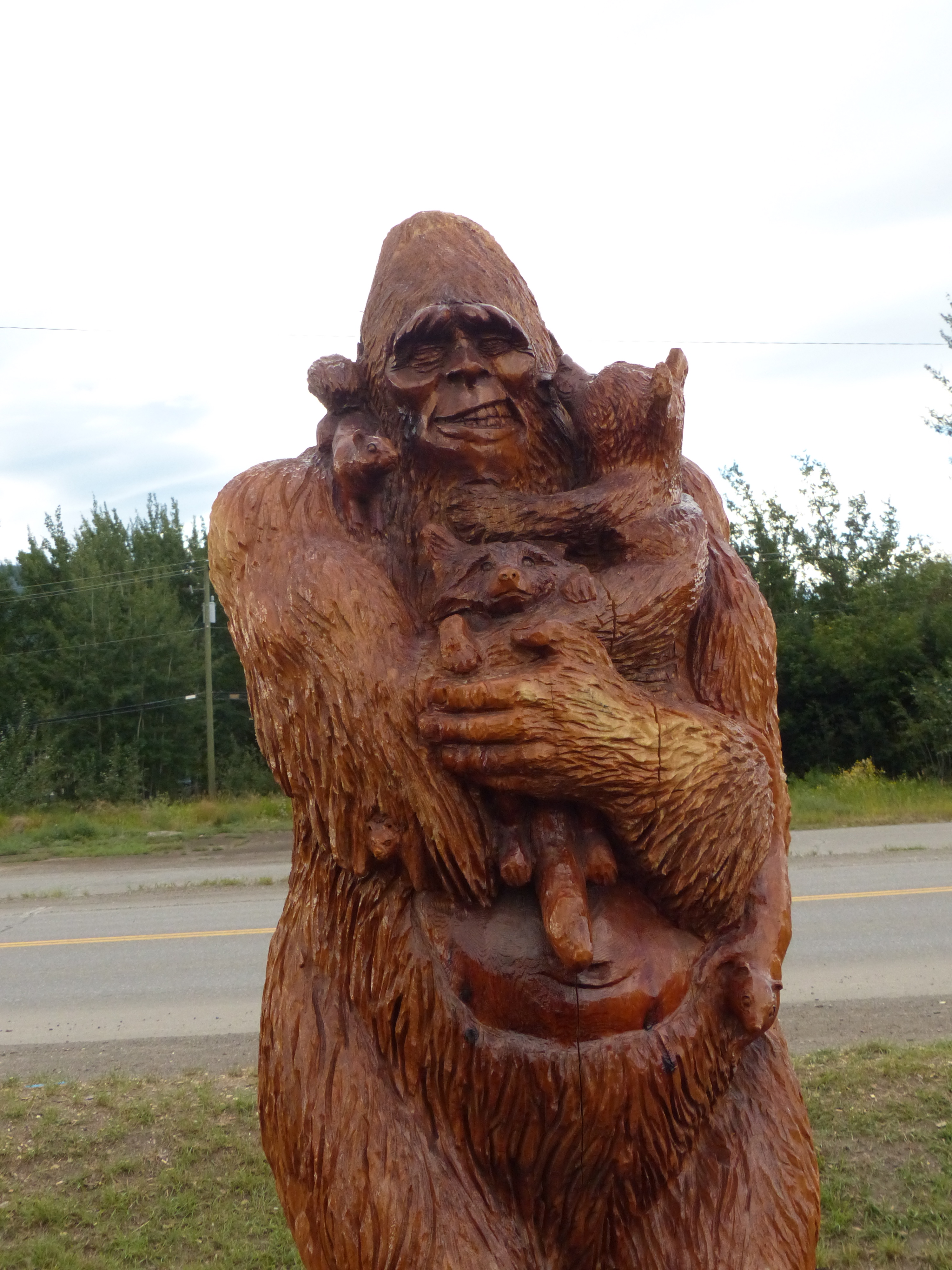
Here is another chainsaw carving from Chetwynd.
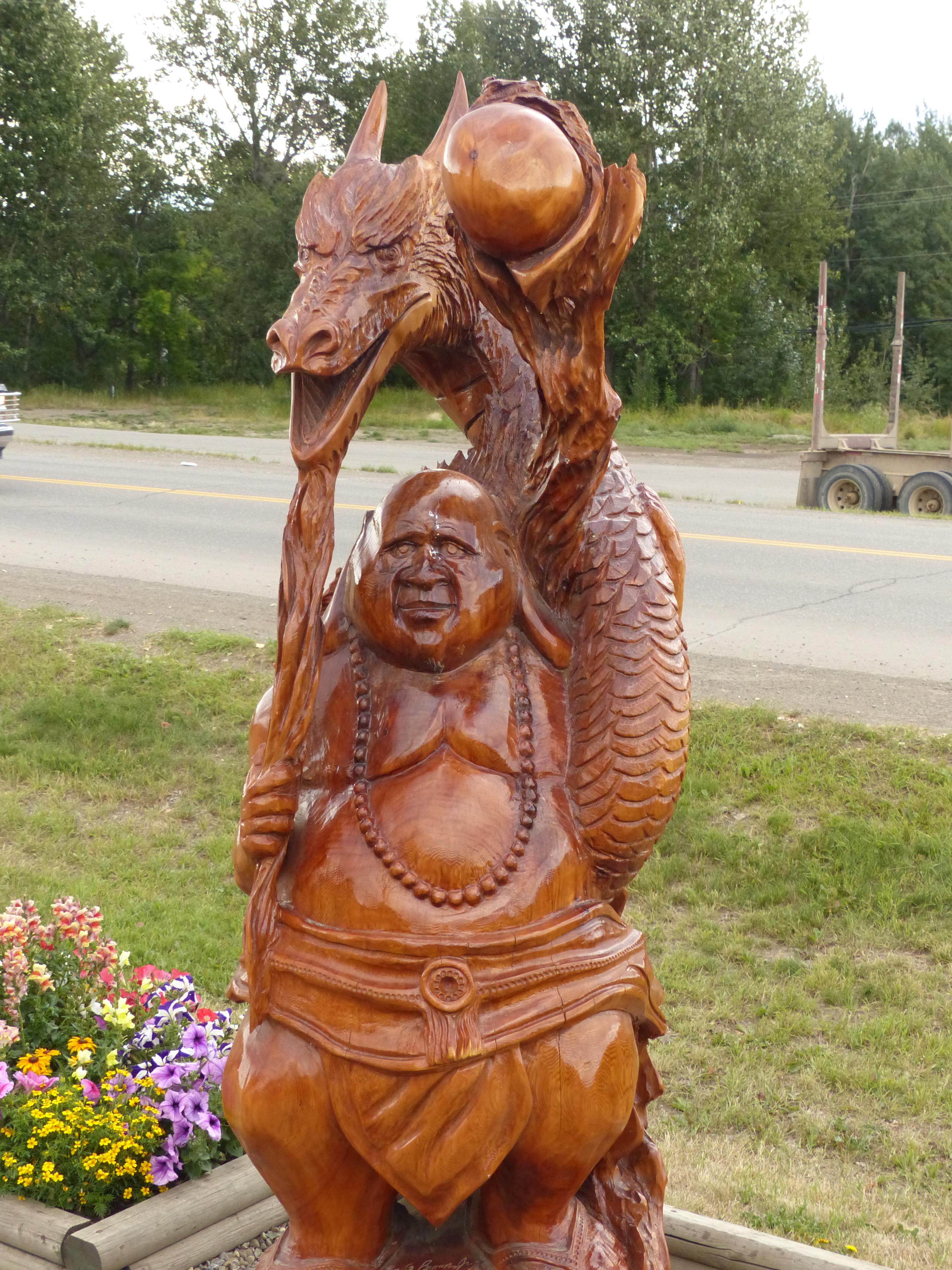
This fellow was carved out of one block of wood and stands on display in Chetwynd, British Columbia, along with other carvings.
My original goal for the day was Watson Lake, but that was far too far for one day’s travel, so my backup goal was Fort Nelson. On the way, I stopped in the town of Chetwynd, the chainsaw carving capital of, as far I’m concerned, the universe. The town’s main drag is lined with the bores of extremely thick trees carved into all sorts of fantastical shapes. The Visitors Center sports about 20 of these wood statues all around it. It’s just astounding artwork.
Then, of course, I had to stop in Dawson Creek. That is the town where the Alaskan Highway starts. The part of this highway that connects Canada with Alaska was built in 1942 by American soldiers to create a surface supply route to Alaska. Despite nearly impossible conditions and total unfamiliarity with the difficulties of building a road in that area of the world, the job was done in nine months. One of the five regiments that did the work was an African-American unit. I don’t need this reminder, I hope, but many Americans do. Blacks in the United States have served this country through generations, thousands of them dying for this country, despite the despicable treatment that was meted out to them in civilian life. Those same blacks that would build a road in terrible climactic conditions to create a supply route to protect Alaska from enemy invasion went home after the war to find – again – that they couldn’t vote, couldn’t go to good schools and couldn’t even drink from the same water fountains as whites. But blacks did and do continue to this day to die alongside whites when the nation needs and asks for their help.
I won’t say a lot about Fort Nelson. The nice gal at the visitor’s center directed me to a motel that was closed for renovation, and the proprietor of that motel directed me to a motel where, among other flaws, the room key didn’t work, but (thank you, says Abby of the sensitive nose), the shower did.
About keys. I worry about keys. Today’s motor vehicles are so sensitive to theft that frequently the vehicle’s owner is the victim of those anti-theft mechanisms. A friend of mine, Brady Carlstrom, owned a Lexus. At a bowling tournament (which was a short but entertaining road trip), a friend of Brady’s – Mike – took a nap (passed out) in Brady’s car, which Brady had locked when he went in to bowl. Mike woke up and couldn’t get out of the car. When he tried to open the door from the inside, everything automatically locked down and the siren went off. Mike had to call Brady on his cell phone to come get him. The language Mike used in the text message was not complimentary to the Lexus image.
An even worse fate was visited upon an angler visiting Lake John, a big fishing lake in Jackson County, Colorado. The man went to the porta-potty, dropped his pants, and also dropped his keys into the stinky sump below. He was four hours from home and only had one set of keys with him. There were few – okay, there were no volunteers who would help him probe the sewage below to find his keys. He eventually called his wife to make the four-hour drive up to Lake John with a spare set of keys.
Me, I know the feeling. When I bought my Honda, I got two sets of keys and ordered three more sets. That’s another thing that separates my generation from current generations. If I wanted extra keys for my 1964 Chevelle, I went to the hardware store and had them made for about a 60 cents each. And if I locked myself out of my car, I and most of my friends could open the door with a coat hanger.
Not now. I told the service guy I wanted three extra sets of keys. He replied that they would be $70 each. Y’see, said he, keys are little computers and they have to be programmed. I said I didn’t care (I did care, but I know my weaknesses), I needed the extra keys. One set would be used every day for the Honda. The master set – the one the dealer needs to make extra keys – would remain in my office. A third set would be in my briefcase, which usually would be in the motel with me in case the regular set accidentally got locked inside the Honda. A fourth key would be secreted somewhere in the framework under the SUV. One can always find a little nook or a cranny where that key can be hidden, and when I lost my driving set of keys on the golf course one day, that hidden key became very important. And there is a final key to replace any of the others I might lose.
So why am I so anal about keys? You have to follow this story closely, because it’s why my golf clubs and a bowling ball got stolen in Grand Junction, Colorado. My previous car was a Dodge pickup with a cap. I was on a road trip to northwestern Wyoming to finish writing a book, and stopped to take a long hike with Abby. I was a couple miles off the highway in the deep forest. I locked up the car. I put the ignition key to the pickup in the bed of the truck, and locked the cap (I didn’t want to drop the pickup keys during the hike; ergo, I left them in the pickup. Some people walk a short distance and hang key in a tree, but what sometimes happens is a group of stupid hikers will come along, find the key, and take it to the nearest town to turn over to the police, which leaves the hikers who hung the key in the tree stranded. Life is sometimes complicated, even for nature lovers yearning for simplicity). I went on my hike. I returned to find I didn’t have the key to the pickup cap. I could see that key sitting on the pickup’s passenger seat. So I didn’t have access to the key I needed to open the cap and get the pickup keys. I had carefully locked away the ignition keys and then punched the automatic lock button to the whole vehicle while the key necessary to get my really necessary key was locked away also. Therefore, I had to break open the cap with a rock shaped like a hammer. I never got the broken lock replaced. When I went on a recreational road trip to Grand Junction, I left my clubs and the bowling ball in the bed of the pickup not even thinking that I couldn’t lock it. Who steals from cars parked in a lighted Comfort Inn parking lot? Well, somebody does.
Now, back to that vault toilet. Given even the remote possibility that something in the pocket of my pants would jump out and land in the sewage below, I remove such items from my pants before I even lift the lid. One day on my trip, it was my wallet. I set my wallet on the toilet paper holder and proceeded with the main purpose of my visit. I walked back 100 yards to camp. Upon arrival, I realized that my wallet was still sitting on the toilet paper roll in a toilet in a campground with 53 camping sites. I am absolutely certain that I set the world record for the 100-yard dash by 66-year-olds as I ran back to that toilet.
The wallet was still there, but I thought, “What if it hadn’t been there?” A good portion of my cash, both credit cards and several other important documents – like my health insurance card – were in that wallet. What if somebody, even an honest somebody, had walked away with it? They would have had no way to find me. People register in these campgrounds by sticking a piece of paper into a metal box. One rarely if ever sees a campground host. And if someone had stolen the contents of the wallet, they would have simply thrown it away. Where would that leave me? I would be like a boxer in the middle of a fight who lost an arm between rounds. One has no conception of how necessary the contents of one’s wallet is until one loses it. At that point, I removed one of the credit cards and hid it in the interior of the Honda. I had plenty of keys to get to it if I needed it.
On the way from Fort Nelson to Watson Lake, I nearly ran into one buffalo, two mountain goats, one bear, one deer and one flagman. The flagman and I had a long chat that started with, “You’ve got good brakes on that car.” I had been gawking at the scenery and nearly ran into the guy. “So where’re you from?” I asked.
“Vancouver,” he answered.
That was about 2,000 miles away from where he was standing on a remote highway, a rather long commute, I thought. “Why,” I asked.
“Job,” he answered. And I pondered, a flagman’s job?
“What does a flagman make up here,” I asked.
“About $800 a week,” he answered. After we got through chatting, I asked if I could leave my resume with him.
I arrived at Watson Lake in the early afternoon. If you don’t know the area, Watson Lake is kind of a crossroads in the north country. Four paved highways come together in the vicinity. I stopped there to load up on freebees at the visitors center, which was run by some of the nicest and most knowledgeable people I’d run into yet.
Watson Lake isn’t a big town, but like several other moderately-sized towns in the Yukon and British Columbia, it had a gimmick. Chetwynd had its chainsaw carvings, Dawson Creek had its Alaska Highway 0 miles marker and living museum, and Watson Lake had its signs
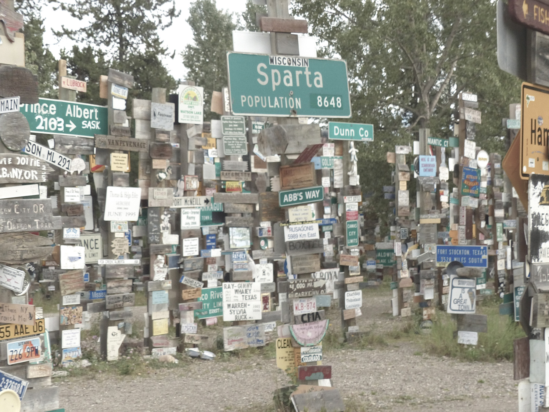
Started by a homesick soldier in 1942, it has become a custom in Watson Lake for visitors to hang a sign from their hometown. There are now 80,000 of them.
In 1942, a soldier working on the Alaska Highway was so homesick, he asked the town fathers if he could put up a sign showing the mileage to his home town in Illinois. Other soldiers started doing the same thing, and after the war and ever since, people have been putting up their hometown signs. At the visitors center, they’ll even give you a kit to make a sign. So now, there are more than 80,000 (not a typo – eighty thousand) signs hanging in the park next to the visitors center. People are just mesmerized by this and spend a bunch of time just wandering among the poles, reading and photographing signs.
I was trying to tell myself not to hurry because chances were I would never be in this part of the world again, and certainly would never be here is such good weather. Since the rain in the Jasper National Park, the weather had been perfect.
So I was going to take the scenic route north of Watson on Highway 4, but the people at the visitors center suggested I not do that. They said the road was pretty rough and not all of it was paved. Hondo the Honda (aka “The Flycatcher”) was wearing a new set of tires, but unpaved roads in northern Canada take their toll. They don’t use limestone for road gravel; they use granite, which is harder, sharper and bigger than the limestone we are used to in the U.S. I don’t know if AAA works in Canada, but I knew my cell phone didn’t work. There’s a point in one’s life where one draws a line between taking chances and taking care. Being stranded on a remote highway in the Canadian bush is not something one enters on the list of “entertaining vacation stops.”
So I took Highway 1 – the Alaska Highway – which starts to bend north toward Dawson City, my goal. That stretch from Watson Lake to Whitehorse is just a wonderful, scenic, fascinating stretch of roadway that I just don’t have the words to describe. Abby doesn’t have the words to describe anything, but she had taken to looking out the back window gazing at the passing parade of verdant vistas and seemed to approve.
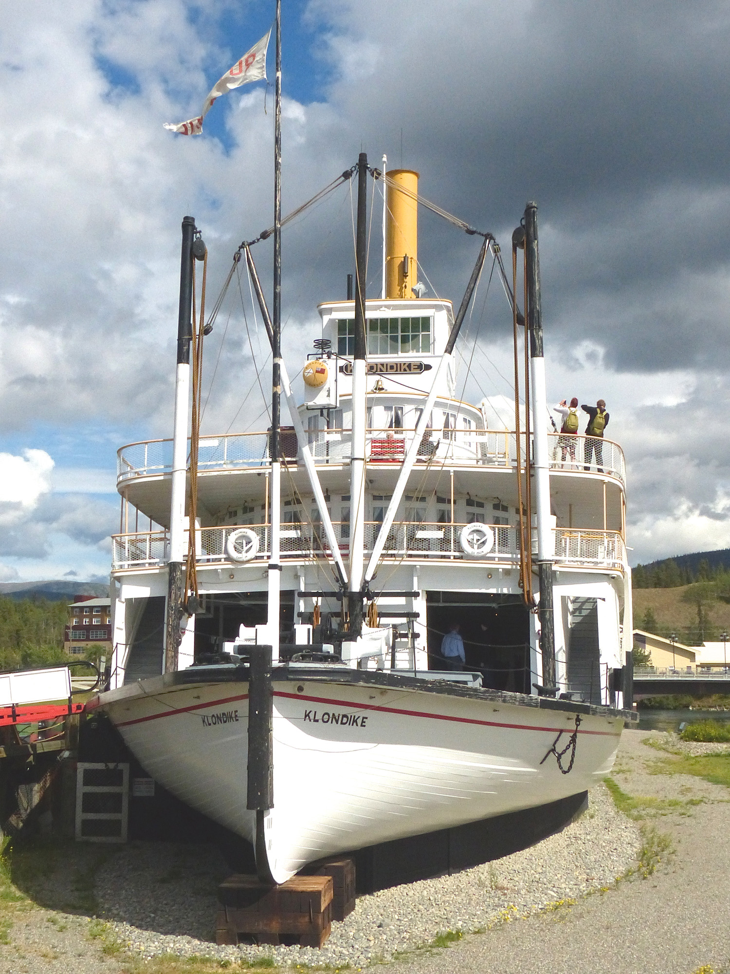
This seems like an odd place for a boat. The steamship “Klondike” used to ply the waters of the Yukon River during the gold rush era.
Did I mention every town had its gimmick? As you drive into Whitehorse from the southeast, the first thing you see is a Riverboat from the Gold Rush era. These riverboats used to ply the Yukon River when the Gold Rush was at its height around 1900 and Dawson City was a destination point with a population of 40,000. This particular riverboat is on land at the moment, and one can park one’s car, stroll up to the surprisingly large vessel, and take a tour, all for free. Fun fact: the engines of these riverboats would burn up to one cord of firewood per hour.
Whitehorse, I think, is the largest city in the Yukon Territory, and I actually found a shop with a guy who could sell me a piece of camera equipment that would allow me to transfer photos from my camera (a real camera, not a cell phone camera) to my computer. From there, I could communicate news of my travels to Facebook, and therein lies the reason for this rather lengthy travelogue. I became fleetingly famous on Facebook with some pictures and stories of my trip, so I thought I’d write it all down and post the whole thing on my brand, spanking new website, Dustinbooks.com.
Driving out of Whitehorse, I again took a wrong turn and traveled about 60 miles down the Alaska Highway before I realized my mistake. I had to turn around on Highway 1, then retrace my route back to Whitehorse, then head north on Highway 2. If you’re wondering, all the highways in Yukon Territory run from No. 1 to No. 10. That’s it. Look at the varicose-vein pattern of paved highways in any state in the U.S. – most of which are smaller in territory than the Yukon – and you get an idea how sparsely populated is this grand region of North America.
You also may be wondering why I didn’t invest in a GPS unit before I left on my trip. For starters, I have a flip phone, not a smart phone, and my 2011 Honda Pilot didn’t come with GPS. I bought it “off the rack,” and so couldn’t order amenities. But I wouldn’t have ordered GPS in any case. On that road trip to Baton Rouge, both of the Jims with me on the trip had GPS on their phones. I woke up in the middle of the night, and we were driving down a frontage road about a mile from the interstate. “Why aren’t we driving on the interstate?” I asked. “Go back to sleep,” they both answered at once. It seems the two GPS phones had given conflicting information.
This happened again in Baton Rouge. The Motel 6 where we were staying was located at the west end of a bridge across the Mississippi River. Jim Anderson and I were returning from a golf course on the east side of the river when we got to the bridge. “Turn left,” Jim said. I said, “That can’t be right.” Jim says, “No, left,” and I said, “No, I mean, that can’t be correct,” and he says, “That’s what the phone says,” showing it to me. We’re in traffic, so I had to make a decision, which to me was obvious. We had to go over the bridge. The phone, you see, couldn’t differentiate between one Motel 6 and another, which reveals a deeper problem.
We, as humans, are developing an unhealthy dependence on machines. Having seen Terminator I, II and III, I know where that can lead. It’s not that I don’t trust GPS systems. Heck, I got misled looking for a campground that turned out to be closed. The map I was using misled me (“map,” for you youngsters, is a kind of detailed aerial view of a region printed on paper).
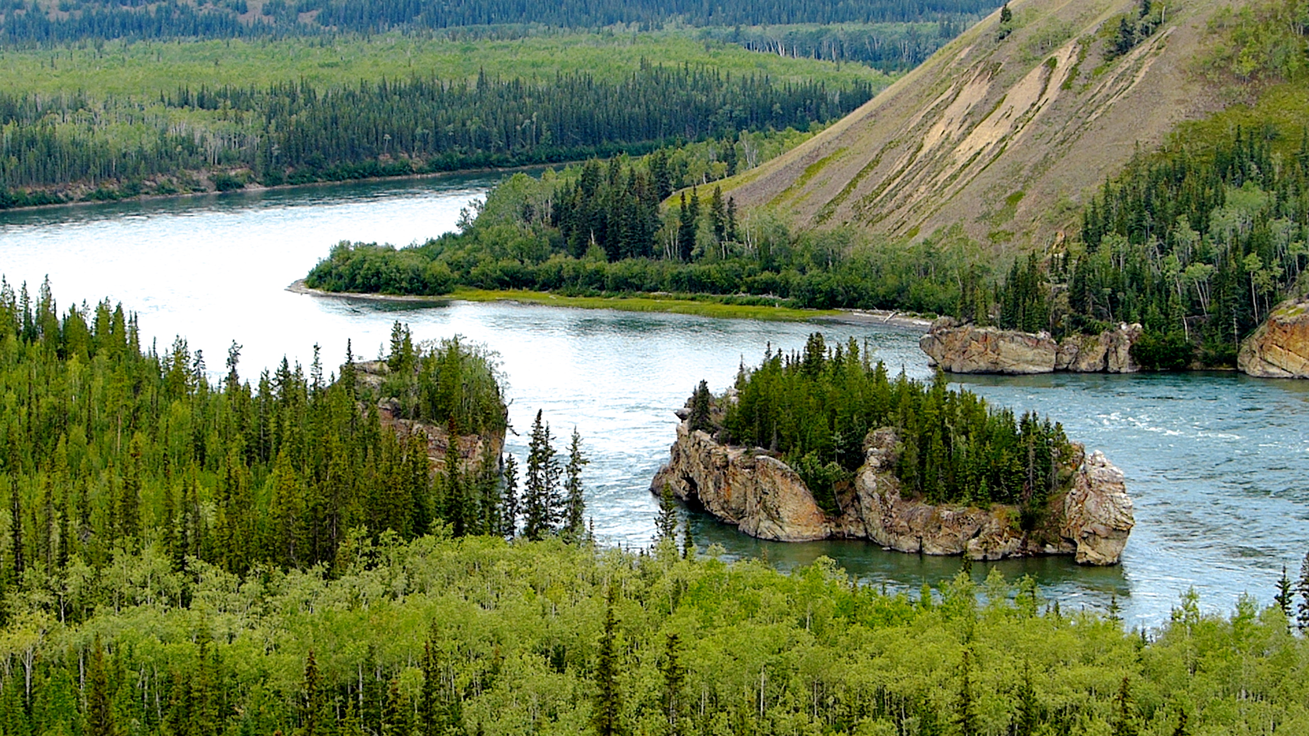
Paddlewheelers plying the Yukon River had to pass this island via the near channel, the wider channel being too shallow. It was a dangerous part of the voyage. I prefer a car.
Maybe if I’d had a GPS system, I wouldn’t have missed the Highway 2 turnoff. Or maybe not. Remember, I have a satellite radio that wasn’t working hardly at all at those latitudes. Maybe that slightly condescending female voice would not have come on and said “recalibrating.” And while we’re on the subject of GPS voices, could we have a little variety? Could we maybe have a fellow with a southern drawl saying, “Ah haite to mention this, but y’all are goin’ to have turn this outfit around and head back thataway.” Or maybe an annoyed black woman saying, “Look fool, this ain’t right! Damn. Turn this thing around, and I mean now. An’ lissen to me next time! Don’t make me recalibrate again or I’ll steer your ass into Lake Michigan!” Or Mae West: “Dahling, if you want to come up to my place, you’re going to have to follow my, um, directions.”
I think I’ll stick to maps and stay away from the other automobile “improvements” that seem to be popping up all over the place. I don’t want a car that allegedly can steer me out of a lane change, or a car that brakes for me, or a car that parallel parks itself. Who do you sue if the car rams into a Lincoln while parking itself? The car? Me? The dumb computer programmer? I’m still irritated about that fly that disabled my $30,000 SUV because its mere presence confused a sensor that reported directly to the car’s CPU without checking with me first. How much control do we want to give up to a … car. Think about this: a massive electromagnetic pulse explosion from a nuclear device, or a solar flare of sufficient magnitude, or even a well-directed pulsar burst from light years away could knock out the planet’s electrical grids at any time, without warning. In the department of climate change, the universe has far more powerful tools than a carbon tax. Could you survive such a celestial event? Wouldn’t you like to have a nice 1964 Chevelle in your garage as backup?
Anyway, I found my way back to Highway 2 (like that was difficult; there are two highways in the area, 1 and 2) and finally found the next campsite. I stayed on Lake Leberge, another one of these Canadian mini seas. Lake Leberge isn’t really a lake, but rather a widening of the Yukon River as it moves north. It was both a highway and a hindrance to the gold seekers headed to the Yukon bonanzas. In the summer, the lake was large enough to be dangerous in stormy weather, and in the winter, ice flows and changing ice conditions also made it dangerous. The lake is mentioned in the works of two giants of Yukon literature, Jack London (“Grit of Women” and “The Call of the Wild”) and Robert W. Service (“The Cremation of Sam McGee”).
As for me, it was the first time I wet a fishing line. I was sitting on a rocky outcrop watching my bobber when a fellow ambled up and said, as all amblers do to all anglers, “Catching anything?”
“No,” said I, “but that’s really not all that important.” And it wasn’t. From that point, I was treated to a wonderful sunset, and the next day, a gorgeous dawn, and I realized I had now endured six entire days without turning on a TV.
Days Seven and Eight
Dawson City. This burg was not very important before the Gold Rush, and isn’t very important now, speaking strictly from the point of view of commerce. As with most settlements, Dawson City owes its geographic origin to the nearby confluence of two great northern rivers – the Klondike and the Yukon.
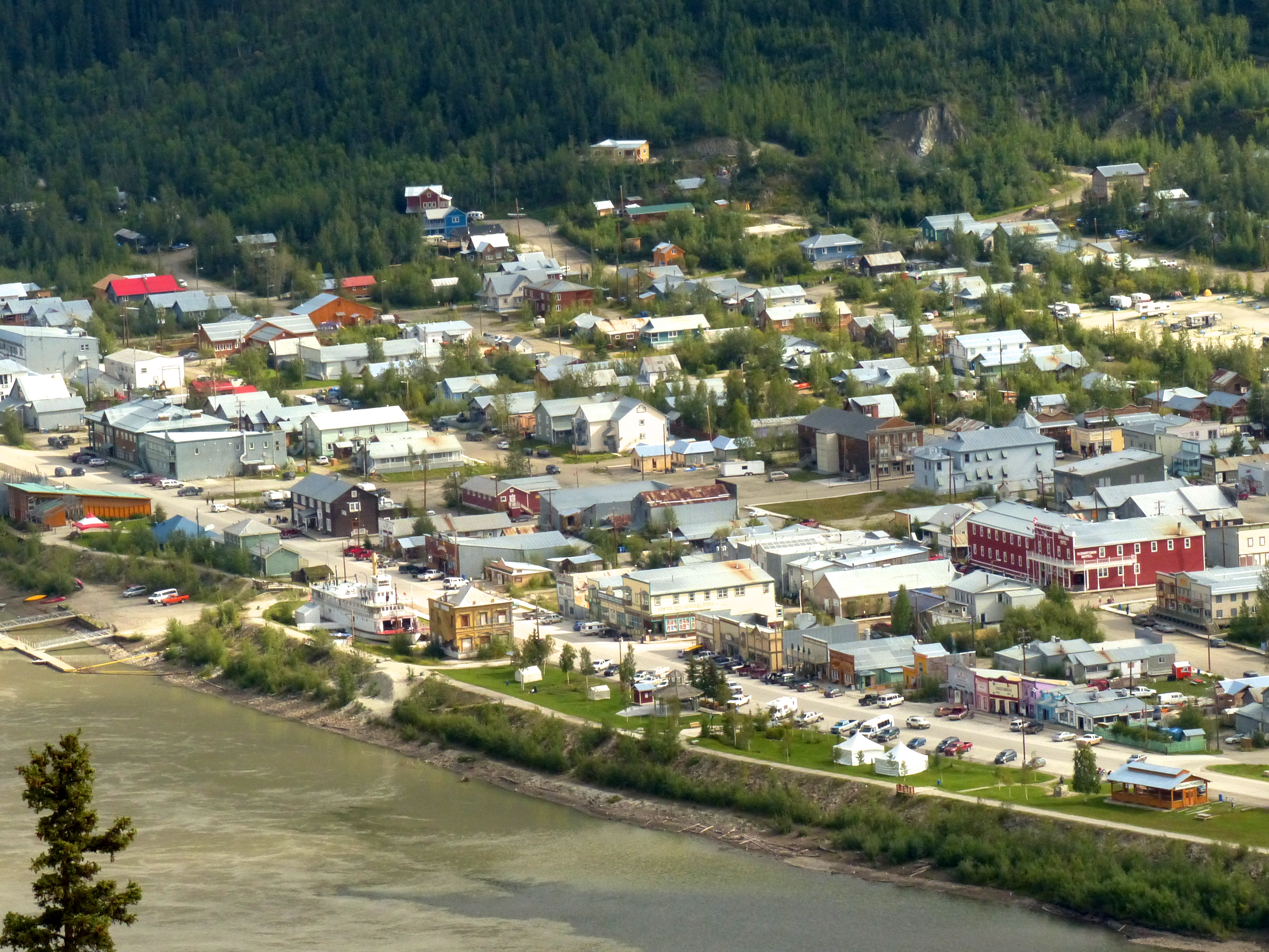
This looks like an aerial view of Dawson City, but it was taken from a mountainside overlooking the Yukon River.
The Yukon is a curious river. All great rivers head toward the sea. Few don’t make it. There is one in Africa that disappears into the desert sands. But the smart rivers head directly for the sea. The Yukon is the third-longest river in North America, yet it rises about 100 miles from the Bering Sea But it then heads in exactly the wrong direction to get to the sea. It heads east, then north, then northwest, then west, then southwest like a deranged gypsy for 1,980 miles before it finally finds the Bering Sea. “Yukon” is an Eskimo word meaning “not smart river.”
Just the storied names “Yukon” and “Klondike” evoke visions of tough minors, visionary explorers, giant bears, native tribes, intrepid dog teams, fierce winters and discoveries of vast amounts of gold that made some rich but more poor. The chief illustrator of this life at the turn of the 19th Century into the 20th was Jack London, who lived in Dawson City for about a year. The town was the territorial seat of government until the Alaska Highway bypassed it, so the population eventually sank to about 1,600. It has enjoyed something of a resurgence because there is still gold there that, due to recent high prices, can be mined profitably, and tourism. About 60,000 people per year visit the town. In 2014, I was one of them. Incidentally, for you global warming fans, the highest temperature ever recorded there was in 1983, or 23 years before the release of that great work of fiction, “An Inconvenient Truth.”
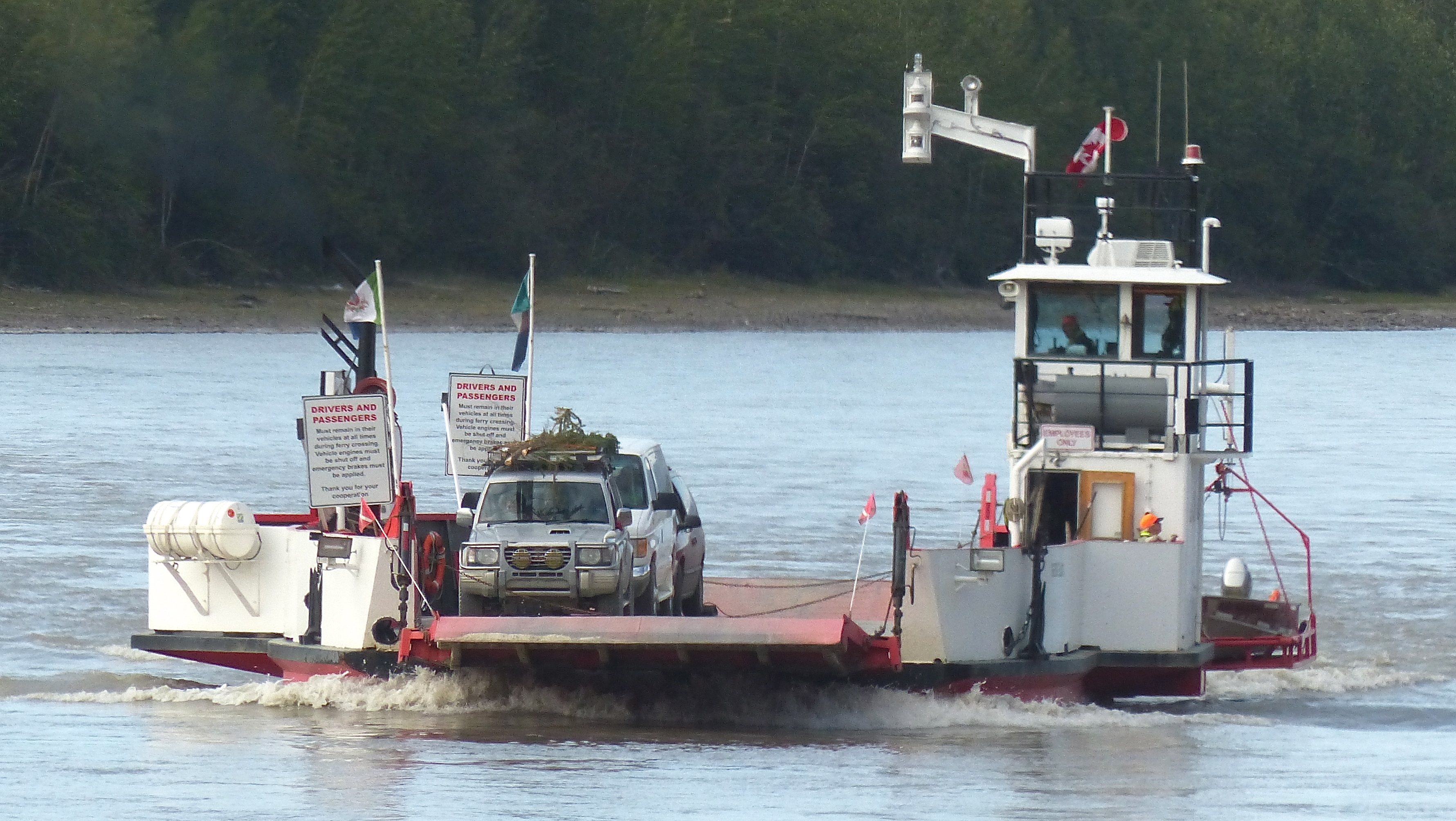
If you can’t build a bridge across the Yukon River, run a ferry. This one ran 24 hours a day, back and forth, from Dawson City to the other side of the river leading to The Highway at the Top of the World.
I camped in a provincial campground along the Yukon River across from town. There’s no bridge there. A ferry runs 24 hours per day in the summer to take people to and fro. At campgrounds, I take Abby around nearby campsites on a leash. She helps me meet people. I was hoping she’d help me meet as pretty a lady in human terms as Abby is in dogdom. However, she met one of her own. Abby is half boxer, half lab. Her color is black with a white chest and three white paws. Out of a nearby campsite comes a rambunctious brindled dog with a head that looked oddly like Abby’s. I asked its owner what kind of dog it was. “Half boxer, half lab,” he replied. What are the chances of that? I stayed in Dawson City two days, and those two dogs had a lot of fun together. Abby’s getting on in years and can’t hike or play the way she used to, so it was good watching her act like a puppy again.
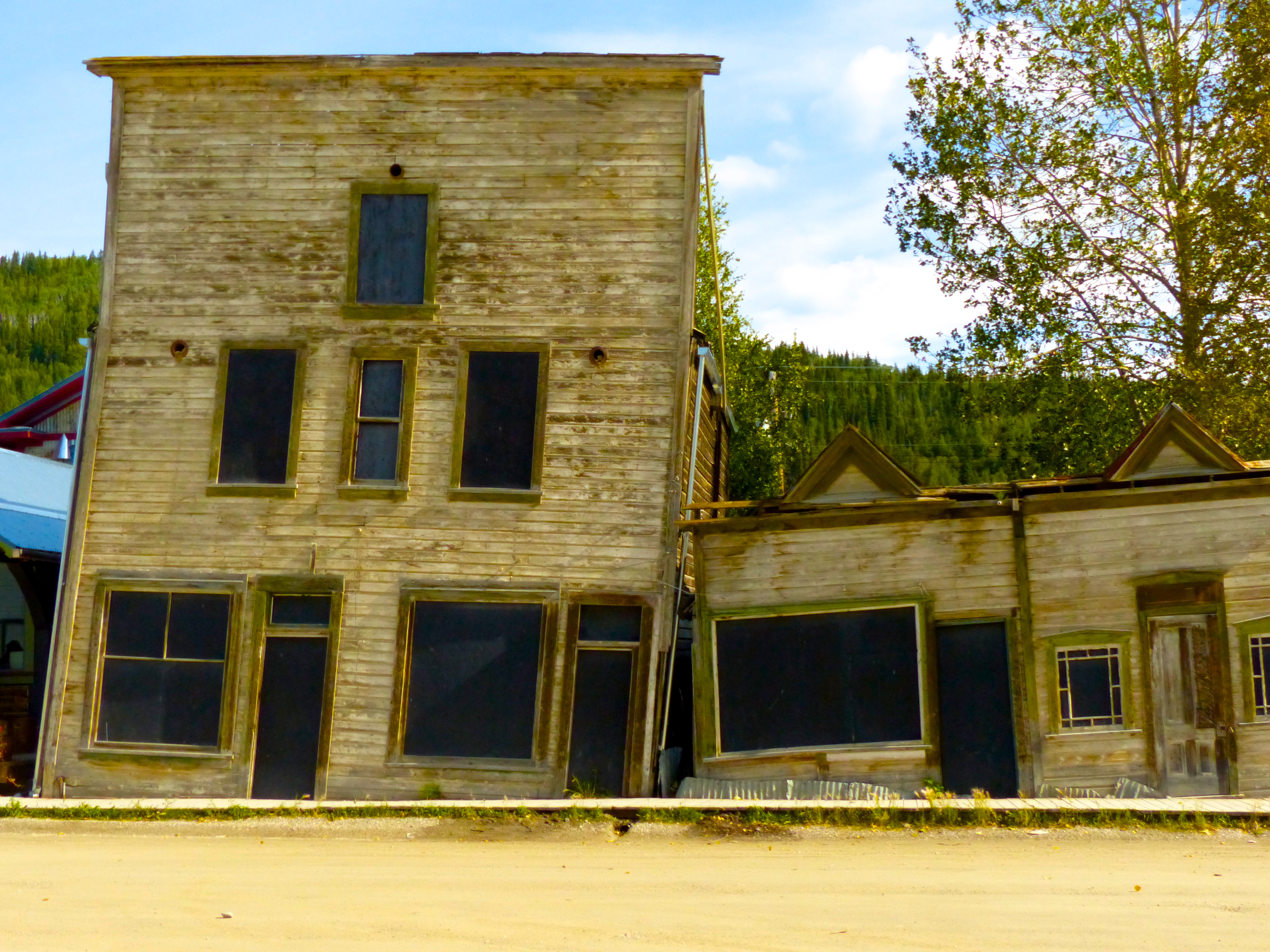
We’re having a discussion in my hometown about building codes, but our needs clearly aren’t as urgent as those of Dawson City, Yukon Territory, where the only thing holding these two buildings upright is each other.
I was still out of communication with the rest of the world, and I wanted to know what my stocks were doing, so I went to Dawson City looking for wi-fi. Unless you’re a guest, you couldn’t tap any of the motels’ connections, which is an old road trippers trick. Another old road trippers trick is how to get free ice along the highways, but I’m not going to reveal that because I believe it to be illegal. Not that I ever did that.
The public library was closed, so I found a hippie café with wi-fi. Talk about getting sent back in time! I hadn’t seen so many tie-dyed shirts, frizzed hair, sandals, Indian braids, moon teas and smelled the faint, lingering odor of marijuana since my last demonstration in college. Nobody talked to me because I think I looked like a narc. I ordered a concoction from a menu with no prices on it and hooked up to wi-fi. There, I found several messages to call home immediately.
I’m not going to dwell on this portion of my trip too much. The news was one of my best friends – ten years younger than me – had died suddenly and unexpectedly. A couple of days later while driving down a lonely stretch of highway, I got to thinking about good and evil. I believe in God because there is good and evil in the world. God represents to me the forces of good. The major religions teach the difference between good and evil and come down on the side of good. That’s enough for me. Kyle Fliniau was a good man. He wasn’t Jesus Christ, or Ghandi, or Mother Teresa, but he led his life in an exemplary fashion in all ways. He was, to use a cliché, a pillar of the community, and a good friend to many, a generous soul, and hopefully will be remembered with fondness for a long time.
I believe that as long as we remember people, they continue to exist in whatever passes for the next life. Maybe our memories of them are their energy source for a continued existence. I don’t think individuals who have lived pointless, useless, self-indulgent lives on this plane of existence spend a long time on the next one – maybe an hour or two – because they gave no reason for anyone to care about, or remember them following their earthbound years. After death, perhaps their souls are shuffled along to the great galactic recycling bin.
The problem with my belief system is we remember bad people as long as we remember good people and thereby give deceased bad people the energy to continue their existence on the next plane. The ancient Egyptians might have had an inkling about this. If they had a particularly bad actor in their world, they would erase all record of his or her existence. That would have been quite a chore in ancient Egypt where they would have had to erase stones, but they did it. The Romans had the same idea. They tried to eradicate all record of Gaius Julius Caesar Augustus Germanicus, better known asCaligula, and rightfully so. Obviously, this didn’t always work. Caligula is well remembered and even admired in some circles today. But if this eradication of one’s record of existence on Earth did work in some instances, how would we know? It’s an enigma, kind of like a road hazard of the mind. Thus are the perils of deep thinking while driving at high altitudes after two hours in a hippie café. But I will do my part for Kyle Fliniau by recalling his honorable life until the day I die.
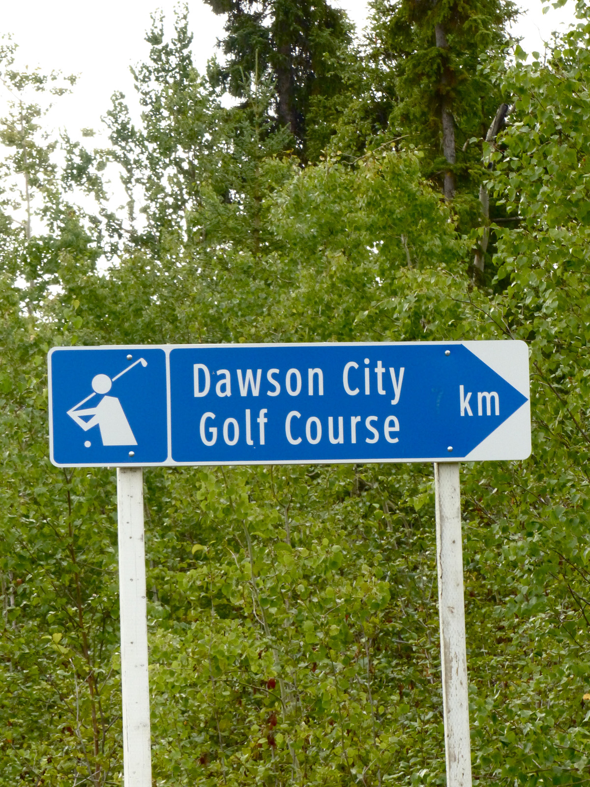
A golf course in Dawson City? Yep. It’s the northernmost golf course in North America with real greens.
I was able to perform one act of remembrance immediately. One of Kyle’s great passions was golf. We used to seek out new and interesting golf courses, and I found one just north of Dawson City. I was headed up to the Top of the World Highway (which is no big deal, by the way, but it is up there) when I saw a sign that said “Golf.” No way, I say. Dawson City’s climate is like my hometown of Walden, Colorado, where we have two seasons: winter and the Fourth of July. But Dawson (as the locals call it) does have a golf course. “It’s the most northern golf course in North America with real greens,” the pro tells me. They let me play before it opened because I whined, “Geez, I drove all the way here from Colorado.” It as fun, and I wished Kyle could have been there. Maybe he was.
Dawson City is about 2,800 miles from Walden, Colorado, by the route I took. Time to turn toward home. I had planned to drive over the Top of the World Highway into Alaska, make a wide circuit through that state, then maybe do some deep sea fishing out of Haines (where I hoped to tour the underwear factory), but Kyle’s death put a time limit on my trip that I hadn’t had before. Kyle was the mayor of Walden; I was the mayor-pro tem. I needed to get back.
Day Nine
I mostly drove today, covering 600 miles from Dawson City to Watson Lake. The days are long this far north, the roads are long, the scenery consistent. Driving along Highway 2 from Dawson to Whitehorse is kind of like a boat ride on a rolling sea.
Okay, I’m guessing alcoholism is a problem in this area.
The land undulates, and the Canadians do their best to keep a road atop those dips and heaves natural to the land. Road construction is the contractor’s perpetual motion machine; the work is never done and it never will be done. Temperatures range from -50º to 90º in one year, and the ground rises and falls, erodes and slides, and water is everywhere, freezing and flowing. It’s a wonder the bulk of the highways aren’t closed during the summer for reconstruction.
Because I have considerable experience driving in frightening winter weather, I can well imagine what winter is like up here. Just the signs tell the tale. There are dozens of “chain up” areas before what one might consider the least of hills. Then there is the “closed to winter travel” which tells one that at certain times of the year, winter wins and man loses.
The only stops I made during Day Nine were to let Abby go out and play. I don’t know that I’d have done much of that when Abby was young because she would take off and run literally over the entire available landscape. I have waited long hours in the Rocky Mountain forests waiting for Abby to return from some ramble, constantly fearful that a mountain lion or a badger might have extinguished that exuberant spirit. Clearly, she always returned or she wouldn’t have been with me on this trip. Now, she can’t do that because she will collapse from a seizure. They call it “exercise induced collapse,” and it can be very severe. On our last backpack, the seizure was so severe, I thought she had died. So no long hikes on this trip.
Abby enjoying a meadow in British Columbia.
But short-term romps in the meadows are okay. I thought about not bringing her along, thinking the stress might induce seizures. I have a trusted friend who would have taken care of her. And a dog can be a large inconvenience. Many motels won’t allow them; they have to be locked up on ocean ferries. I didn’t bring golf clubs because I didn’t want to leave her locked in the Honda for hours in the summer. But then again, watching her romp in a field of flowers will brighten anyone’s day. And then again again, when a bear wandered near my camp one afternoon, there was Abby doing her best pit bull imitation, standing stiff legged with hackles up, barking and glaring in the direction of the bear.
And when a drunken Indian at Dease Lake stuck his head in my window and more or less demanded a ride to “the res,” Abby came charging up from the rear of the SUV, and the Indian backed off. That problem got solved fairly quickly. I didn’t know if “the res” was a reservoir or a reservation, but I asked where “the res” was. He pointed. I said, “Darn, I’m going the other direction.” It didn’t matter what direction he pointed, I was going to be going in the other direction.
And Abby’s my dog. Sad moments stick in my mind. Not necessarily tragic moments, or disastrous moments, but sad moments, like seeing your dog trapped behind a fence looking longingly at you as you drive away to go play golf. I would have had that look stuck in my mind for weeks had I left Abby in Walden. And dogs are the best mood control drugs on earth. They look at you when you’re down as if to say, “Why are you sad? I can help. I’m a dog, you know.” A little doggerel for the road:
Where are we going today, Jim,
And what are we going to do?
I don’t care what you say, Jim,
As long as I’m doing it with you!
And, if you leave Abby behind, I can come home and watch her run in circles, wag her stub tail, and look accusingly at me as if to say:
Where did you go and what did you do, and how come I wasn’t there with you?
So on this trip:
Wherever you are, I should be,
Wherever I am, you should be,
That’s why you’re on this trip with me.
I got to what looked like a nice motel outside of Watson Lake where the rooms had everything except a phone and where the rooms cost $159 per night, having just been remodeled and all. The owner was a nice guy, but I said I really needed a phone in a room. I didn’t add, “a cheaper room.” We were sitting in his restaurant with another guy who owned a motel in the town. He had phones in the rooms. And the rooms were cheaper. “This is the friendliest competition I’ve seen in a while,” I commented.
This is where I was introduced to the phone card, because Guy No. 2’s motel was even cheaper if you paid in cash, but then you couldn’t make long-distance calls. Guy No. 1 said just buy a phone card. They’re only $20. So I did. I made several phones calls on the card that night and following nights down the road. When I got back to Walden, I still had 350 minutes available. I may have overpaid for the card.
Day Ten
My original plans called for me to head for Skagway or Haines and do some deep-sea fishing. Because I was on a schedule, that wasn’t going to work. Next trip, I thought. But I did want to fish some of those lakes and maybe have a fresh fish dinner of some sort. So I left the Yukon Territory, where a fishing license was $20, and dropped into British Columbia where a license was $50 for six days, assuming I could find a place to buy one.
The first sign of officialdom on Highway 37 south is Boya Lake, which I imagined was named after some angler hauled in a monster fish and exclaimed, “Boya, boya, boya, whatacatch!”
I found a camp host with an official British Columbian vehicle and asked if I could buy a fishing license here. No, she said. You can get one over the internet. Do you have wi-fi here? No, she said. And besides, she went on, fishing wasn’t very good on Boya Lake. Well, where’s the nearest place I can get a license? Dease Lake, she said. So I headed for Dease Lake, about 100 miles away. Can you imagine driving through Colorado, or Wisconsin, or Vermont and being told the next place you can buy a fishing license is 100 miles away? Fine, says I, and drives away.
I was kind of meandering along because there were all these signs saying watch out for wildlife. I saw a couple moose along the way, but that was it. I arrived at Dease Lake and went into a big market there. I waited in line to get to the counter where I asked to buy a fishing license. “We don’t sell licenses. We really should, but we don’t,” the clerk said.
“Where can I get a license?”
“At the provincial office over there, but it’s not open until Monday,” she said. It was Saturday. I was beginning to think that maybe British Columbia didn’t want people disturbing their fish, and this was confirmed at the Kinaskan Lake Provincial Park. I wanted to stay at Swan Lake Provincial Park to see the ballet, but it was too far down the road.
The camp host came around to collect the camping fee, which was rising the further I progressed south, and I said “I know you can’t do anything about this, but I really wanted to fish on one of these nice lakes, but I can’t seem to find a place to buy a license. And look, I’m camped right on the shore here.”
The camp host replied (and I paraphrase), “Well, you could get one online before you get here, but it costs $50 for a visitor’s license for six days and the possession limit is only five trout, so that’s, like, $10 for each fish, and if you’re like me living on a budget, that’s pretty expensive food. Don’t know if you really want to do that. And I see you don’t have a boat, and you really need a boat to catch anything on this lake, and even then the fishing isn’t that good this time of year, but here’s some free firewood.” And she walked away. I never did get a fishing license in British Columbia. Clearly, they don’t want visitors to do that.
This cryptic sign either denotes mountians ahead, rough pavement ahead, or there’s a girl in the next village with three breasts.
The northern part of the Cassiar Highway, named for a town that no longer exists, was not in good shape when I traveled it. Especially south of Dease Lake, it had several construction delays and numerous tiny red flags that said “slow.” The flags warn the driver of some road hazard, like potholes or broken pavement or a large crack in the road. Problem is, the flags are right at the road hazard. I really had to watch for these things to avoid slamming on the breaks and seeing Abby flying by me into the windshield (Abby can’t read, you know).
I think the problem in this area was a massive construction project in progress, and trucks were hammering the pavement into rubble. The project is a BC Hydro electricity transmission line being built from the north part of the province where they generate electricity with (gasp!) dams, to the metropolitan south. Canada, unlike the United States with its inexplicable dithering over the Keystone Pipeline project, is building for the future. The 500,000-volt transmission line is being built to supply power for an expected population increase of 1 million in the southwestern part of the province. BC Hydro is spending $2 billion a year constructing this line.
Power line construction workers wait 200 feet above the ground for a part to be delivered by helicopter in a remote forest in British Columbia. Back in the U.S., we can’t even muster the will to build the Keystone Pipeline.
I spent a couple hours watching them work. The towers, over 210 feet tall and weighing 37 tons, are brought in by heavy lift helicopters flying over mountaintops and ridges. One section of the transmission line climbs up and over the steep slopes of a 10,000-foot ridge of the Coast Mountains. The towers dangle from cables while workers rush to attach it to a foundation and set guy wires. The ground crews can sometimes do this in 11 minutes. After the towers are set, workers climb to the tops and await delivery of smaller pieces of equipment by smaller helicopters. While I was watching, they were bringing in pulleys used to string the power lines from tower to tower. The workers were standing out on the towers’ arms 200 feet above the ground while the helicopter daintily lowered a part weighing over a hundred pounds to them. I wondered what, given what flagmen make in the province, their wages were. Note: the project will create more than 1,300 person-years of employment. Such a project would be impossible in the U.S. not because of the engineering hurdles, or the technical issues, or the problems presented by difficult terrain, or financial concerns, but simply because of lack of will in the highest office in the land. I drove on, depressed by that thought. Except there’s a floppy-eared dog in the back looking at me as if to say, “I’m a dog. I can help.”
“Can you help build the Keystone Pipeline?” I asked.
Her facial expression changed just a bit to a mournful, wistful look; “I’m just a dog.”
Day 11
I took a side trip, this one on purpose, to Hyder, Alaska, where it occurred to me that enforcement of building codes in the town for which I was now the mayor was not that big a deal. I ate at a restaurant that was a used bus. Oddly enough, it was called “The Bus” restaurant. It was next to a fish processing plant that supplied the fare for the restaurant, and it more than fair fare; it was really good. I had halibut that had never been frozen. It may have been caught, cleaned and cooked that same morning.
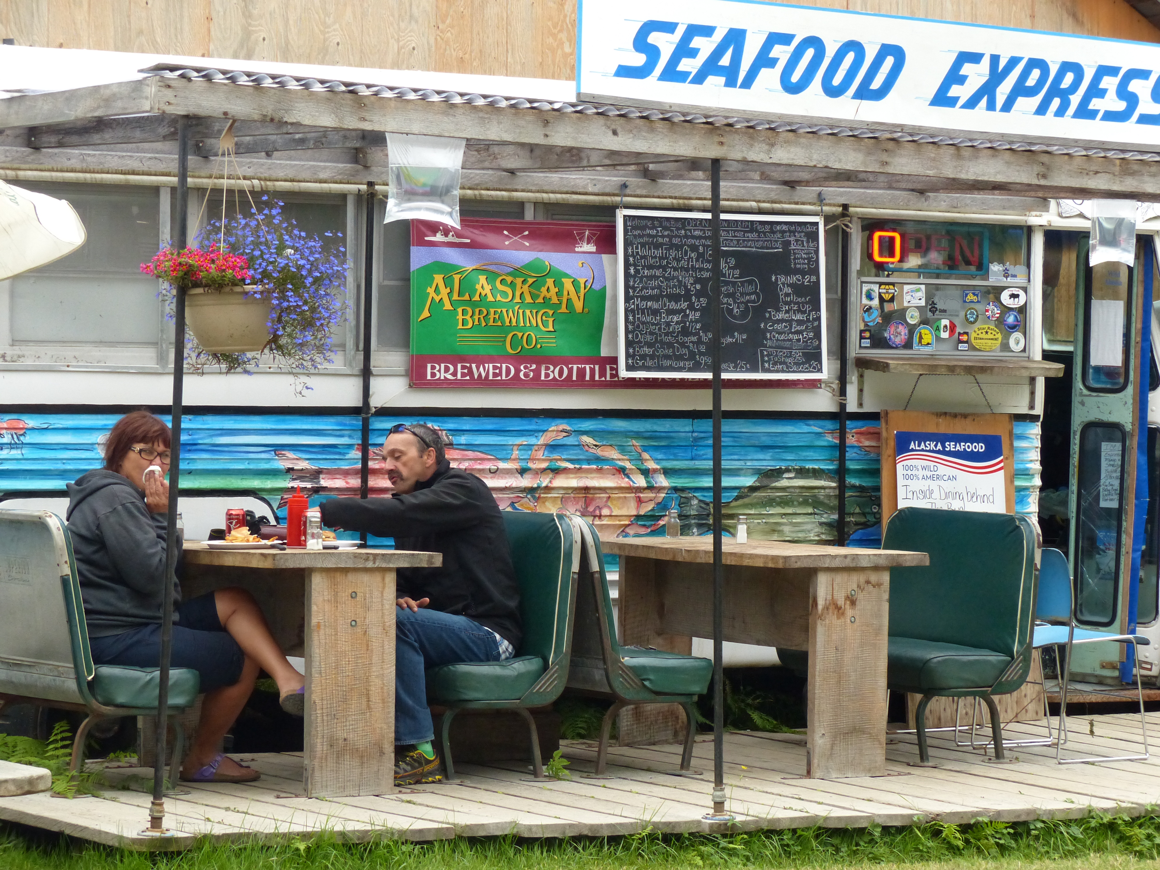
The seafood is really fresh here. The processing plant is located just next door. This restaurant can be found in downtown Hyder, Alaska.
I chatted with a fellow who was carrying a .357 in a shoulder holster and warning restaurant patrons not to leave food in their cars because of a bear infestation. This was the time of year when bears are loading calories to prepare for hibernation. Besides The Bus restaurant, the town’s claim to fame is that it lies on the road to the Fish Creek Wildlife Site and the Salmon Glacier. The latter attraction is Canada’s largest glacier accessible by road, but it ain’t a very good road, so I passed. Despite what the global warming crowd is babbling about nowadays, there are tons of glaciers in this part of North America.
The Fish Creek Wildlife Site is like a zoo in reverse. The people are in the cages, and the wildlife runs free outside. And the wildlife one comes to see here is the grizzly bear. The aptly-named fish creek is where salmon come to spawn, and then die. What a disappointing life cycle. Just after you get your first piece of tail, as it were, you die. Then the bears and the eagles come and eat you.
They tell me there are some exciting moments up here because one is wide open walking from the parking lot to the fence and elevated boardwalks along the creek. One tends to walk briskly to the fenced area.
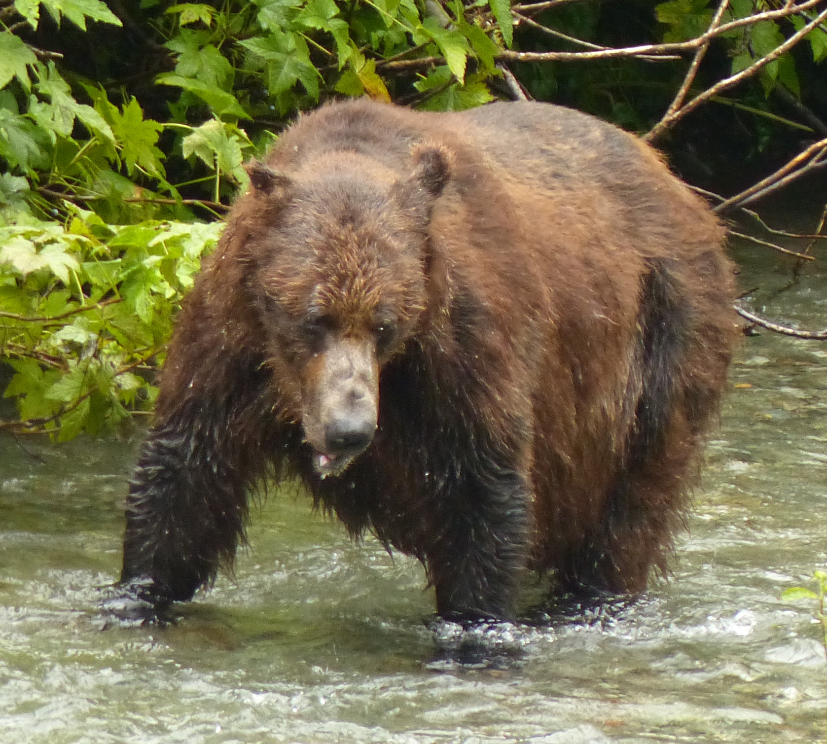
This was the only grizzly seen at the Fish Creek wildlife viewing site. I think U.S. Fish & Wildlife hired the bear to hang around the area as a tourist attraction.
I only saw one bear there. I am fairly certain that the U.S. Fish and Wildlife Service has one bear on retainer who is required to put in an appearance on slow days when there aren’t any other bears. This grizzly kind of appeared for ten minutes every hour – nice work load! – and walked up and down, then went away. There were tons of fish in the stream just making love and dying, but the bear wasn’t interested in those fish. A photographer – this place is infested with photographers who are not normal tourists – said the bear wanted a certain kind of salmon and wasn’t finding it. That seemed odd to me. When I go into a restaurant as see salmon on the menu, I don’t ask what kind of salmon it is. However, judging from the bulging gut of this particular bear, he’d already found plenty of fish to eat.
Hyder is in Alaska, which is right next to Steward, which is in Canada. This was to be my one visit to Alaska on this trip, and I probably won’t be back to Hyder. They have a gift shop with KKK memorabilia, and I thought we were beyond that.
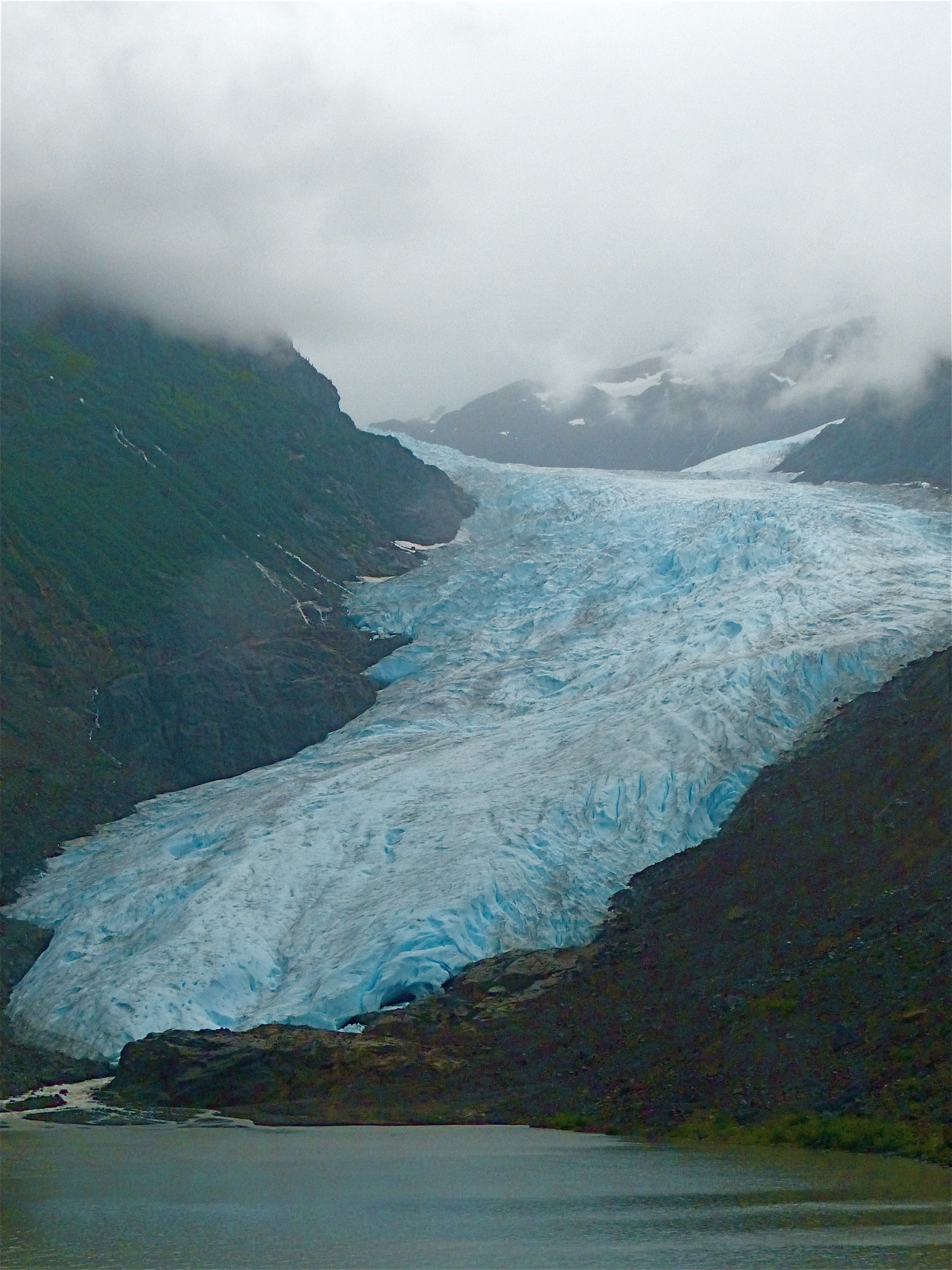
The global warming crowd would have us believe that glaciers are disappearing, so I thought I’d get a picture of one of the several I saw along just a short stretch of highway.
But the drive from Meziadin Junction down Highway 37A is one of those spectacular North American routes. The highway cuts through the Coastal Mountains that rear up nearly at the perpendicular on either side of the road. Glaciers crawl down gorges and streams fling themselves over sheer cliffs. And rocks occasionally come tumbling down.
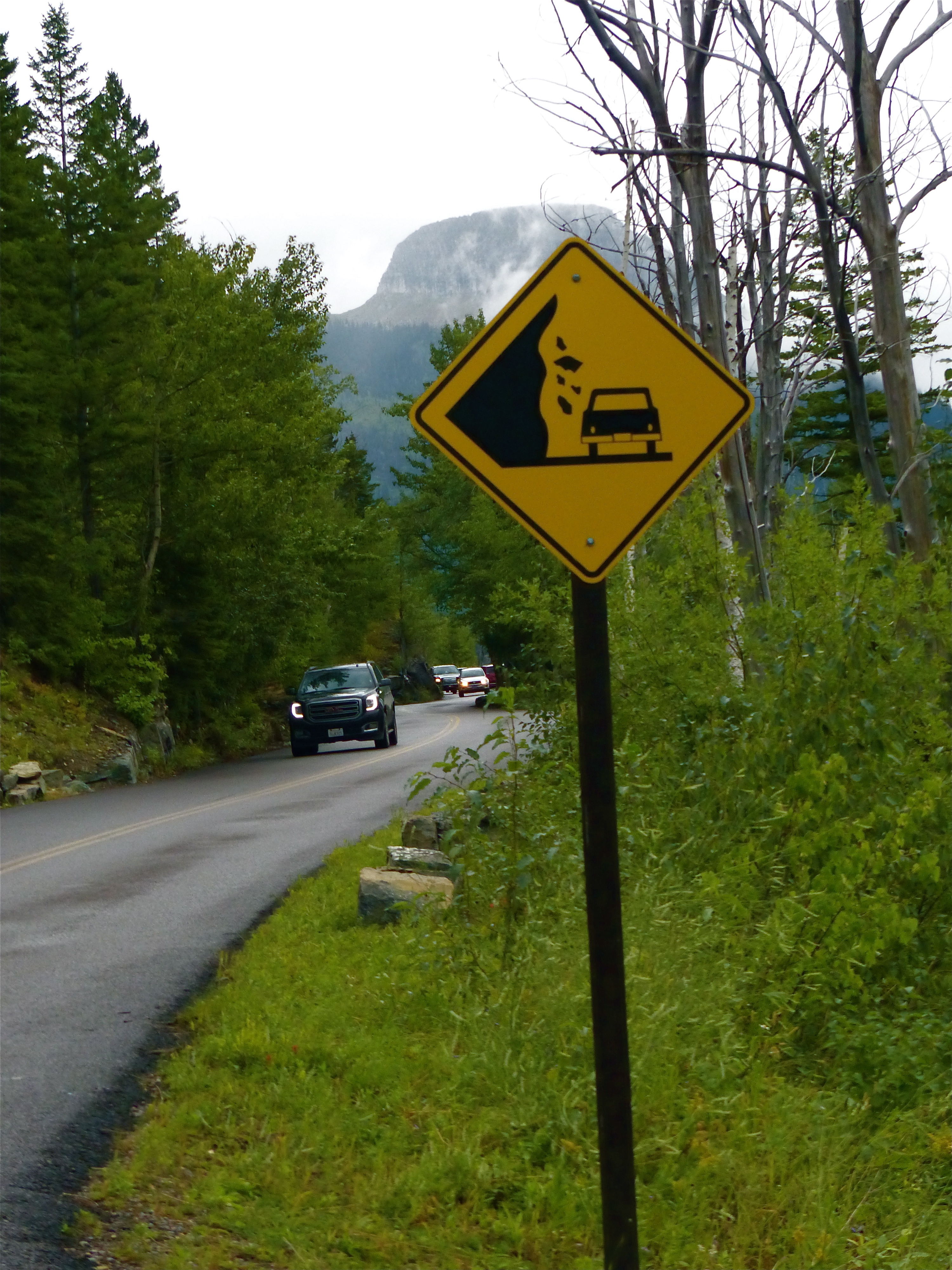
This would be an attractive, scenic road were it not for this rather disturbing sign.
Both Canada and the United States have avalanche warning signs. The first time I saw one of these signs, I thought to myself, “What am I going to do if I see an avalanche hurtling down the mountain at 200 mph? Duck?” But there is a reason for the signs; they don’t want you stopping along that stretch of highway and thereby increasing your chances of being crushed. The Canadians, who use imagery a lot along the highways, have signs that show rocks falling off a cliff to denote an avalanche zone. The American signs show rocks falling off a cliff with a car beneath the falling rocks. I suppose we undereducated Americans need slightly more graphic warnings.
We have a dangerous curve in Jackson County where I live. A flashing yellow light warns of the dangerous curve ahead, but motorists largely ignore it. I think a more effective sign would say, “3 People Died in One Accident on the Curve Ahead,” which is true. It was the most unusual fatality I ever covered as a reporter. One motorcycle going around a blind curve crossed the centerline and crashed head-on into a motorcycle coming from the other direction. A third motorcycle following the first one moments later crashed into the wreckage. All three drivers were killed. My part of the world is a mecca for road-tripping motorcycles in the summer; this was one that ended tragically for all parties.
When something like this happens, there is an outcry to improve the road, make it safer. Eventually, the Colorado Department of Transportation (CDOT) moved the cliff alongside the road back twelve feet to improve sight distance. Most of us thought that was a colossal waste of money. It’s still a blind curve, and there’s not much anyone can do about careless drivers. In this case, crossing the double-yellow brought disaster to three families who never knew each other and never will.
There’s a list all road trippers know but don’t always follow:
Slow down. It’s no shame to pull over and allow faster traffic to pass. It’s smart to pull over and take a nap when one is dozing off at the wheel. It’s intelligent to make sure one’s tires are adequate for the trip. It’s especially dumb to drive drunk, or smoke dope and drive (there’s a reason why they call it dope, you know). Don’t text and drive, don’t get too distracted by the scenery, be alert for animals springing out of the bush alongside the road. I’m sounding like a mom, I know, but I want us all to make it home.
Here’s a couple more I’ve learned on my own:
When you’re on two-lane highways, keep both hands on the wheel and be especially alert when there’s oncoming traffic. Simple physics tells us that crashing head-on into an oncoming vehicle will be twice as bad as crashing into a stationary telephone pole. Things beyond your control – a blown tire, a patch of oil, a major gust of wind – can throw you into that oncoming lane. You have to be ready to react immediately. So don’t change the radio, reach for that cup of coffee, look down at a map, when there’s a car or a 30-wheel truck coming at you in the other lane.
Also, driver distraction is the No. 1 cause of motor vehicle accidents. This statistic has been brought to the public’s attention because of use cell phones by drivers. However, scenery distraction is rarely if ever mentioned. The North American West is one gigantic scenery distraction. It’s why I almost hit the flagman. If you see something you like, pull over. Don’t do the exorcist head swivel by following the scenic attraction from in front of you to beside you to behind you while unconsciously steering your vehicle to the left. The scenery in the West is great, but it’s not to die for.
Distraction is statistically the leading cause of accidents. For us road trippers, I believe the second ranking cause of accidents is falling asleep at the wheel. Or having your passenger fall asleep while you’re at the wheel.
Four of us were on a road trip from St. Louis to Aspen one winter, approximately 1,000 miles. With four drivers in a van, there’s no need to stop; two sleep, one drives and the fourth keeps an eye on the driver. I drew the 4 a.m. shift. So everyone was asleep, including Jim Schappe, who was riding shotgun. I didn’t care. I was pretty wide awake and looking forward to the sun coming up. The weather was good, the road was clear, all was calm if not bright.
All of a sudden, Schappe, who outweighed me by about 60 pounds, lunges out of his seat and grabs the steering wheel. And here is where you get an actual illustration of the cliché, “Holding on for dear life.” I was not only holding on to the steering wheel for dear life, I was yelling as loud as I could at him. I don’t remember what I said. It might have been, “What are you doing?!”, except I might have added some adjectives and adverbs of the coarser sort.
My screaming woke the two guys in the back who had no idea what was going on. They told me later they thought we might have driven over a cliff. That nearly happened on another road trip. Our pal Charlie was insisting on driving long after his allotted shift, and all of us were awake ‘cause we were scared, but it was his van. Charlie finally went shooting up an exit ramp at about 80 miles per hour, and Darryl McGraw shouted at him to slow down, and the shouted louder at him to stop. Darryl later said he was sure Charlie thought the exit ramp was the actual highway. We had to forcibly prevent him from driving any more.
Anyway, Schappe finally woke up. I pulled over with shakes so bad I could hardly stand up. After I calmed down, I asked him what had happened. “I had a dream that we were about to run into a bridge abutment,” he explained.
“Well,” I said, “We nearly did.”
Day Twelve
I’m on the downhill side of my road trip, which is to say I’ve reached all the goals I set. I’m meandering my way southeast through lower British Columbia. One day was lost to photography due to a pervasive pall of smoke haze from a forest fire. That also casts a pall on the joy of camping out, the act of which almost demands a campfire. Due to the dry conditions, campfires were prohibited.
So sitting in my camp sans campfire, I had occasion to sit and admire the Canadian camp dumpster.
The Town Board in Walden, Colorado, had a minor debate about keeping trash dumpsters available for the traveling public while denying them to the freeloaders in and around the town. We have a kiosk outside of town for visitors driving through that includes a parking lot, a restroom, a display of maps and attractions, and a trash dumpster.
We found the trash dumpster was filling up three or four or more times a week even when there wasn’t much tourist traffic. And we knew from examining the trash that most of the garbage was coming from locals freeloading off of their neighbors. This is an instance that illustrates that laws and regulations and many government actions are taken not because of the action of 97 percent of the people, but because of the actions of 3 percent of the people. Most of the residents of Jackson County paid for trash collection and therefore kept the local trash collection company in business. But perhaps 3 percent did not. So we either have to pass and enforce theft of service laws, or remove the dumpster. We chose the latter course because who wants to go sifting through garbage to identify a perpetrator who might be on your bowling team. We live in a very small county. But no matter how large the jurisdiction, be it town or nation, most laws stem from the actions of a small minority of citizens. Very few people are vandals, but we have laws against vandalism because some are. Very few people are murderers, for that matter, but some are. So it goes.
Canadian Provincial parks have a different problem. They want to keep trash dumpsters available for the traveling public while denying them to the freeloaders in and around the campground, but in their case, the freeloaders are bears and other creatures of the woods. But mainly bears.
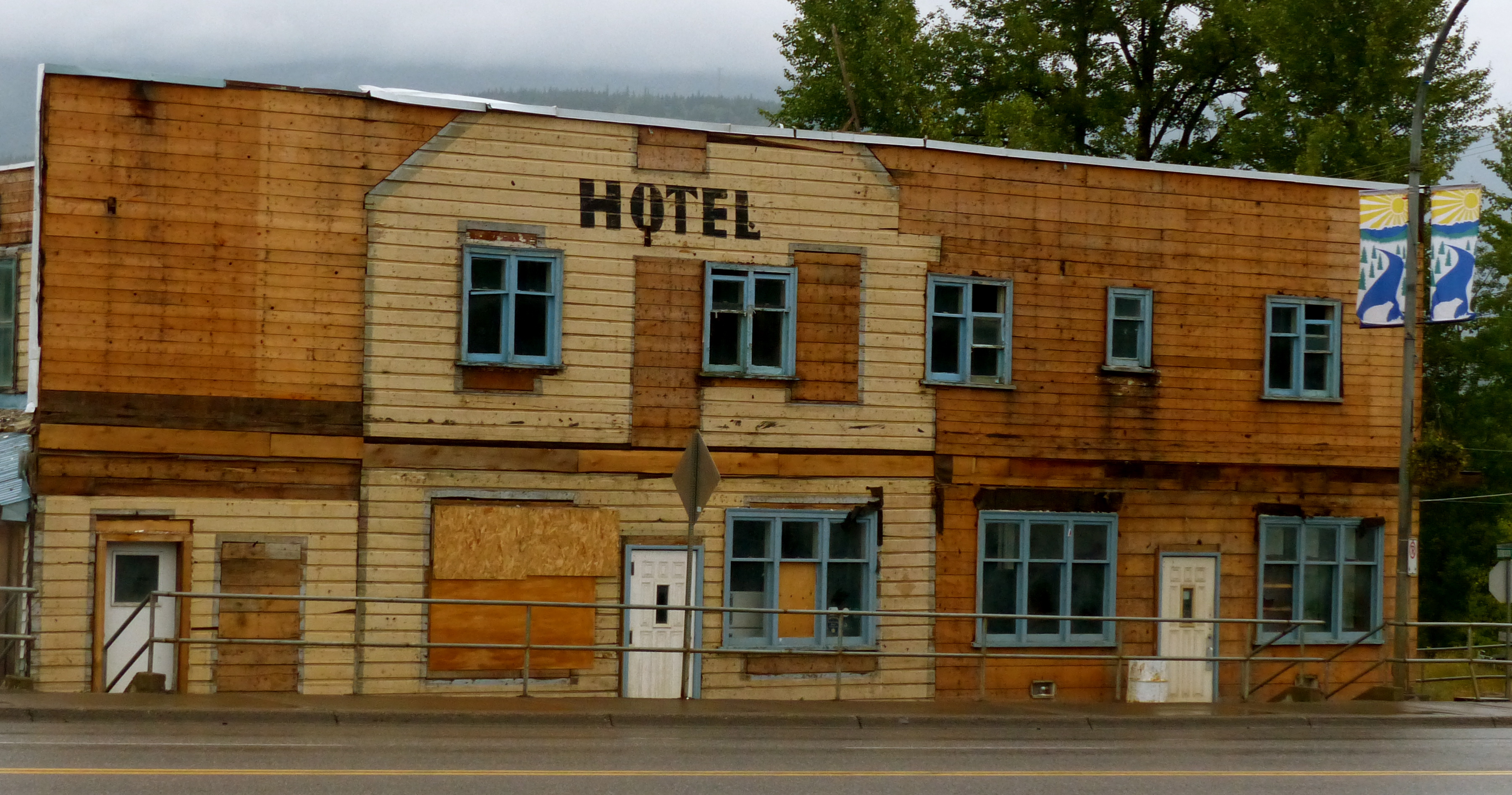
Okay, I’m cheap, but I didn’t stay here.
I remember camping with my family on a road trip to Glacier National Park. My dad said, “Jimmy and Donnie, come here and look at this.” At the far end of camp was a grizzly bear sitting on its haunches waiting for everybody to go to bed. My brother and I were sleeping in a pup tent, and it didn’t occur to me that the bear might well skip the garbage cans for fresh jimbalaya meat. I’ve grown a little more careful about bears in my declining years; hence, the Remington pump shotgun with double-ought loads.
Anyway, the Canadians and many western states have replaced the standard garbage dumpster with a heavy steel container that can only be opened by slipping your fingers under a steel plate and tripping a latch. I needed to read the directions the first time I used one to get the lid up, which is further proof that bears can’t read. But they can reason. I read that a bear in New England had learned how to access bear-proof containers. Researchers actually filmed the bear doing it. The bear and its immediate family all had to be euthanized lest the skill spread through word-of-fang to all other bears. Okay, I’m kidding about that last part.
These bear-proof dumpsters aren’t cheap. A single-lidded one costs about $1,300. They are built from steel thicker than the steel used to build the average car, which might lead one to believe that Canadians are more concerned about protecting their trash than they are about protecting the occupants of their motor vehicles.
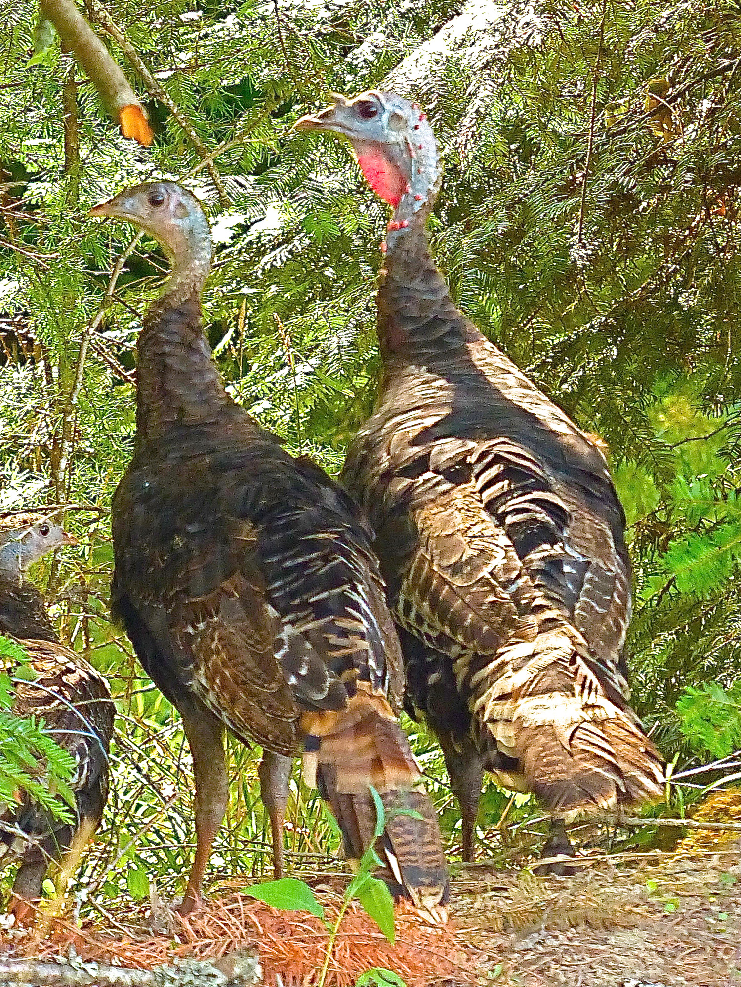
This was an opportunity to take a nice turkey home for dinner, but there was a campfire ban in effect.
This portion of the trip was through rolling savannahs, immense lakes and big sky. It was getting late in the day and I was searching for a campground. I had just bought some sausage from what appeared to be an area settled long ago by Germans and was eager to grill it along with a couple ears of fresh corn. I left the highway for what I thought was a campground, but was actually a gigantic, scary chasm. It was named “Chasm.”
What made it scary was that it was in the woods. Before they erected a fence around one end of it, I could imagine walking along, listening to the birds and admiring the foliage, and the plunging off a nearly sheer cliff to a hard landing 1,000 feet below.
This was formed by a geologic mechanism resembling Niagra Falls. An interesting trivia question is: “What is the only U.S. national monument that is moving?” The answer is: Niagra Falls. It is slowing moving backwards as the flow of water erodes the rocks beneath it. This is how this chasm was formed, by a river flowing from melting glaciers. When the glaciers melted completely away – as the global warming fanatics 20,000 years ago warned that they would – the chasm abruptly (in the context of geologic time) stopped forming. It left what one could imagine would be left if the Niagra River stopped flowing. Very interesting, but it wasn’t a campground.
The next campground was 44 miles off the highway; the next campground was closed. The next campground was at Loon Lake, which I assume was named for the bird and not the people who lived there. While traveling through the Yukon and British Columbia, always in the back of my mind was winter. This whole region is absolutely stunning in summer, but it must be absolutely terrifying in winter.
Loon Lake was located about 30 miles off the highway and accessible via a long, winding, hilly road through ranchland. The lake itself sits in one of those mountain valleys and is huge. And along the shore are all these homes and resorts. It kind of reminded me of Lake of the Ozarks in Missouri. I think a lot of people from Kamloops (that’s a city in British Columbia) had second homes up here, as do residents of the St. Louis area with vacation homes at Lake of the Ozarks. The difference between the two lakes is that road to Loon Lake stinks. I also discovered that the campground had been closed years ago.
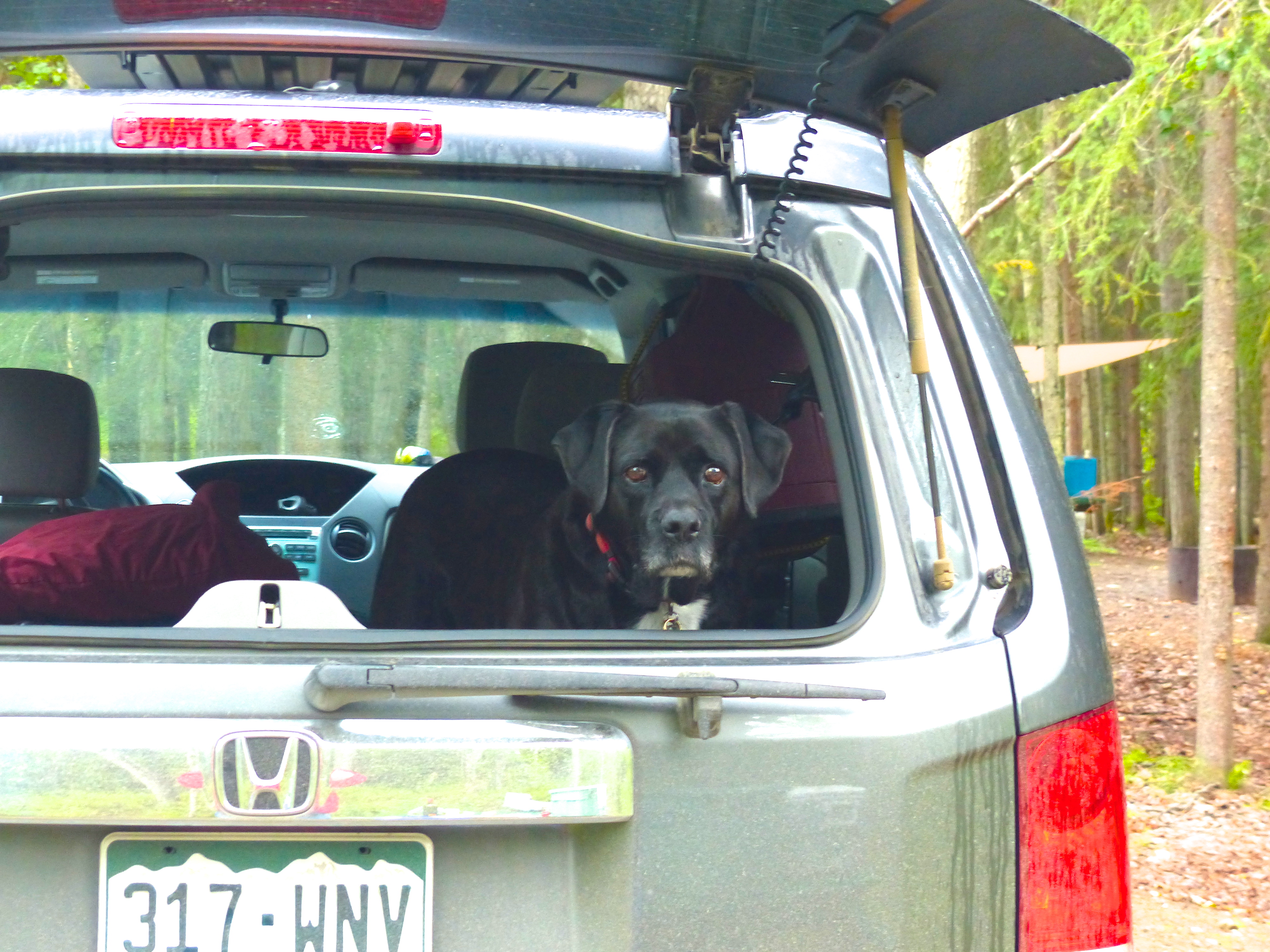
This is the look one gets when one is eating and the dog is not.
So back to the highway went I, and it was now getting dark. I had grown wary of driving way off the highway in search of a campground that might not be there, so I plowed on through the little town of Cache Creek. There was a campground about 20 miles ahead … maybe … and nice little motel just on the edge of Cache Creek. The motel was nice, but the owner had a carefully cultivated lawn the chief feature of which were several little signs that said, “No Dog Walking.” I didn’t really blame him; the lawn was very nice. I took my dog elsewhere, but I noticed a fat lady with two of those annoying yappy dogs walking her pets on the lawn.
Here we go again. I stopped at a nicely-maintained and attractive motel outside Glacier National Park in Montana and inquired if they allowed dogs. “”No,” said the lady at the desk. “We used to, but one guest we had a few years ago spoiled it for everyone else.” Another rule made because 3 percent of dog owners, like the illiterate fat lady, ruin it for the other 97 percent.
The next day, I drove past Juniper Beach Provincial Park and campground about a half hour outside of Cache Creek. Oh well. I’d needed a shower.
I was following Highway 1 again. This highway from Calgary to Vancouver may be the sceniest highways I’ve ever been on. There are other more spectacular stretches of highway, like Going to the Sun Mountain in the U.S. Glacier National Park. But for sheer number of wonderful viewing spots along the longest stretch of highway, Highway 1 is No. 1. If I do this trip again, which I probably will after Abby passes on, it would be a good route from Calgary to Vancouver, where one can pick up a comfortable ferry ride back to the U.S. I also noticed many, many golf course along this route, more than I expected in these northern latitudes.
I skirted Kamloops and headed for Highway 97 and then Highway 6, and then Highway 3A. They are moderately scenic and along deep valleys, wide rivers and long lakes.
This modest sign probably wouldn’t meet the standards of the Budweiser marketing division, but it lured me in for a visit.
So there I was driving along and I see this sandwich board sign along the side of the highway that said “Craft distillery. Tasting room open.” Next to the sign was a little dirt road that looked like a long, rural driveway. I thought, this I’ve got to see. I followed the road about a mile until I got to this unassuming ranch house with a sign outside that said “tasting room.” And sure enough, here was this youngish gal behind the counter with a cheery smile and glass in hand.
Now we’ve all heard of craft breweries, which are usually located in resort towns and attached to restaurants. But I always thought of distilleries as huge buildings with shining stainless steel vats, with miles of pipe leading to big oaken barrels that sit in large warehouses for years while they “age,” kind of like whiskey prisons. It’s not let out until it’s done its time.
The “Kootenay Country Craft Distillery” looked nothing like that. The tasting area looked like someone’s living room. I never did see the distillery. But the husband said the vodka won some medal in Chicago. I never did see the medal.
This whole thing seemed a little iffy to me. The gal said they were temporality out of straight vodka although they distill 300 bottles a week. Me being a (former) investigative reporter was thinking 300 bottles a week at $40 per bottle times 52 weeks means they are grossing $624,000 per year. They didn’t look like they were grossing $624,000 a year, or maybe it costs $600,000 a year to produce the stuff. Anyway, they were nice enough. They’ve got a website if you’re interested in getting expensive booze by mail.
This Canadian couple actually hailed from Colorado. The wife attended CU-Boulder, transferred to Montana and met her future husband. They discovered this little valley in Canada, fell in love with it and emigrated. Eventually, they started making gin and vodka “from organic wheat grown by one particular grower we trust.” Well, that sounds like someone from Boulder.
I started drinking vodka when I discovered I was gluten intolerant because I thought vodka was made from potatoes. Some vodka is made from potatoes; most of it is made from wheat. It was a tragedy of small proportions in my life to discover I couldn’t drink beer anymore, but it is said God protects fools and drunks. It turns out that the distilling process destroys gluten.
All they had on hand was gin, which to me, if you put it on ice, mix it with tonic water and add lime juice, tastes pretty much like vodka. I’m a forcibly reformed beer drinker. So why was I taking a taste test? I don’t know, but I knew I was going to buy a couple bottles just for the peculiarity factor. I’m going to take one bottle down to our local bar to see what everyone else thinks. “I’ll take two bottles,” said I.
“Good,” she said, turning away. “That’ll be $40 … per bottle.” Okay, this may be award-winning gin or vodka made from coddled wheat, but I don’t usually pay $40 a bottle for vodka. It’s more like $15. But, for a souvenir and a story, I paid up and moved on down the road.
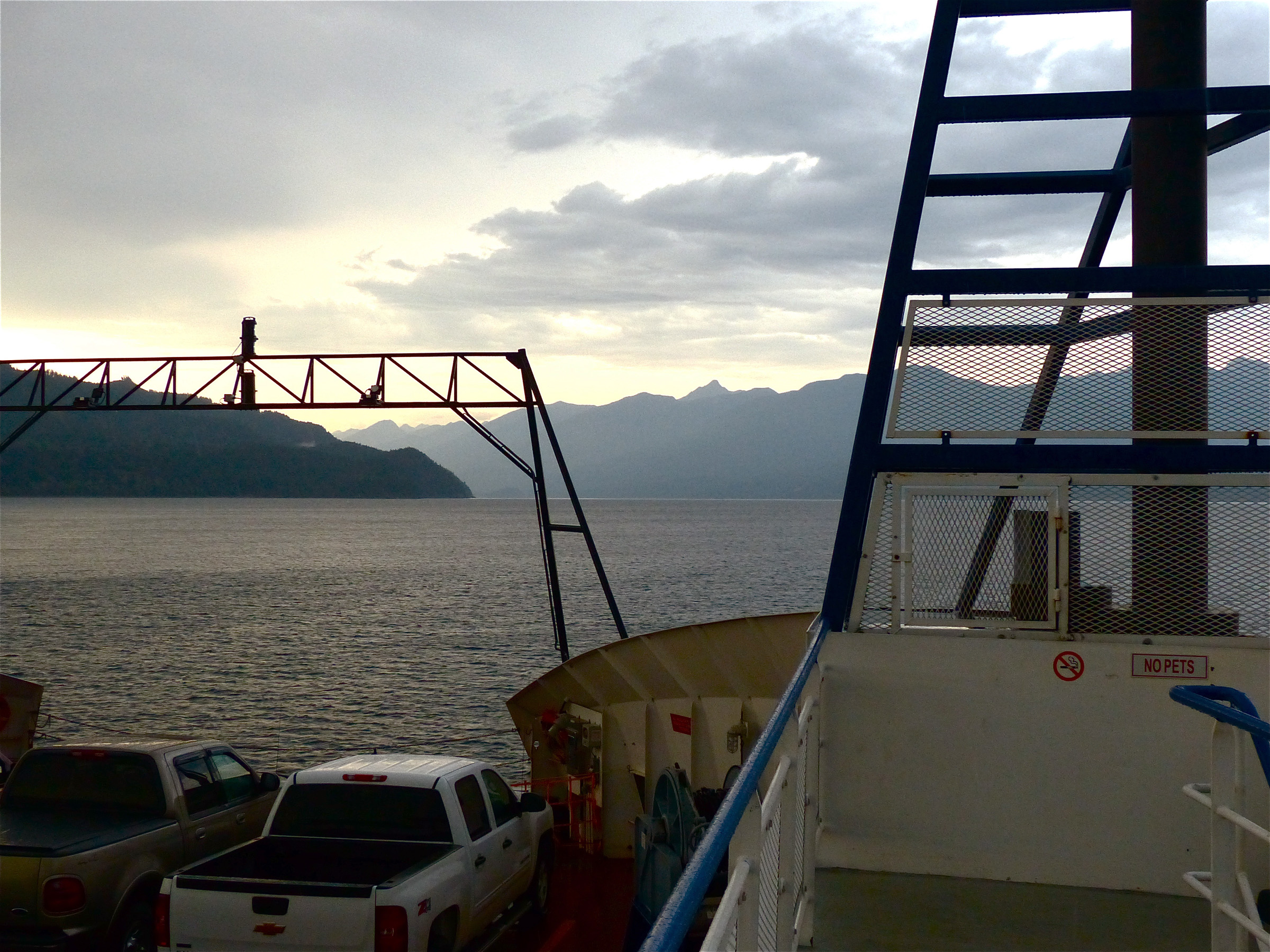
This was a really big ferry connecting two truncated sections of a highway. Our destination was those mountains in the far background.
I would take two ferry rides along this route. One was a normal ten-minute river crossing. The other was more like a voyage. The latter connects two sections of Highway 3A separated by Koontenay Lake (The Canadians spell it Kootenay; the Americans spell it Kootenai). This was the biggest ferry yet, and the voyage took 45 minutes. The name of the ship was the “Osprey.” Why this name, I have no idea. It didn’t exactly fly through the water. It was more of a waddle. The “Whale Shark” might have been a more appropriate name. I asked a fellow in the passenger section, “Does this connect with 3A on the other side of the lake?”
He said, “Yes, it does,” and then paused. “You got on the ferry without knowing where it was going?”
“I’m on kind of a road trip. It looked like a fun ride,” I replied.
“Must be nice,” he said. Ferries that connect public highways in Canada are free, so even if I’d gone in the wrong direction, I could have hopped back on and gone back to where I’d started. God knows I’d done that often enough on this trip.
There are many ferries in this part of Canada, and there are many bridges. Lots of those bridges are old and therefore quite photogenic. I believe lengthy steel truss bridges over vast rivers were built to bolster the postcard industry. We don’t build them anymore because governments couldn’t figure out how to get a big enough cut out of the postcard industry, and besides, everyone has cell phones now that enable them to take their own photos.
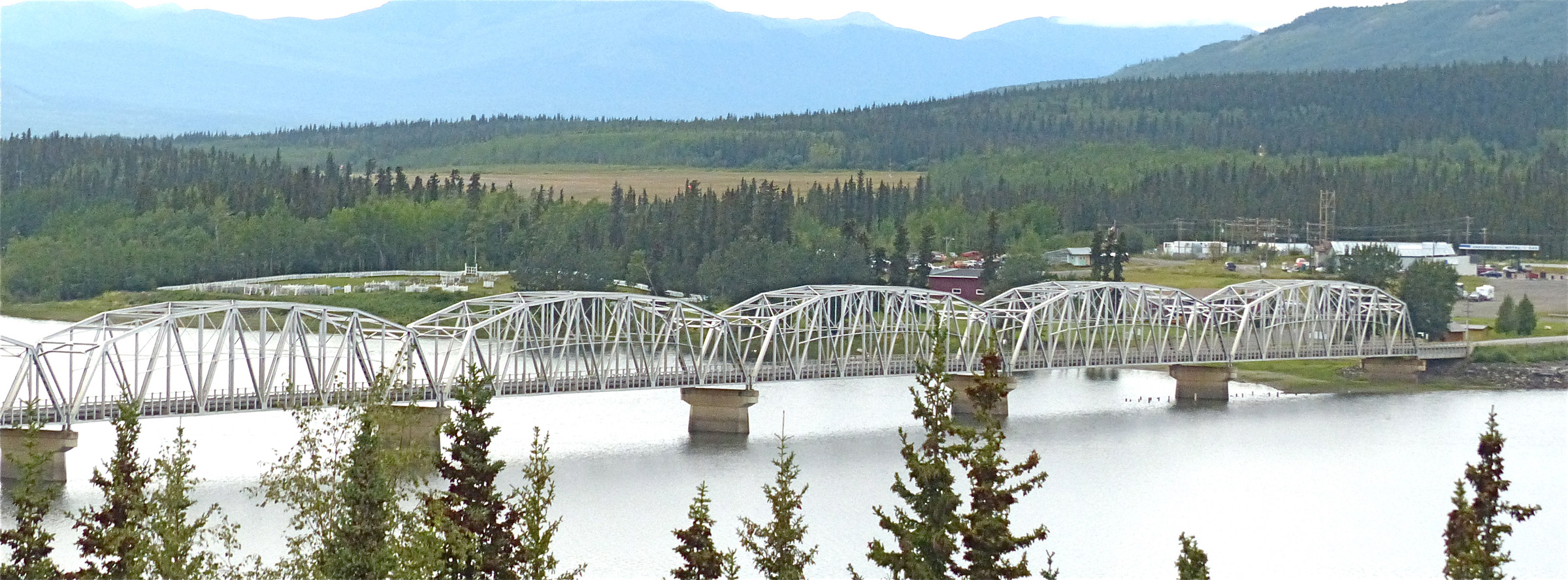
Northwest Canada has dozens of these beautiful iron truss bridges spanning wide rivers.
We had one of those in St. Charles, Missouri, that carried a state highway across the Missouri River. It was built in 1904 just in time for the St. Louis World Fair. The bridge was state of the art for its time. It was odd because it had a little turn on the west side. It was a very narrow bridge, and one of the most entertaining vehicle accidents that I ever covered as a reporter occurred on that bridge. A big pickup equipped with large towing mirrors was headed east on the bridge, and a garbage truck was headed west. One of those mirrors became entangled with a lever that operated the garbage truck’s compactor mechanism. The result was an entire load of compacted garbage got dumped on the highway, closing it for hours. I remember the bridge fondly because I believe I had the fastest time ever traversing the span on a motorcycle. That didn’t happen during a race or anything; it was just something I did one night about 2 a.m. when there was no traffic.
That particular bridge was blown up and replaced with a more modern, more utilitarian structure. That’s the trend – utilitarianism. We had a pretty little steel trust bridge north of Walden, Colorado. I called the “sphincter-pucker bridge” because it was so narrow. If one was crossing in a big pickup at the same as a garbage truck coming from the opposite direction, one’s sphincter might well pucker. That was replaced by a boring, utilitarian box culvert structure, and no one will ever take a photo of that.
I asked the Colorado Department of Transportation if they could at least reinstall the steel trusses as decoration, but they replied, which is: “Oh no, we can’t do that. Those trusses were painted with asbestos-based paint and have to be disposed of as hazardous waste.” Well, why not strip them and paint them with safe paint? “Oh no, we can’t do that. We’d have to erect a tent to contain the stripped paint dust and dispose of that, which would add tens of thousands to the cost of the project.” Costs are costs, apparently. The motto of every DOT in the U.S. is, I believe, “Oh no, we can’t do that.” CDOT delayed the project for a year – eating those higher costs due to inflation – because as they were about to begin, they found the tiny nest of a migratory bird under the bridge. It wasn’t a condor or anything like that, just some wren of some sort. The EEKs would have been mortified had this one small nest been disturbed. One suspects that cost was chalked up to “fowl luck.”
But Canada still has tons of these big old bridges. One in particular had that steel grid deck that if you stop, you can look through and see the river below. It gives a driver an eerie feeling to drive over it because of the strange sound it makes and the strange this-is-not-pavement feel as one crosses over.
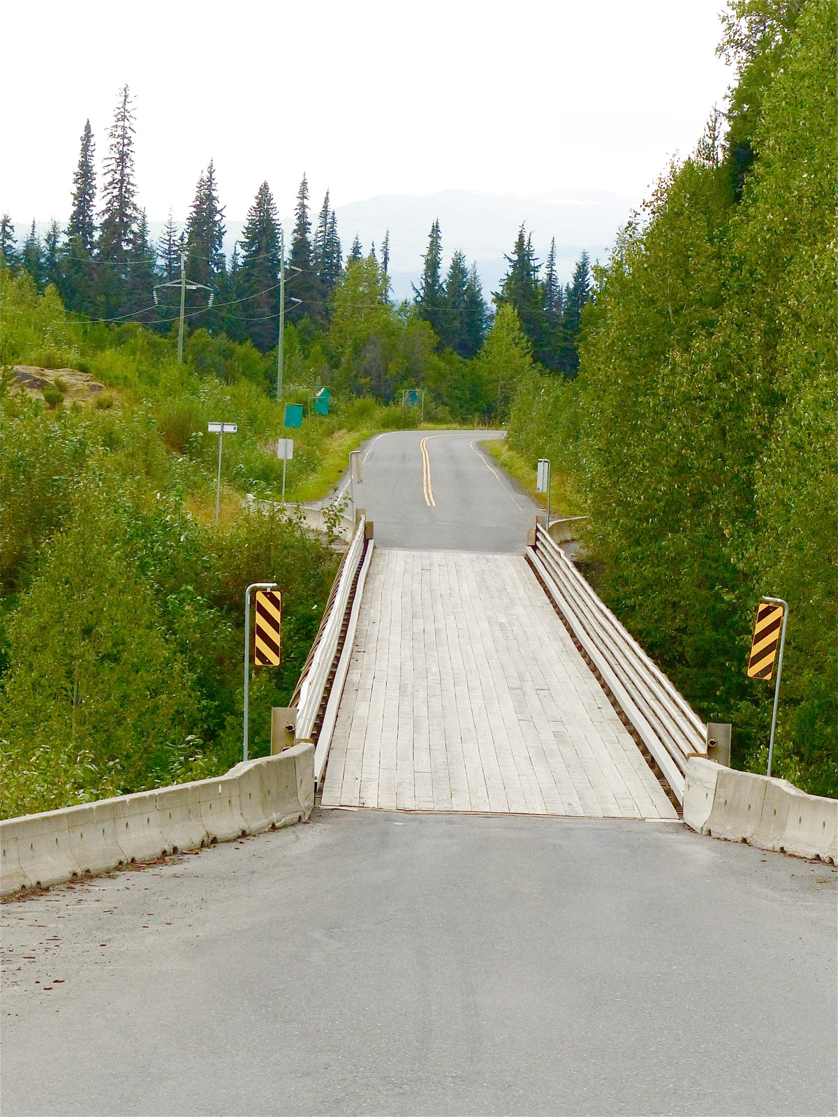
There is so little traffic in this part of Canada that this one-lane bridge really isn’t a problem.
And along one highway, I chanced upon this one-lane bridge. This wasn’t a sphincter-pucker bridge; this was one lane. A sign on my side said, “Yield to oncoming traffic.” I thought it would be a great joke to get another sign exactly like that one and put it on the other side of the bridge. Then when two cars approach the bridge at the same time from different sides, you could take bets on how long each would wait for the other to move.
Highway 3A meanders down toward the U.S. border. The weather was turning to chill and rain. I would have taken more time going through several picturesque towns – one by the name of New Denver – but it was getting late and dark. I wanted to make the last provincial campground before re-entering the U.S.
It was typical campground, except I couldn’t find any firewood. I stopped a lady and asked if anyone was selling firewood. “Yes, some man is going around selling wood, but it costs a lot.”
“Oh,” said I, pondering my next move.
But then the lady said, “We’ve got plenty. We’re camped right up the road.” We walked up the road to meet her husband, who peeled back the top on his pickup bed to reveal a couple rows of split and stacked firewood and he gave me a large armful, plenty for one evening. He wouldn’t take any money for it, and just said he was glad to help.
This is the rule of minorities again. I’d bet 97 percent of campers are generous, sharing, wouldn’t steal a wallet sitting on a toilet paper dispenser, give ears of corn to their neighbors, don’t play loud music or run generators at 1 a.m., don’t try to burn beer cans in the fire pit, but 3 percent aren’t. That’s why there are a lot of rules in campgrounds that normal campers don’t even need to read. It’s just another case of where the sins of the few afflict the many.
Day Thirteen
Back in the U.S.S.A. (Beatles reference, for you youngsters). The Canadian penchant for not being able to give meaningful road directions to anywhere led me around and around Creston until I finally found the border crossing. There, I got hassled again about the serial number thing on my shotgun.
“If I’d had been the Canadians, I’d have made you take it apart,” said the border patrol guy. Here is an instance where I wanted to say something, but restrained myself because one has to realize who wields the hammer in any given situation. What I wanted to say was, “You work for a government that purposely sent weapons into Mexico, and then were surprised when they came back and were used to kill a border patrol agent. You work for a government that doesn’t even police its southern border. You’re hassling an American citizen who volunteered that he had a weapon in the car, and what about the dog? I paid $25 for a veterinarian’s letter saying the dog was cool! I want someone to check the dog!”
But then, I didn’t want to spend the rest of the morning sitting there while they searched the car, checked the dog, threw out my ears of corn, charged a duty on the booze (which I also declared), and so on. They have the hammer; they can do that. So I shut up and told Abby that they really wanted to check her out and at least say what a pretty dog she is (everybody does) and went on my way to face my next problem: how to get rid of $80 in Canadian currency.
In Canada, at least in 2014, the two currencies were interchangeable. In fact, the U.S. dollar was worth a little more than the Canadian dollar, so Canadian retailers were getting a little premium on their sales when they took American money. I didn’t figure exchanging currencies in the U.S. would be a problem.
But when I got to Libby, Idaho, it was a problem. I went to a bank and asked them to exchange the money. “We can’t do that unless you have an account here,” quoth the teller with a big smile. I’m looking around this big, ornate, spotless lobby with a bunch of tellers with pasted-on “can I help you” faces in a large, solid, impressive stone building, and they can’t perform the simplest of financial services short of making change?
No bank in Libby would exchange the money. No credit Union in Libby would make the exchange. I went to a jewelry buyer – which is kind of an upscale pawn shop – to see if they would make the exchange. They were very nice and called all over town for me, but no one except McDonalds would take Canadian money. Not needing $80 worth of quarter-pounders, I moved on wondering what I would do with the money.
I got to a normal mini-mart gas station outside Glacier National Park and bought about $20 worth of stuff. I jokingly said to the clerk, “Can I pay you in Canadian money?” The clerk said, “Sure. Let’s see, I just push the Canadian key on the cash register, and here we go.” I spent the rest of the money buying gas, and thought, here’s this little, ordinary gas station/mini-mart that could perform with the touch of a key a service that those big, fine, solid, snooty banks couldn’t do. Amazing.
Here’s another odd fact about Canada – they abolished the penny. I say “odd” because when I was there, you could go into a store and buy a bunch of stuff, and the clerk would say, “That’ll be $9.18.”
“I thought you abolished the penny?”
“We did,” the clerk would say, and give you change as if the bill was $9.15. Or maybe it was as if the bill was $9.20; I never really checked because who cares about three cents one way or the other? However, the policy hadn’t caught up with the practice. Merchants and their cash registers were still pricing and charging in pennies, but there were no pennies.
And we in America might be saying, “How stupid,” but eventually our practice will catch up with our policy. What is stupid is what occurs here in the U.S. In 2013, the cost of making pennies and nickels exceeded their face value for the eighth year in a row. In 2013, the cost of minting a penny stood at 1.8 cents, nearly twice its face value. To make nickels cost twice as much as dimes – 9.4 cents vs. 4.6 cents – despite being worth only half as much. So the taxpayers lose about $100 million a year being nickled and pennied to death. Yet Nancy Pelosi, the best the Democrats can come up with to lead their party in the House, can stand in front of cameras and say, “The cupboard is bare. There’s no more cuts to make.” I hope and I pray that there is no American with an IQ over 40 who believes that.
I didn’t bring any Canadian paper money back home, but I did bring some “toonies.” That’s a two-dollar coin made of two different metals. They’re cute. I use them as ball markers.
Day Fourteen
Canada is lot like the United States in that when they ran out of white man names they reverted to American Indian names. And I apologize in advance if anyone is offended by the term “American Indian,” but I am just at a loss to come up with a label for anyone that won’t offend anyone. There are whole groups of people out there who make a living out of being “offended,” (I call them the Our Offended Ones, or the OOOs) so it’s better to voluntarily apologize in advance than be forced to apologize later by celebrity OOOs. I don’t like “Native American” because that just means someone was born in the U.S. I’m a native American. Some Indians don’t like “Indian,” which is a total misnomer anyway.
Indians were called Indians because Christopher Columbus, when he found the Americas, thought he had found the Indies. He should have called the native peoples “Columbians,” so then his thunder wouldn’t have been stolen by Amerigo Vespucci, another Italian explorer who came along 50 years after Columbus and put his name, not that of Columbus, on maps. So two large continents got named for Amerigo, not Chris. In Canada, Indian communities are called “First Nations,” or by their tribal names.
First Nations is another misnomer. It assumes there were no people here before the current “First Nations.” There is considerable evidence there were people here before the current genetic strain migrated across the Siberian Land Bridge long ago. And as a matter of historic fact, one would be hard-pressed to find a scrap of land anywhere on Earth where one set of invaders (or several sets of invaders) hadn’t taken that land from someone else. Just in general, England was populated by Celts, who were conquered by Romans, who were driven out by Picts and Angles and Saxons, who were mostly conquered by Danish Vikings, who were later conquered by former Vikings – all of whom were named “Norman” – who conquered part of France and crossed over to conquer England. The blood of the English became so intermingled with the blood of their conquerors that any claim to a “First Nation” membership would be ludicrous. England didn’t used to have OOOs until Muslim enclaves became established in parts of Britain.
But as I said, it appeared that the whites had run out of place names when I crossed “Baking Powder Creek” along Highway 37. In Colorado, I live near the Poudre River, which is to say Powder River, which originally was the Cache de la Poudre River, which was named because some Frenchman cached his powder along the river and either forgot where he put it or got killed and never came back for it. Presumably, it’s still there. “Powder” is a word of some power, and there are lots of places names in the U.S. and Canada that include the word: the Powder River, Big Powderhorn Mountain, the Powder Basin, Powder Creek (one at least in most western states), and so on. But “Baking Powder?”
Plus everywhere you can find a Willow Creek, a Bald Mountain, a White River, a Blue River, a Porcupine Creek, Wolf Lake, Bear Lake, Elk Lake, Deer Lake, Moose Lake, and on and on and on. But you will only find one of these: the Anhluut’ukmsim Laxmihl Angwinga’asanskwhl Nisga’a Provincial Park in Northern British Columbia. Can you imagine giving someone directions? “Just take the first right after the Anhluut’ukmsim Laxmihl Angwinga’asanskwhl Nisga’a Provincial Park entrance.”
“Could you write that down?”
“No, I don’t think so.”
On this day I made it to Glacier National Park where I hoped to reprise the trip over the Going to the Sun Highway which I last made in my youth. I stayed in a motel because Abby, with paws over nose, indicated it was time.
Day Fifteen
Well, the entrance to Glacier National Park was right there. In fact, I stopped at a store across from the entrance to buy some coffee and a hat. Then I drove on down Highway 2 on the assumption that highway took me to the entrance of the park. I drove for about 45 minutes before I got to wondering where the hell the park was. It’s a really big park. I checked the map and realized I’d made another wrong turn.
While that cost me in gas and time, it really cost me in weather. The morning was bright and clear, but I’d burned most of the morning away taking a wrong turn and looking for some whiskey. There was yet another of those “craft distilleries” in Coram, Montana, just outside the park. I discovered that by driving past “The Whiskey Barn,” which didn’t open until noon. It was 9 a.m. But there was a fellow working in the barn, so I went in to talk to him. He was loading cases next to a vat full of more cherries than I’ve ever seen in one place at one time.
I asked if I could buy some of his products, but he said the law prevented him from selling anything before noon. There’s a logical law. A liquor store down the street can sell his product at 10 a.m., but he can’t until noon. It reinforced my opinion that most liquor laws are written to generate revenue for local, state and federal governments, not for any other purpose.
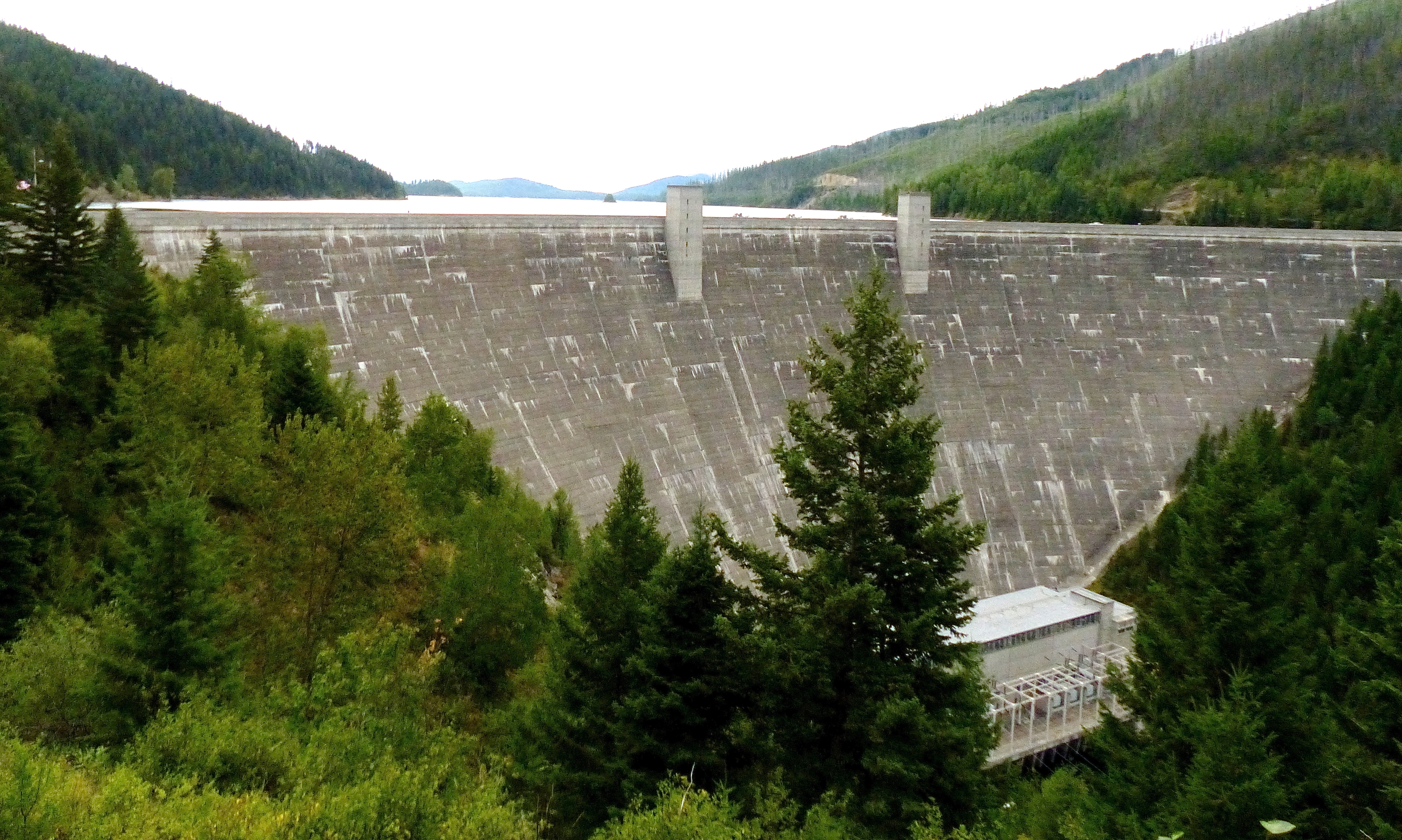
The Hungry Horse Dam outside Glacier National Park generates 428 megawatts of squeaky clean electricity.
Since I had an hour to kill, I took a trip up to a moderately sized hydroelectric dam. I like to admire such dams. The really big ones inspire wonder and awe that mere men could build such structures, but the smaller ones are impressive also, and they do their part by day after day pumping clean electricity into the grid and creating vast lakes for recreation, flood control and irrigation purposes. Yet there is nothing beneficial in the U.S. that some group can’t label as evil.
In Colorado, we have a state law that says 20 percent of our electricity has to come from “alternative” energy sources, “alternative” meaning “more expensive.” Those sources of energy that qualify as “alternative” include wind generators and solar panels, but not hydroelectric. But, you say, there is nothing cleaner than hydroelectric. Water flows downhill, turns generators, and continues on its way. Bada bing, bada boom. Mankind has used dams for irrigation and power generation purposes almost since mankind learned to put two bricks together. But the extreme environmentalist kooks (EEKs) don’t like dams because dams alter the natural state of things.
I would argue that man’s very existence alters the natural state of things. We build roads so EEKs can travel to conventions and protests; we grow food where there was once forest so EEKs can grow “organic” food that costs more than “regular” food; we build private airplanes so the Gig EEK – Al Gore – can fly around and promote energy conservation; we build warships so radical Islamists cannot sail over here and behead EEKs; we build voting machines so EEKs can vote for candidates who have never taken a science course in their lives; we dig up rare earths from the ground so EEK entertainers can text message and be embarrassed when TMZ shows those texts on TV; and we build sewage treatment plants so EEKs can live in houses with indoor plumbing and not vault toilets into which wallets and keys can fall. We and every other living thing on Earth alter the natural state of things just by breathing (we expel vast quantities of carbon dioxide, you know). Go live on the moon if you want a static environment.
So I killed an hour admiring the dam and thinking how boring the valley would be without it, then returned to the liquor store to buy a bottle of “Fireweed,” bourbon whiskey with cherry brandy liqueur (remember the vat of cherries?), and a bottle of “Mule Kick,” a rye whiskey flavored with jalapenos, garlic and black pepper. We certainly have come a long way since prohibition.
Then, of course, I took the wrong turn down Highway 2, came back, and I was going to the sun. This would be a great highway if the sun had actually participated that day, but rain and fog moved in.
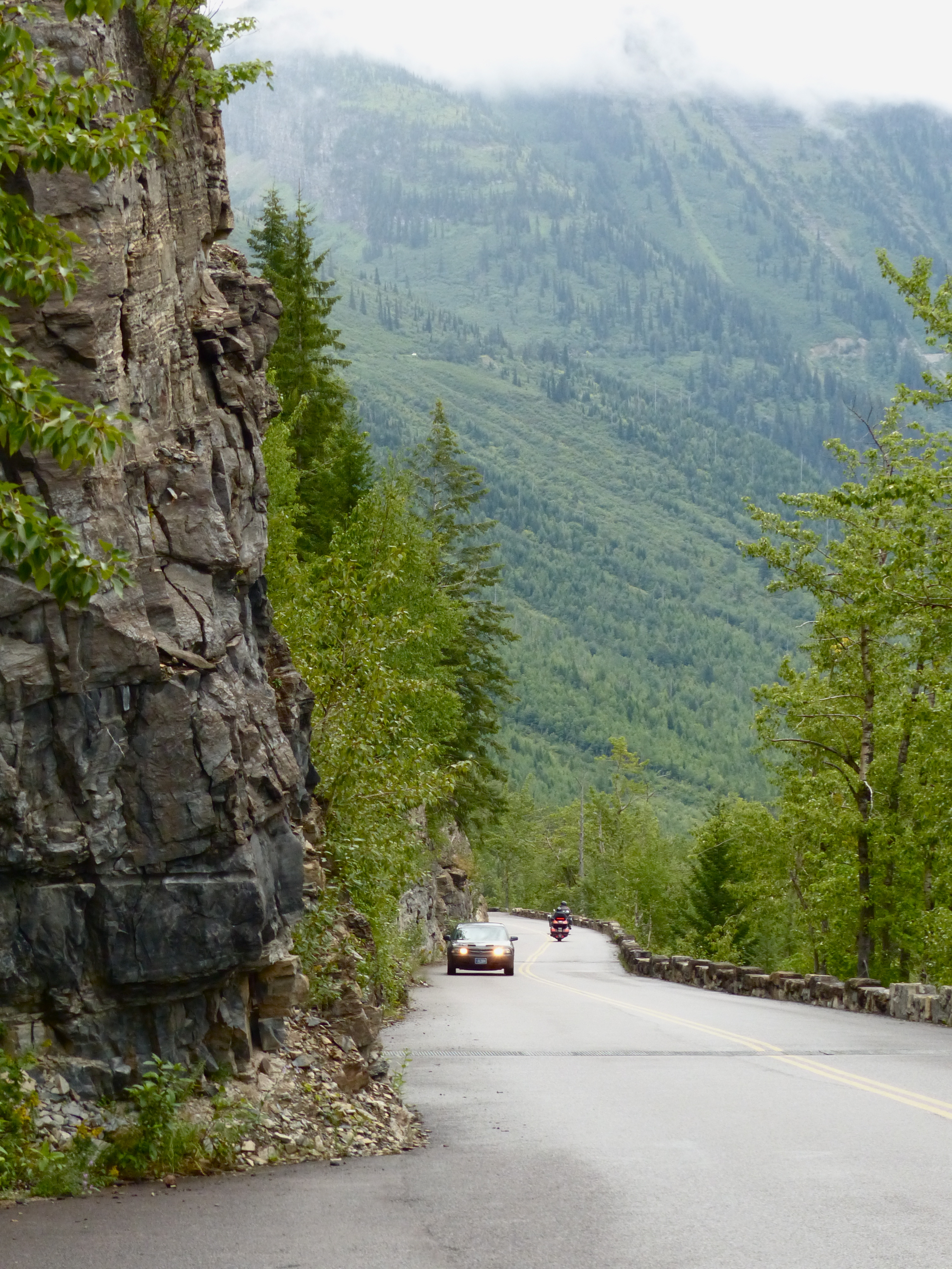
The Goring to the Sun Highway in Glacier National Park looks a lot like this much of the way – sheer cliffs on either side of the roadway.
The Going to the Sun Highway was cut out of the side of a mountain during the Great Depression strictly as a tourist attraction. Nobody would take this road if they were in a hurry to get anywhere, and it’s closed half the year because of snow and avalanches. In places, it’s just cut out of the sides of cliffs. And it’s two-lane. With no shoulders. And little stone walls instead of guardrails. There is nothing that will tighten your sphincter more than driving next to a 1,000-foot cliff in a fog so thick you can’t see the headlights from an oncoming car 20 feet in front of you.
But I did that, and it didn’t seem so enjoyable as it did with the whole family 55 years ago. We stopped along the way and took a hike despite the “bear warning” signs just to add a little excitement to the trail. I think I took my Boy Scout knife along just in case. As I remember, it was clear and sunny back then.
But not much to report from the rainy and foggy drive. Even in the bad weather, there were tons of tourists up there. If I ever do it again, I think I’ll hit the road before dawn and get a good parking spot just as the sun comes up. What could be more fun than driving along a 1,000-foot cliff in the dark?
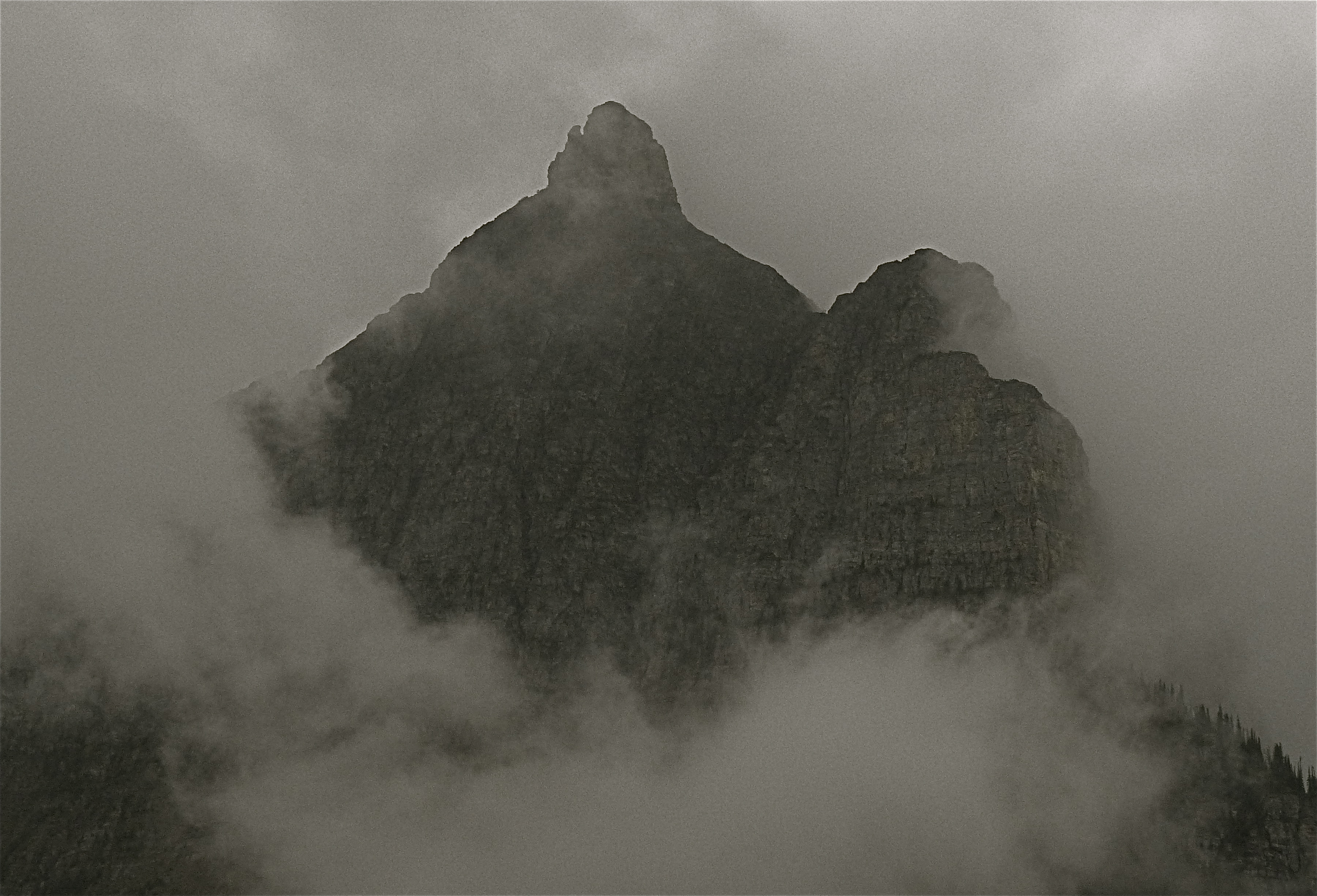
A peak in the Glacier National Forest looks ominous wrapped in a shroud of clouds.
After that, I headed out across the spine of Montana looking for the Missouri Breaks. I found not many people live in northern Montana, there weren’t any parks along Highway 2, and not many motels. In fact, not any until I got to Harve. I think they meant to name to town in honor of the Green Bay Packer’s famous quarterback – a living god in Wisconsin – but misspelled his name.
There were a lot of motels in Harve. I usually like chain motels, but after staying with motels in this one chain 54 times, I still haven’t figured how to get the one free night they promise. And local motels are cheaper. So I booked a room at a motel downtown. I started to move my stuff into the room and decided I couldn’t stay there. I actually thought I might not survive the night there. I think like that when electrical systems crackle and spark when one turns on the light. And my dog thought the bed smelled bad.
So I went to the front desk, and the gal there said – as if she had heard this before – “I understand and we’ll refund your money.” So how does a Luddite without a smart phone find a decent, reasonable motel in a small town? Ask a local. People in the rural areas of North America are most of the time friendly and helpful. This one fellow in Harve sent me to the El Toro Inn “right down this street.” It was a great room, clean, large, with all the amenities and cost $63. And no extra charge for the dog.
I thought about previewing rooms. I could have gone to a seedy (but cheap) motel, looked in at a room and said, “Eeeeeeeeee Uuuuuuuuuu,” at which point a burly manager might have said, “What?!” at which point I would have said, “The E.U. I hate the E.U.,” which would have gone over fine in rural Montana. But most desk clerks won’t do actually show you a room before you rent it, so I go with the advice of locals.
Speaking of amenities, read the disclaimer on your motel wi-fi sometime. It will warn you that any transmissions one makes are not secure, which means that a hacker in an air-brushed Star Wars van stationed outside the motel with the right equipment could eavesdrop on all your internet traffic. Long ago, I learned not to make stock trades from a motel room. I still wanted to own those stocks when I got home.
Getting to Harve across northern Montana’s Highway 2 is not a recommended sight-seeing route unless one wants to ponder what might be called the strength of the land. Wheat grows on gently rolling hills from horizon to horizon. It’s called the “king of grains” because it’s so useful in so many ways. One way it’s not useful is in feeding Jim Dustin because Jim Dustin is gluten intolerant (which is to say in the world of grains, I’m a racist). However, one can’t but marvel at how much wheat there is growing on those vast landscapes.
I know high schools don’t teach much in the way of “history” any more, but in 1800, most Americans – 95 percent – lived and worked on farms or ranches. Today, only a tiny fraction – 4 percent – live and work on farms and ranches, yet they produce enough food to feed the entire population of the United States and many foreign countries. The agrarian population in the nation used to produce its leaders and aristocracy. George Washington and Thomas Jefferson were planters, after all. Today, we get our leaders from professional political families whose scions attend Ivy League schools and dabble in commerce, yet a scant few of them have ever dirtied their hands with actual dirt. Teddy Roosevelt visited this part of the country, but didn’t really stay very long. He spent some of the family money on ranching, but really didn’t do very well.
I think a signal accomplishment for a political leader to put on his resume would be to mow one of our gigantic hay fields, or guide a combine from dawn and on into the night across one of these immense wheat fields. One sight that sticks in my mind from a road trip (it was before I was a very good photographer – I should have stopped, but we were all in a hurry to get home) was a line of seven combines coming over a low hill as night fell over the land. If you take a scene out of the movie “Patton” and replace the line of tanks with combines, and put bright and numerous headlights on the combines, you might get a sense of what that looked like.
Another sight that sticks in my mind was darkness during another road trip across Wyoming. I said to my friend in the passenger seat, “Do you see anything unusual out there?”
He looked for a while and answered, “No.”
I said, “Do you see any lights at all?”
His eyebrows rose, and he said, “No, nothing.” You might expect from reading a travelogue that some startlingly exciting event is about to be related, and that I’m stringing you along with these mundane memories while holding off on the big event like a singer with a single hit will hold off singing that hit until the end of the gig (John Denver did that to me in Rolla, Missouri).
Well, I’m not doing that. Much of what I contemplate while driving down our highways is how America got to where she is today. My own opinion is that the U.S. reached the height of its power and prestige in the 1950s (when, as it happened, we started building the Interstate Highway System) and has been in decline since. We’ve gradually moved from being a nation of hardy and self-sufficient individuals and families to being a nation of nearly helpless dependents. Every president since Lyndon Baines Johnson has gone out of his way to add to the welfare rolls. You want hardy and self-sufficient? Hang around with a kid who grew up on a ranch and raised an FFA pig, not one who can reach Level 9,042 in a game on his smart phone. The latter kid will grow up to believe food comes from grocery stores and two-by-fours from lumber yards.
There are tiny towns along Montana’s northern reaches that subsist off the rural economy. One finds the people in those towns almost uniformly friendly to folk as common as they are. It wouldn’t do to drive a BMW into one of those towns and ask a local where the BMW could park without getting spattered with gravel from passing trucks. But if one asks, “Can I get to the Missouri Breaks from here?” one might get a smiling answer, “Yeah, I think that gate is open. And it’s pretty chilly, so the rattlesnakes won’t be too active.”
I’m not big on arranged tourist trips, but sometimes that’s the only way to get to see some sights. From Harve, I was headed for a boat trip to the Gates of the Mountains. The tours began at 11 a.m., 1 p.m. and 3 p.m. With my usual fine sense of timing, I arrived at the parking lot with one minute to get my ticket and get down to the boat, which I accomplished. I learned this technique from my golfing buddies who eschew any value in warming up and consistently arrived at the golf course about two minutes before tee time, which could explain why I’m a lousy golfer.
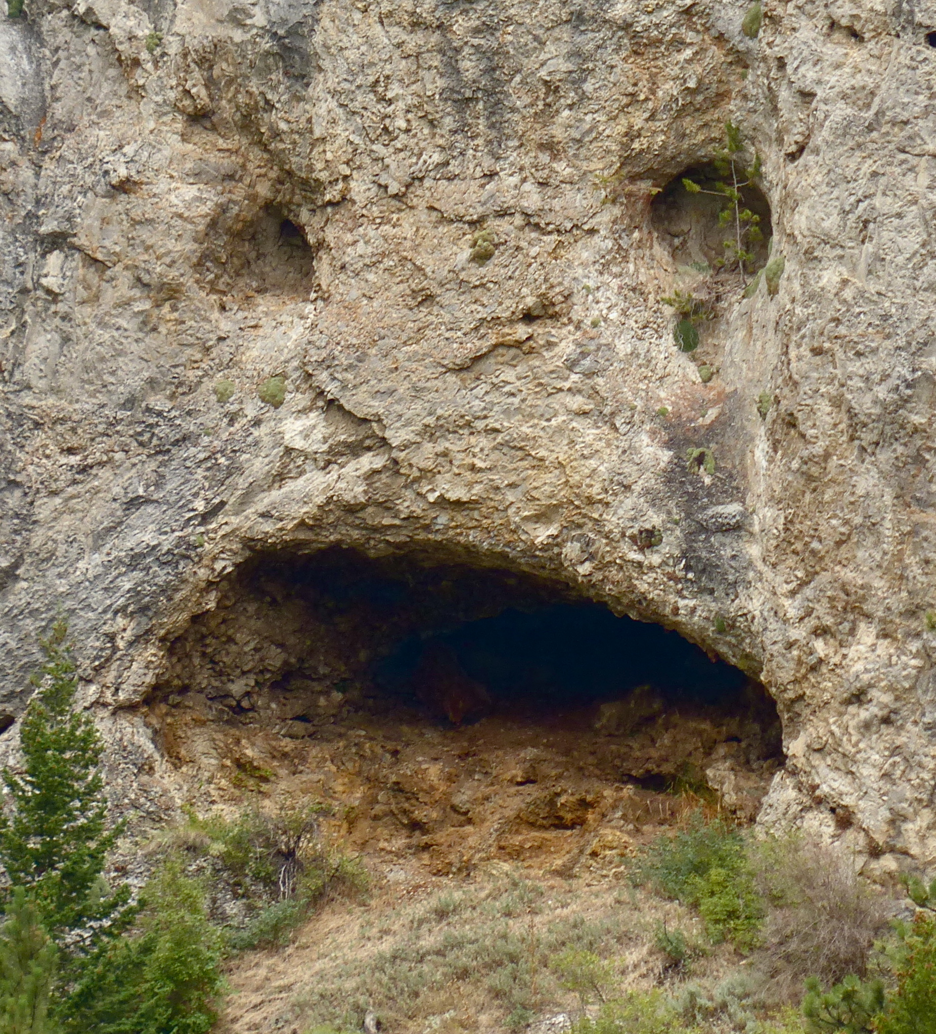
This naturally-formed face in the limestone cliffs above Upper Holton Lake reminded of a certain basketball parent in Walden, Colorado.
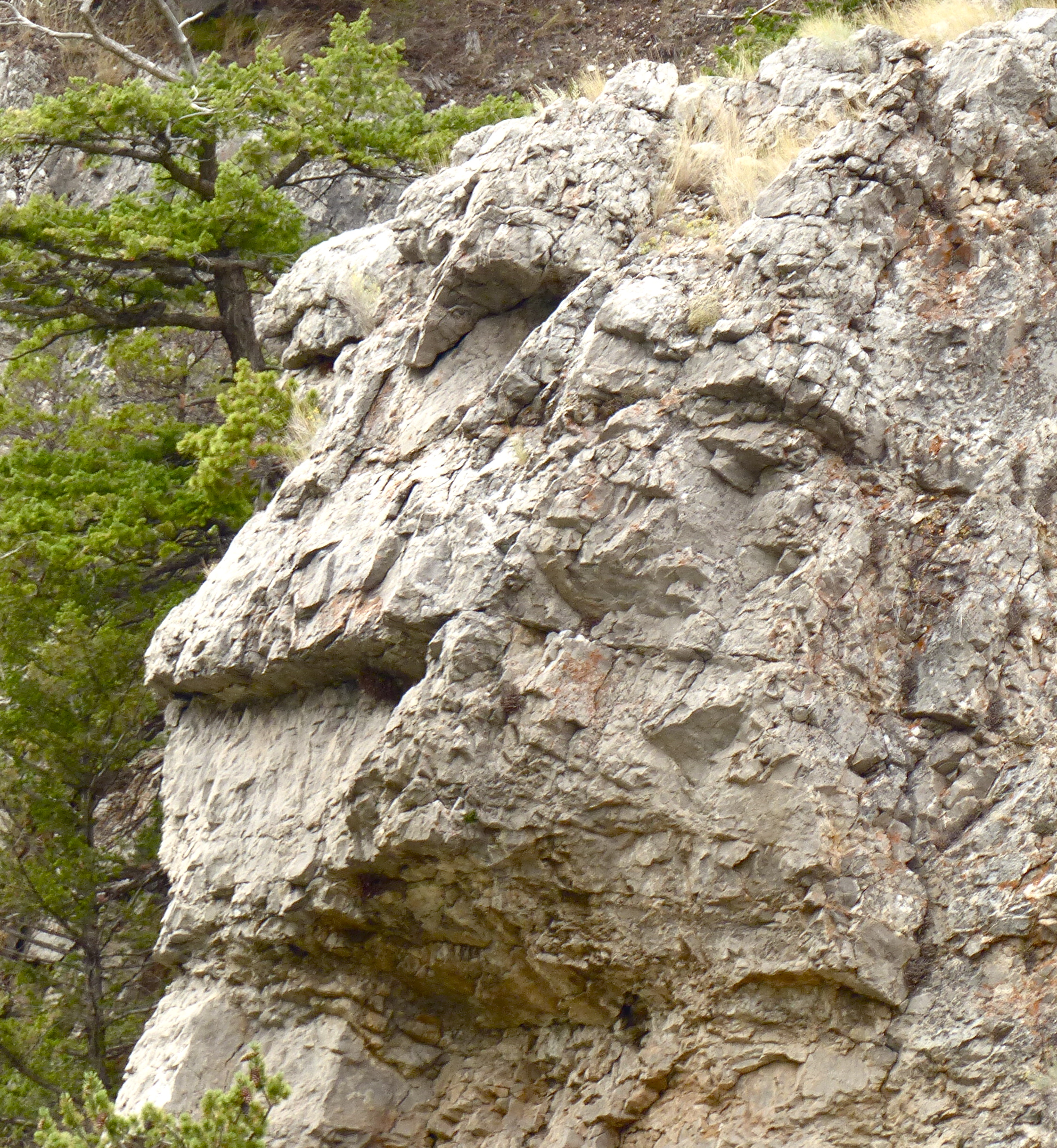
Another face Mom Nature carved into the limestone was this one called either the lizard or the monkey.
But what a deal. For $16, you get a two-hour, guided boat ride replete with learned commentary about that pesky subject about what so many of us know so little – American history. The Gate of the Mountains is a canyon carved through limestone by the Missouri River over millions of years. It gets its name from an optical illusion cleverly demonstrated by the pilot of the boat. Moving upriver, the water seems to come to an end at a limestone cliff. But as the boat moves to the north, one limestone cliff seems to pull away to the south, opening up the river. Meriwether Lewis observed this during the incredible journey of the Corps of Discovery in 1804 otherwise known as the Lewis and Clark Expedition. It was Lewis who gave the canyon its name.
If we ever bring a thorough study of American history back to the K-12 curriculum, “Undaunted Courage” by Stephen E. Ambrose should be a required textbook. Not only is it an exhaustive history of the Lewis and Clark Expedition, it is couched in a detailed look at a very young nation that had suddenly become very big. The U.S. had just purchased 800,000 square miles of land from France, an exchange that made and changed history. Napoleon himself observed that what amounted to a land grant to the U.S. would create a nation that could one day “humble” France’s old enemy, the British Empire. It also – curiously – helped make the United States the only empire in history that acquired more land through purchase than through conquest. It was an early and exclamatory testimonial to the power of capitalism.
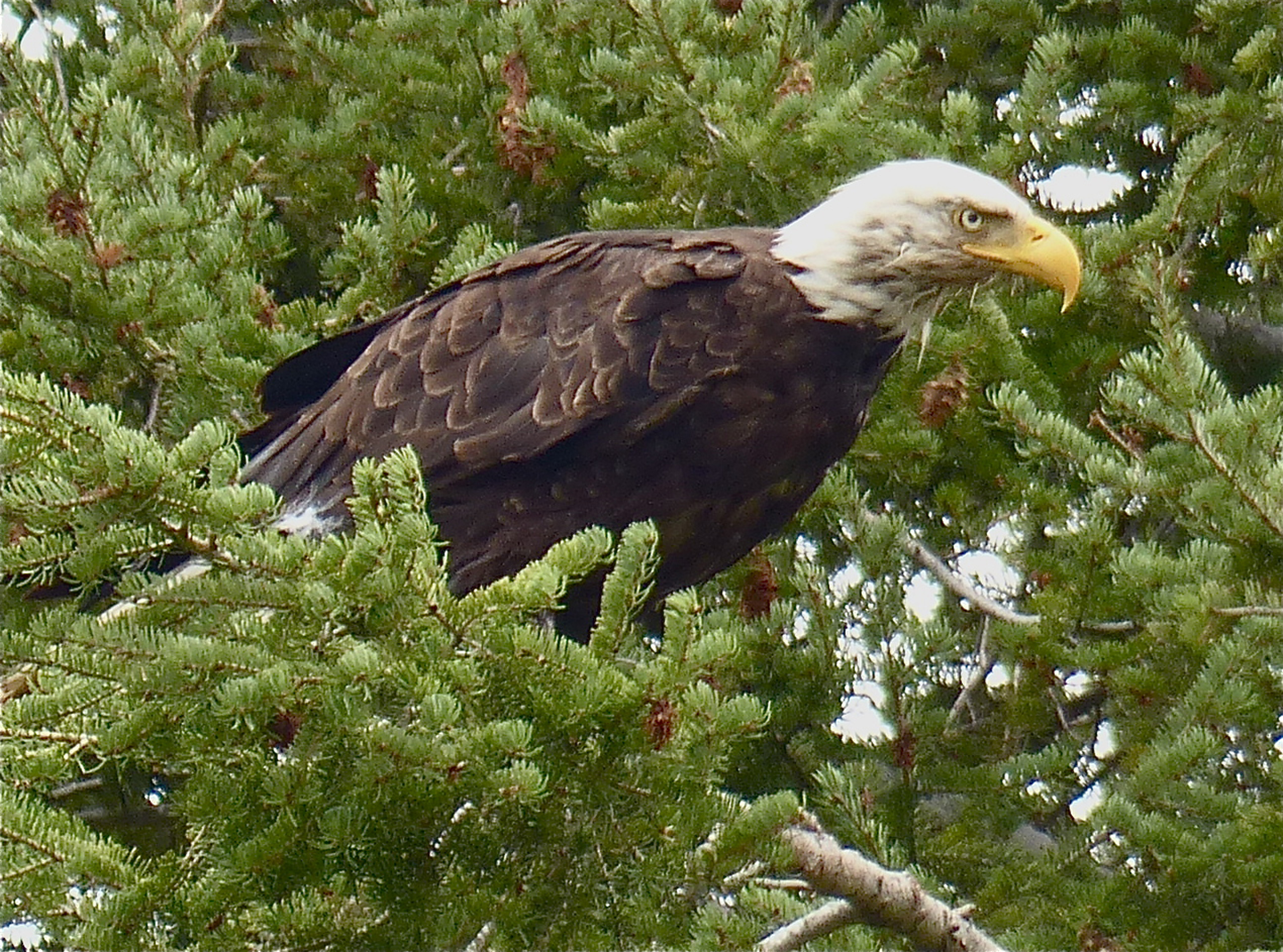
A bald eagle prepares for takeoff from a tree along the Missouri River.
A blue heron takes flight along the shores of Upper Holton Lake in Montana.
The Missouri River that Meriwether Lewis traveled in 1805 is now buried beneath Upper Holton Lake, a reservoir created by another of those pesky hydroelectric dams that provide the power to light so many of our homes and industries. But the rising waters didn’t hide the geology of the area that is as instructive as its history. The limestone deposits in the region have been carved by moving water for millions of years, the results of which are strange pinnacles, hanging arches, bizarre shapes and a couple of faces (see photos). And the rising waters didn’t seem to disturb the animal inhabitants of the area, such as eagles, ospreys and cormorants. They actually appeared to pose for photographers passing by in the boats.
I was busy taking pictures when a lady asked me, “Did you buy that hat in Walden, or are you from there?” For you readers who have never heard of Walden, it is a town of 600 in a county of 1,600 square miles. The population of the whole county is 1,350, giving it a population density of less than 1/12 the population density of British Columbia. What are the chances of running into one person among 40 on a boat ride in the middle of Montana who knows about Walden, Colorado? “My son worked for Corky Lozier (a Jackson County rancher) for three summers,” the lady said.
After that two-hour tour that didn’t end as Gilligan’s did, I moseyed on down back roads to White Sulphur Springs, a small town with a golf course. It had been raining pretty much all day, and only fortuitously stopped for a couple of hours for me to take the boat tour. The roads were scenic, but the rain continued. I found a lousy hotel room in White Sulphur Springs. Here’s another rule. If a hotel room is built around some other attraction, like hot springs in this case, you’re going to pay more for less. Being in the hotel room entitled me to dip in the hot springs pool, which looked to me like the perfect petri dish for all sorts of water-borne diseases brought by travelers who hadn’t showered in five days. Think about it; one doesn’t shower before diving into body-temperature mineral springs, one showers after. Anyway, if the hot springs dip comes with the room, you are paying for the hot springs and the room. So I had a lousy room and paid too much for it. Why did I go there? It was recommended by a local. There is something to be said about chain motels; you know exactly what you’re going to get. I always feel a little guilty about letting Abby sleep on the motel bed with me (she sheds; I’ve asked her not to, but she can’t help it), but here I didn’t.
Day Sixteen
I knew I wasn’t going to make it Walden in time for Kyle Fliniau’s “celebration of life.” I regret missing it. Kyle was such a relentless proponent for Walden’s improvement that the county clerk, Hayle Johnson, came up with an idea to fill town potholes on Kyle’s day of remembrance. Kyle hadn’t wanted a funeral. I thought they were just going to pick a big pothole, drop a golf ball in it, fill it with asphalt, and go home. But no. Donations poured in to the local hardware store to purchase bagged asphalt, county and town workers showed up with equipment, and more than a hundred citizens armed with hand tools spread out through the town and filled potholes all over the place. It may become an annual event.
The day before this happened, it was raining in White Sulphur Springs, so no golf. I made good time down the interstate, so I stopped at the Little Bighorn Battlefield National Monument. Much of the recorded history of the world in the last 3,000 years or so has been decided by brilliant military commanders, but probably an equal portion of that history has been caused by incompetent commanders. This battle was yet another illustration.
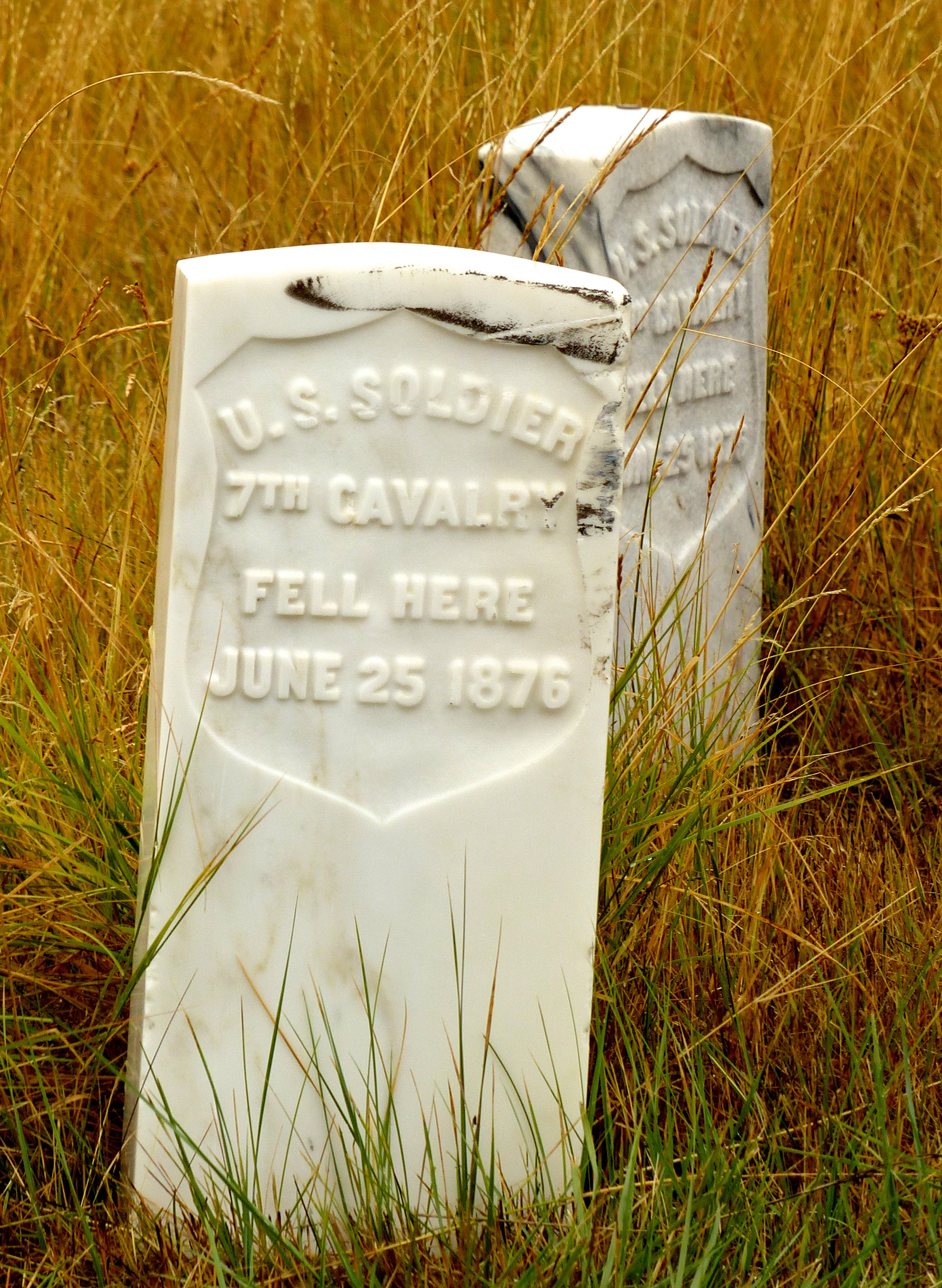
A tombstone marks the spot where a member of Custer’s 7th Cavalry died during the Battle of the Little Bighorn.
Lt. Col. George Armstrong Custer with about 600 men made about every mistake a military commander could make. He didn’t reconnoiter, so he didn’t know he was attacking 1,700 Sioux and Cheyenne warriors who were as well-mounted and well-armed as his troops. He split his command into three elements, therefore allowing the tribes to attack and defeat each in detail. He charged ahead with five companies so rashly that he lost contact with his supporting units. And so on. Crazy Horse, Sitting Bull and other chiefs were quick to take advantage of these mistakes, wiping out Custer and 200 of his men and stopping Marcus Reno and Frederick Benteen from coming to his rescue.
This particular battle probably didn’t change history much, not even American history. It did get rid of Custer, who had presidential ambitions. But the Plains Indians were doomed to defeat. It was a short war between an advanced technological society and a nomadic people stuck in the Stone Age.
I have been trying to plough through a book entitled “Guns, Germs and Steel: The Fates of Human Societies” that attempts to explain why the residents of some continents advanced – technologically speaking – so quickly while others stalled. I’m not getting it. The historical fact is that when Columbus and other Europeans got to the Americas, they found the inhabitants woefully ill-equipped to resist conquest. Why? Nobody knows. Why should a European virus like smallpox be so destructive to the indigenous population, and not the reverse? Why is it that American indigenous germs didn’t cause a deadly plague among Europeans? Europe and America have the same array of natural resources. Why didn’t coastal Indians in America discover Europe? The winds blow in each direction. Why did ship building in America stop at basically large canoes while in 1407 the Chinese were building ships 400 feet long, 166 feet wide, and capable of carrying 1,000 passengers? When the Spaniards came, why were the Plains Indians so quick to see and adopt the advantages of the horse, but not gunpowder?
We don’t know, or at least I’ve never seen that satisfactorily explained. Suffice to say that technological innovation and advancement for societies carries with it more benefits than simply building better weapons. Consider: When Custer advanced on the tribal encampment along the Little Bighorn, there were an estimated 5,000 Indians living there. The Little Bighorn is not really a river; it’s more of a glorified creek. What happened to the human and animal waste created by a camp of 5,000? They didn’t have water treatment plants; they didn’t have sewage treatment facilities or even vault toilets with abandoned wallets. It’s no wonder they were nomadic. They may have been the pure and pristine peoples of the plains living in harmony with nature, but they also had an infant mortality rate of 50 percent and left their elderly to die in the winter. Sorry you OOOs out there. You might be politically correct, but history is not; it is what it is.
That was the last major attraction on the trip, but what would a road trip be without me almost running out of gas (or in some cases, actually running out of gas). I was returning from a Missouri road trip a couple years ago in my new, 2011 Honda Pilot. It was the first vehicle I had ever owned that had a mileage range on it, or the number of miles you can go on the remaining gas in the tank.
I was in Nebraska, where premium gas cost less than regular. Don’t ask me why. I’d just taken a walk with Abby at an I-80 interchange where I thought the gas was higher priced than other places. I decided to drive on. There are cases where one can drive less than a mile off the interstate and find gas for considerably less. Laramie, Wyoming, is an example. On one day in October, 2014, one could get gas at the station nearest the interstate for $3.49 per gallon If one drove three blocks further, one could buy gas for $3.29. Don’t ask me why. And then there is the curious case of Gunnison, Colorado, where on Oct. 25, 2014, gas on the west side of town cost $2.12 per gallon, and then steadily increased until one arrived one mile later at the east side of town where gas cost $2.29 per gallon.
Even a seasoned road tripper can get mousetrapped though. After I left that Nebraska interchange, the highway signs said the next interchange was 21 miles away, or something like that. I got there only to be greeted by a sign that said “No Services.” This is “The West” folks. There are tons of highway interchanges with “No Services.” No problem; the next interchange was 17 miles away. Guess what; “No Services.” And the next one was 21 miles away, and guess what? I had 21 miles left in my tank of gas. What would be the odds of three interchanges in a row having “No Services.” In this case, 100 percent. But there was a town. But my range said “0.”
Seasoned road trippers are resourceful. On a road trip to New Orleans with three girls – every young man’s dream – my Dodge van was breaking down. It was a lemon. This particular van broke down in seven different states. One breakdown was when I was taking the entire male side of a wedding party to the wedding. I’m not a mechanic, but I deduced that the cables connecting the gear shift to the gears were, in technical terms, caddywampus. To make them golferwampus, I rerouted them around a piece of frame and held the assembly together with – are you ready for it – a vice grip pliers. Yes, these things did happen back in the day, and people drove from New Orleans to St. Louis with car held together with a vice grip, or duct tape (good for broken hoses), or bailing wire (to reattach a muffler pipe), or someone leaning out of the passenger side to manually give the wiper blades a couple of swipes when the wiper motor failed.
Back in Nebraska, I started knocking on doors to see if I could buy a gallon of gas. You young people aspiring to be road trippers should know there is such a thing as road karma, or maybe it’s spelled “carma.” You will recall I was trying to buy gas for less than, say, $3.52 per gallon. I was now willing to pay $10 a gallon just for enough to get to Ogallala. First door, “No, I don’t have any, but the sheriff lives right over there. I’m sure he’ll help you.” I’m thinking, who doesn’t have a gallon of gas around the house? Next door, “The sheriff isn’t here, but his cousin lives right over there. He’d probably sell you a gallon.” Third door; cousin not home, but cousin’s boat is sitting in the driveway with a gas can in it. Well, I thinks to myself, I will (duct) tape this $10 bill to the boat and take about a gallon of gas, and if someone comes out waving a shotgun, and can hurriedly point to the bill to prove I wasn’t stealing the stuff. I put a gallon in and headed to Ogallala, eight miles away. The range still said 0. But I made it and learned that there is a little slop built into the range gauge. Might be good to know in the future.
So now I’m coming home from the Canadian wilderness not having once even come close to running out of gas. I’m leaving the Little Bighorn Battlefield Monument, and I need gas, but everyone knows that gas costs more around a tourist attraction than elsewhere. I’ve got 54 miles of range left. I hit the interstate. Within 20 miles, there’s an interchange; No Services. Not only no services, but no nothing, not a store, not a house, not a ranch, nothing. I stay on the interstate until the next exit; No Services. Finally, with 14 miles left on the range, I get to an exit with services, specifically gas, and carma strikes. The only gas station there sells only premium – $3.99 per gallon.
Then I make the mistake of walking into the adjacent bar to ask for directions on how to get to a craft brewery in Sheridan. It’s a mistake because it’s 2 p.m. and the three guys at the bar are already beyond the blood alcohol content limits for driving in most countries. A half hour later, I get out not having any idea where this brewery was but happy that my self-restraint systems were all in working order and I didn’t end up spending the afternoon with the boys.
Now I’m probably 12 hours from home and could probably make it in time for Kyle Fliniau’s celebration of life if I drive straight through. I decided that I’m too old for that, and the town of Walden didn’t need to have two celebrations of life in one week. I don’t like driving at night in The West because animals run out in front of cars. Animals run out in front of cars in the East too, but they’re little animals. In The West, we have elk, moose, mule deer, grizzly bears, buffalo, antelope and, of course, cows. I hit a mule deer in Montrose, Colorado, while driving a pickup with a heavy brush guard on the front. The deer still did $5,800 worth of damage to the front end, and I was only going about 40 mph. I can’t imagine what would have happened if I’d hit the animal doing 75 mph. Impact studies have shown that the deer likely would have end up
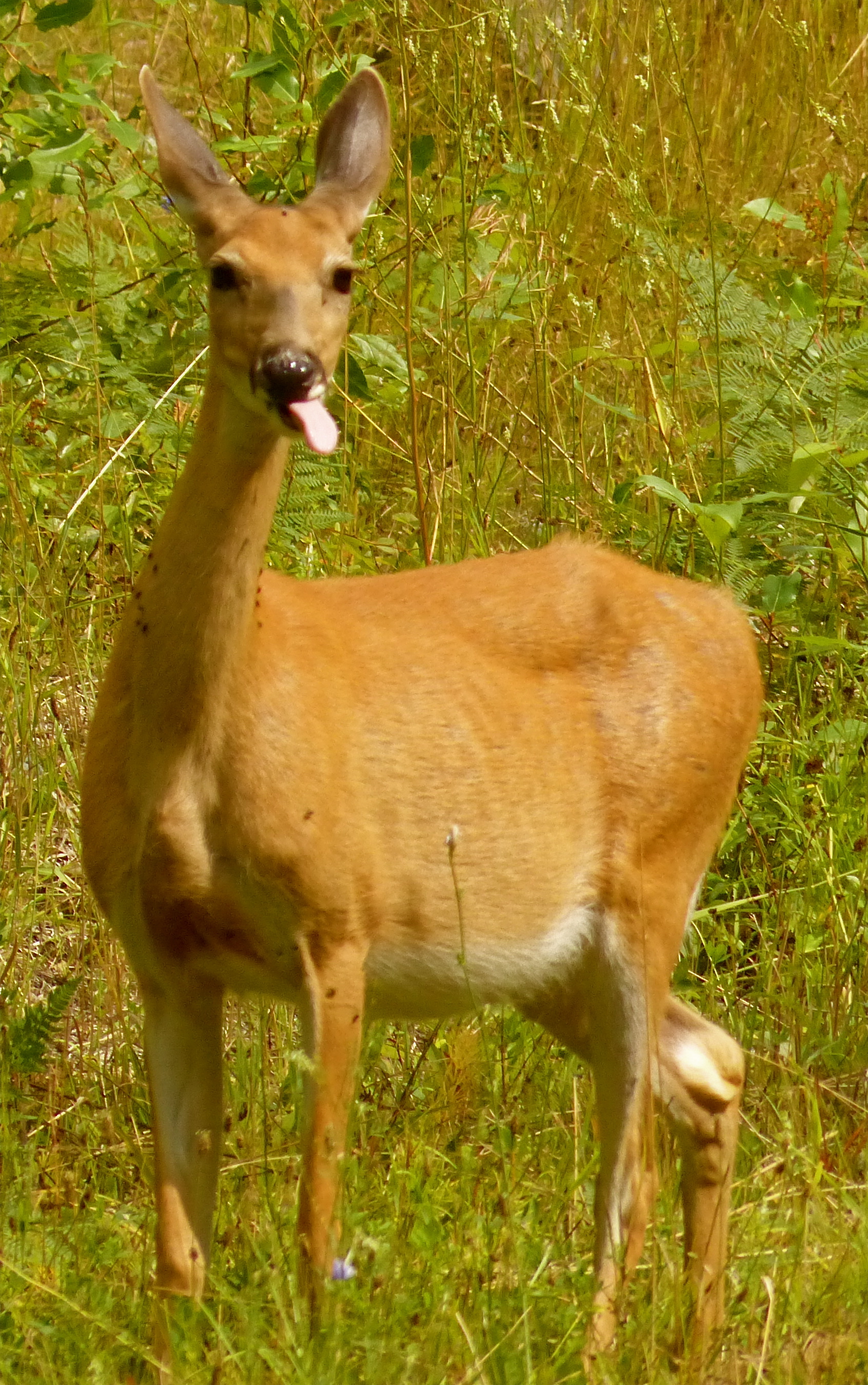
Some big game animals seem to instinctively know when it’s not hunting season.
sharing the front seat with me.
It’s not really a matter of being alert or not. I “hit” a deer in Saratoga, Wyoming, one evening. Actually, the deer ran into the side of my pickup. I never saw it. I asked my date what the big “thump” was, and she said I just “hit” a deer. This was also when I discovered not only can you not sue the deer – these animals, despite the fact that many of them are called “bucks,” have no money – for damages. I couldn’t sue Wyoming Fish & Wildlife for failing to control the animals over which they claim responsibility. I’ve reported on many frivolous lawsuits in my time, including one in which a man’s wife, who got him a stripper for his birthday, sued the stripper’s agency because her boobs weren’t big enough. Or the woman in Chicago who got off lightly on an embezzlement charge because her lawyer argued that she had a “shopping addiction.” Or the jogger who sued the shoe company because she tripped and injured herself when her shoe laces came untied. Unfortunately, I could go on. But I don’t sue. In my 66 years on this Earth, I’ve never sued anyone except one recalcitrant deadbeat who had a friendly judge fail to notify me when the trial was being held. I eventually collected, incidentally. So I also didn’t sue when driving through Nebraska on another road trip I hit a turkey going 65 mph (I was going 65 mph, not the turkey). What was damaged was the exact same front-left quarter-panel that I had just had installed after hitting the mule deer in Montrose. I didn’t even bother turning that one in to the insurance company.
We’ve all had problems with insurance companies, especially we drivers. That’s why we have Obamacare. Enough people were unhappy with their insurance companies that they thought – or maybe “thought” is the wrong word – that the government could do a better job. To that I say, HAHAHAHAHAHAHAHAHA! Who couldn’t have seen that coming?
I only had one real beef with insurance companies, and that goes back to Clark, the 1964 Chevelle. I was selling Christmas trees for the St. Charles Jaycees back in 1973 or so. We’d had an ice storm, and Clark was parked in, I guess, a bad spot. A Jaycee came running up to me and said someone had hit my car. I walked over to the scene of the accident, and the guy was still there. He’d slid in to my passenger side door. Well, I took his insurance information, but allowed, “You know, the car door still opens, and it’s not like there aren’t any other dents on this car. I’m not even sure I’ll turn it in.”
About an hour later a Jaycee came running up to me and said someone hit my car. I said I know. He said no, this is another guy. So I went over and found he had hit Clark in the exact same spot as the previous guy had. Now, my car door wouldn’t open at all, so I had to get it fixed. The first insurance company was fine. They offered $125 (okay, this was a long time ago when they made cars out of steel, not plastic) to fix the door. The second insurer refused to pay anything because, “You can’t do damage to damage,” an interesting legal leap forward in (not to get too technical here, but the root word is from the Latin) “weaseling.”
I replied, “Yes you can, because I can produce six or seven Jaycees who were witnesses to both accidents and who will sign depositions saying that I could have opened the car door after the first insured hit me, but not after the second.” This is called, again from the Latin, a “bluff.” Most of my Jaycee friends were in the bag by the time of at least the second accident and maybe by the time of the first, it being cold and not too busy at the Christmas tree lot, but the insurance company didn’t know that. They would have known that if more of their “agents” were involved in community service organizations, but they weren’t, so I got an additional $125. None of the $250 was spent on repairing the door, by the way.
At that point in my life, Clark wasn’t going on any more road trips. The first ominous clouds of the coming pall over the open road were beginning to appear on the horizon. First came the laws requiring a motor vehicle owner to have insurance. Then came the laws requiring that motor vehicles have adequately working parts, as in more than one headlight. Then came the laws requiring that motor vehicles meet certain emission standards, and then the laws requiring that cars be inspected for defects, and then the laws limiting speed limits to no more than 55 mph – the one example involving the lure of the open road that we road trippers with the aid of such people as Sammy Hager (“I Can’t Drive … 55”) beat down.
Oddly enough, my dog is familiar with these freedom flights. As a young dog, she used to sprint for the open door of my office and escape into the wilds of Walden. She was like a cowboy on Friday night, visiting all the fenced-in dogs, raiding the inadequately-maintained dumpster locations, checking all the pee-mail within running distance and generally outmaneuvering me when my pickup appeared. That was her open road, and she’d come home eventually, as I did.
Day Seventeen
Having decided not to do an all-night drive, I stayed in Buffalo, Wyoming, for no particular reason. It was a big enough town that I thought there would be a movie theater, and there was, but it wasn’t showing anything I wanted to see. Going to the movie theater is kind of a gamble nowadays. Even as a senior citizen, you’re going to plunk down $10 or so to get a ticket. Then you’re going to plunk down an additional $12 or $15 to buy a soda and popcorn. Do you know why this is? Because, I am told, distributors of first-run movies – the “studios” – take 90 percent of the gate, so the theater owner makes $1 out of that $10 ticket. He (or she) makes the rest up on concessions. Fine. I know that. But having paid $25 to watch the damn movie, I shouldn’t be subjected to a half-hour of commercials before the movie starts. But I am. So I maybe see two movies a year at the theater, and it’s like choosing a local motel – it’s a crap shoot. “Robin Hood” Starring Russell Crowe should have been a dead-bang cinch. Not. One of the worst movies ever. Why? I don’t think the French in the Twelfth Century invented the Higgins Boat (look it up).
The last leg of my trip from Buffalo, Wyoming, to Walden, Colorado, was uneventful. But it was a nice day, with plenty of time for thought – just simple, quiet, introspective thought. I channeled Jay Edwards (who wasn’t dead at the time, but have you ever heard someone say something that just sticks with you forever?) who had once said to me, “I don’t listen to the radio when I drive; I think.”
I hadn’t thought about this at all during the trip, but I was thinking now, “How much did this trip cost?”
The answer was the quintessential road tripper’s answer: it doesn’t matter. I’d figure it out when I got home, but on the day I’d left, I’d said to myself, “I should have enough.” But then again, when I left the Little Bighorn Battlefield National Monument, regarding the issue of gasoline, I had said to myself, “I should have enough.”
Fast forwarding to the recapitulation – sort of – of my expenses, I think the 17-day trip cost about $4,000. Approximately $3,000 of that was for gas. My dad, who introduced the family to road trips, would have rolled over in his grave (if he had had a grave; we spread his ashes over his dream home property southeast of, as it happened, Asheville, North Carolina) at this imprecise accounting. Dad kept meticulous records when he was on the road, usually for no purpose. But he did keep meticulous records anyway. My brother was chosen as the executor of my parents’ estate because I kept records like, “I think this trip cost about $4,000, but I can’t tell you why.” Well, I’m not going to deduct it, so who cares?
But here’s the crux of the issue. I just recently heard about a couple, or a foursome, who were of the age “in their 30s” who had embarked on an around-the-world vacation. Never in my life would I have been able to spend the time or the money to do that (unless the duration of that trip was no more than two weeks). This is a subject about which I have thought a lot, and on that final stretch down from Buffalo, Wyoming, to Walden, Colorado, I thought about again. When are we as Americans confronted with the need to work?
As citizens of the richest nation on Earth with (almost) complete security from violence of any sort – foreign or domestic (and you radical, idiotic, anti-gun fanatics, please restrain yourselves from reacting – I don’t take comments on this thread – because a young lady was beheaded by a man with a knife, yet others were saved by a gun-wielding citizen on September 26, 2014, who shot the assailant. The mistake the shooter made was he didn’t shoot the assailant eight more times), we don’t need to work. I’m sorry. Re-read the previous paragraph and condense: We. Don’t. Need. To. Work. There are government welfare programs that will support us all. I wouldn’t want to live that way. My dad would turn over in his ashes if I did. But many do.
You cannot learn how all of America operates until you take to the road and talk to the common folk. You will meet people on the road, as I have, who don’t work. They are young, intelligent, open to lively conversation, and utterly unrepentant about the burden they are imposing on society. What thousands of economists and canny politicians have observed is encapsulated in the words of an ardent socialist, George Bernard Shaw: “The government who robs Peter to pay Paul can always rely on the support of Paul.” Which is to say the working folk will support the not-working folk until, eventually, they won’t.
But we are road trippers. We are not activists. We do not walk around in circles with stupid signs in our hands. We travel. We drive. We camp. We tour. We rent. We spend. And we love our access to the open roads in this United States of America. Part of our way of life is the freedom to travel – mostly unimpeded – to all the corners of our exceptional nation and hopefully that other nation north of us.
So okay, as you read this you’re not driving down the highway from St. Louis to Lake of the Ozarks, or from Kamloops to Loon Lake, or from Boston to Los Angeles, or from wherever to wherever. But you could. Where else in the world can you do that? Imagine if you and your Honda Pilot and your dog were snatched up in a Dorothyesque tornado and plopped down on the western border of Holland. If you started driving to the east, from The Hague in Holland to Berlin, Germany, it’s a six-hour drive. Six hours! You couldn’t cross Kansas in that amount of time. From Berlin, Germany, to Warsaw, Poland, it’s a five-hour drive. From Warsaw, Poland, to Moscow, Russia, it’s a 15-hour drive. Wow, I say, unimpressed. I drove 7,285 miles without a significant official obstruction. Imagine driving from Holland to Moscow without a significant official obstruction. Let me repeat a previous observation: HAHAHAHAHAHAHA! You cannot do that anywhere in the world except North America! (Well, maybe Australia. I haven’t been there). Nobody else has the roads. Nobody else has the mini-marts. Nobody else has the security (i.e. police you actually can trust). Nobody else has ready access to fast food. Nobody else would allow you to wander through town and (allegedly) steal gasoline. Nobody else would speak your language across 9,540,000 square miles of territory.
There is more to the lure of the open road than just taking off and being an irresponsible idiot for a couple of weeks. There is the opportunity to do that as a crazed individual who has just lost his dog, or as a family with two weeks available, or as a bunch of fraternity brothers going to an out-of-state game, or as some girls on their first spring break, or as older guys going to Alaska for the first and last time, or as golfers on a tour, or as motorcycle riders of whatever ilk, or as whatever else. We can do that in America. It’s like a calming drug, and yes, it is addictive.
I ran across a newspaper article recently with the headline, “Working toward a carless society.” It was about developers building residential properties near mass transportation hubs. These developers were therefore able to provide less space for parking to the tune of less than one space per apartment. I’d call that a shocking development. Just by myself I own the Pilot, a pickup and a snowmobile.
One of the developers was quoted as saying, “Our future tenants will not need to own a car to maintain a great lifestyle,” and went on to say that millennials in general drive fewer miles in general than previous generations. I take it that “millennials” are people younger than me, and I am a “previous generation.”
Well, I am. My world was designed for cars. The Interstate Highway System and Route 66 were designed for us, the motel was invented for us, the service station evolved into the mini-mart for us, boat ramps were installed for us, bridges spanned rivers for us, driveways led to our homes with one-, two-, and even three-car garages that were located in suburbs because my parents wanted several apple trees and a large yard. Tourist traps and speed traps exist because of us, the internal combustion engine has reached the very peak of engineering excellence because of us. Legends like the American muscle car, the Italian speedsters, the iconic Volkswagon, even the idiotic Yugo were built for us. World history has literally changed because of our thirst for gasoline and oil and anti-freeze. Roads lead to everywhere we want to go and where people want us to go. There is a suspension bridge over a deep gorge in Colorado that goes nowhere. It was built by an entrepreneur in 1929 to attract tourists who could only get there by car.
If I may digress for a moment, I first visited the Royal Gorge Bridge on a road trip years ago. We were standing on the bridge looking at the Arkansas River 955 feet below. Then Darryl McGraw says, “I wonder if we took a piss over the rail would the stream of piss hit the water before we finished peeing?” That would have been an interesting experiement if there hadn’t been so many people around. But we actually did get to test that out on a subsequent road trip to Taos, New Mexico. There was a suspension bridge over a remote gorge, and no people around. The bridge wasn’t 955 feet high, but it sufficed. Answer: one’s piss dissolves into droplets soon after leaving the source.
Back to the carless society: Do I have a beef with this developer who wants to cater to people who don’t need or want cars? Absolutely not. Despite the efforts of a specific political party, this is still a capitalist nation. If there’s a market for that sort of thing, it is only natural that an entrepreneur step forward to fill it. That fellow who built the Royal Gorge Bridge did it for $320,000.
The millennials can make their own impact on American history. They can tell tales of wild bus rides and distant journeys to the other side of town. They can revel in telling stories of the finite number of restaurants and clubs they can reach. They can ponder peeing off the top of an apartment building. They can be the impetus for new businesses and industries that cater to their habits and desires. That’s fine with me. I won’t be around to see it, but I wish them luck and joy.
Me, I’m planning my next road trip. There were a lot of things I didn’t get to see on my last one, and I thought of several ways to make my travel in the Pilot or a similar vehicle more comfortable and enjoyable. I expect more regulation for that future road trip, especially at the borders, more taxes on oil and gas, more speed laws and toll roads as our federal, state and local governments gradually run out of money. I expect to see a mileage tax on gasoline to replace the current consumption tax, and that government mileage monitor on your vehicle will lead to all kinds of pernicious behavior by the feds who will want to know where you went and why, but I don’t care. I’m going to go anyway.
It’s a pity you don’t have a donate button! I’d certainly donate to this superb blog! I suppose for now i’ll settle for book-marking and adding your RSS feed to my Google account. I look forward to brand new updates and will talk about this blog with my Facebook group. Talk soon!
I got this website from my pal who shared with me on the
topic of this web page. At the moment I am browsing this
web page and reading very informative articles here.
Its just like you read my thoughts! This is definitely an amazing web site. We’ll undoubtedly return.
Hello there, just became aware off your blogging through Google, and found that it is really informative. I’ll be grateful if you continue this in future. Numerous perople will be benefited from your writing.
Cheers!
Excellent pieces. Keep writing that kind of information on your blog.
I’m really impressed. I’ll personally suggest it to my friends. I’m sure they will benefit from this site.
Hello to everybody. This is my first quick visit to this
web site; it contains remarkable and actually excellent data for readers.
Very informative article, I am regular reader of your site.
I am thankful to the owner of this web page who has shared this impressive article here.
Good stuff. I came across your site by chance. I have book-marked it for later!
Hi there colleagues. Fastidious articles and pleasant
commentaries at this site. I’m enjoying it.
Wonderful work! This is the kind of info that is meant to be shared across the net. Shame on the search engines for not positioning this higher!
I wish you and Abby many, many more miles together! And keep on writing for the rest of us! Happy trails, Jim!
Magnificent, very informative. I’m wondering why experts of this sector don’t notice this. You should continue your writing. I am confident you have a huge readers’ base already!
I don’t, but thanks for the thought.
Amazing trip, but I just thought that I should let you know, that your photo labelled Cormorant taking flight along the shores of Upper Holton Lake, Colorado, should actually read “Great Blue Heron, taking flight….
Thanks. I changed the cutline.
I really like reading an article that can make men and women think.
Also, thanks for permitting me to comment!
My spouse and I stumbled over here from a different web address and thought I might as well check things out. I like what I see so I am just following you. Look forward to looking at your web page yet again.
Hi there, I found your blog via Google. Whilst searching for a comparable subject, your web site got up, and it looks good. I have bookmarked it in my google bookmarks.
A lot of other folks might be benefited out of your writing.
Cheers!
I think this is one of the so much significant information for
me. And i’m satisfied reading your article. But
want to statement on few general things, The site style is ideal, the articles is
actually nice : D. Just right task, cheers
Hi there, just became alert to your blog through Google, and found that it’s truly informative.
I’m gonna watch out for Brussels. I’ll appreciate if you continue this
in future. Lots of people will be benefited from your writing.
Cheers!
I am sure this piece of writing has touched all the internet users. It’s a really really fastidious piece of
writing.
I am extremely impressed together with your writing talents as smartly as with the structure on your weblog. Is this a paid topic or did you modify it your self? Either way stay up the nice high quality writing, it is rare to see a great blog like this one today..
Woah! I’m really enjoying the template/theme of this website. It’s simple, yet effective. A lot of times it’s difficult to get that “perfect balance” between usability and visual appeal. I must say you’ve done a superb job with this. Additionally, the blog loads very fast for me on Internet explorer. Superb Blog!
An attention-grabbing dialogue is value content. I believe that it’s best to write more on this matter, it won’t be a taboo subject but usually people are not brave enough to talk on such topics. To the next. Cheers
Thank you for another informative website. Where else could I get that kind of info written in such a perfect way? I’ve a project that I’m just now working on, and I have been on the look out for such information.
This is a great tip particularly to those new to the blogosphere. Short but very accurate information. Thanks for sharing this one. A must read post!|
hello there and thank you for your info – I’ve certainly picked up something new from right here.
I’ve been browsing online more than 3 hours today, yet I never found any interesting article like yours. It’s pretty worth enough for me.
Everything is very open with a really clear explanation of the challenges. It was really informative. Your website is useful. Thank you for sharing!
Your mode of explaining the whole thing in this article is
truly fastidious, all be able to without difficulty know it, Thanks a lot.
I like it when people get together and share opinions.
Great site, continue the good work!
Thanks!
Hi there! Someone in my Myspace group shared this site with us so I
came to check it out. I’m definitely enjoying the information. I’m book-marking and will be tweeting
this to my followers! Excellent blog and fantastic design and style.
It’s remarkable article.
I think this is most vital information for me. And I am glad reading
your article. The web site style is perfect, the
articles are really excellent. Good job, cheers
Can I just say what a comfort to find a person that genuinely understands what they are discussing on the internet. You definitely know how to bring an issue to light and make it important.
More people must read this and understand this side of the story. It’s surprising you’re not more popular since you most certainly possess the gift.
Superb Site.
Thanks.
I have read through a number of personal blogs in addition to completed many websites,your work is in fact incredible.Hats off for the motivation not to mention loyalty.Do continue all of us up to date at a later date too.
Hello exceptional website! Does running a blog like this require a massive amount work? I have absolutely no knowledge of programming however I was hoping to start my own blog in the near future. Anyways, if you have any suggestions or tips for new blog owners please share. I understand this is off subject however I simply had to ask. Thanks!|
It’s hard to find knowledgeable people on this topic, but you sound like you know what you’re talking about! Thanks
This is the right blog for anyone who wants to find out about this topic. You realize so much it’s almost hard to argue with you (not that I actually would want to … HaHa). You definitely put a new spin on a topic thats been written about for years. Great stuff, just great!
Interesting content. Appreciate you sharing a fantastic guide. I must say I
took pleasure in the read!
Thanks, I’ve recently been looking for info about this subject for ages and yours is the greatest I have discovered so far.
The recommendations you shared here are quite priceless. It was such a pleasurable surprise to have that waiting for me. They are usually to the point and easy to learn. Thanks a ton for the innovative ideas you’ve shared here.
Most I can comment on is, I am not sure what to say! Except needless to say, for the great tips that are shared on this blog. I could think of a trillion fun strategies to read the reports on this site. I do think I will at last take a step utilizing your tips on those things I could not have been able to address alone. You’re so careful to let me be one of those to benefit from your valuable information. Please know how significantly I enjoy the whole thing.
There is noticeably a bundle to know about this. I assume you made certain nice points in features also.
Hi, I am Kavin. It’s my first time commenting anyplace. When I read this piece, I thought it was a brilliant post.
I’m amazed, I must say. Seldom do I come across a blog that’s both educative and engaging,
and without a doubt, you have hit the nail on the head.
We are a group of volunteers and starting a new scheme in our community.
Your website provided us with useful information to work on. You have
performed a formidable process and our whole community will likely be
thankful to you.
A round of applause for your article post. Awesome.
Hello! I could have sworn I’ve been to this site before but after checking through some
of the post I realized it’s new to me. Nonetheless, I’m
definitely delighted I found it and I’ll be bookmarking and checking back frequently!
With havin so much content and articles do you ever run into
any issues of plagorism or copyright violation? My blog has a
lot of exclusive content I’ve either authored myself or outsourced but it appears a lot of it is
popping it up all over the web without my authorization.
Do you know any techniques to help prevent content from being ripped
off? I’d really appreciate it.
I don’t know of any cases of someone plagiarizing my material. I’m just throwing it out there anyway. I’m not trying to make any money on it,
You could certainly see your skills within the article you write.
The world hopes for more passionate writers like you who
aren’t afraid to say how they believe. Always follow your heart.
Sooooo fast. Beautiful
I’m obliged for the blog.
Really appreciate you sharing this blog article. Keep writing.
Hi there to all, the contents existing at this site are actually remarkable. Well, keep up the nice work.
Hey, thanks for the blog. Great.
Really informative post.
I’m not sure where you are getting your information, but good topic.
I needs to spend some time learning much more or understanding more.
Thanks for excellent info I was looking for this info for my
mission.
Definitely a brilliant look at this subject.
Thanks so much for the blog.Thanks Again. Really Cool.
Thanks for sharing, this is a fantastic post. Really Great.
Hey I am so happy I found your website. I really found you by mistake,
while I was browsing on Yahoo for something else. Regardless I am here now and would just
like to say many thanks for a remarkable post and an all-round entertaining
blog (I also love the theme/design). I don’t have time to read it all at the moment but
I have bookmarked it and also added in your RSS feeds, so when I
have time I will be back to read more, Please do keep up the great job.
Hi mates. Nice arguments presented here. I am enjoying it.
Hi there. I became alert to your blog through Google, and found that it is truly informative. Numerous folks will benefit from your writing.
Cheers!
This is one awesome article post. Keep writing.
Thanks for sharing, this is a fantastic blog article. Keep writing.
Thanks again for the blog post.Much thanks again.
Hello! I just want to offer you a big thumbs up for your great
info you’ve got right here on this post. I’ll be returning to your site for more
soon.
Your style is unique compared to other folks I’ve read
stuff from. Thanks for posting when you have the opportunity, Guess I will just bookmark this blog.
Good information. Lucky me I recently found your website by accident (stumbleupon). I have saved as a favorite for later!
Every weekend i used to visit this site, for the reason that i
want enjoyment, for the reason that this this
web page conations truly pleasant funny material too.
amazing post, extremely informative. I wonder why the other specialists of this sector do not notice this. You must continue your writing. I am confident, you’ve a great reader’s base already!
Because the admin of this web page is working, no hesitation very shortly it will be
renowned, due to its quality contents.
I stumbled upon your site almost by mistake but now after I saw a few posts I’m fully hooked! Bookmarked!
You could certainly see your enthusiasm within the work you write. The world hopes for more passionate writers such as you who are not afraid to mention how they believe. Always go after your heart.
Thank you for this impressive report. I am refreshed following reading this. Thank you!
What’s up to every body. It’s my first go to see of this weblog; this web site carries amazing and really good material in support of readers.
A round of applause for your blog post. Thanks Again. Great.
I really like your website. You write quite well! Thanks for the post.
Keep on working, great job!|
Clear, informative, simple. Love your post!